 Old Cumbria Gazetteer
 |
 |
|
| Sleddale Fell, Longsleddale | ||
| Sleddale Fell | ||
| civil parish:- | Longsleddale (formerly Westmorland) | |
| county:- | Cumbria | |
| locality type:- | hill | |
| locality type:- | fell | |
| coordinates:- | NY49330705 (etc) | |
| 1Km square:- | NY4907 | |
| 10Km square:- | NY40 | |
|
|
||
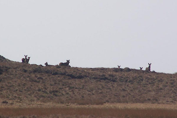 BNO67.jpg Red deer. (taken 12.4.2007) 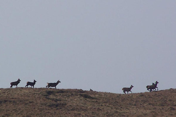 BNO68.jpg Red deer. (taken 12.4.2007) |
||
|
|
||
| evidence:- | old map:- OS County Series (Wmd 27 3) placename:- Sleddale Fell |
|
| source data:- | Maps, County Series maps of Great Britain, scales 6 and 25
inches to 1 mile, published by the Ordnance Survey, Southampton,
Hampshire, from about 1863 to 1948. |
|
|
|
||
| evidence:- | old map:- OS 1881-82 New Series (outline edition) placename:- Sleddale Fell |
|
| source data:- | Map, engraving, area north of Kendal, Westmorland, New Series
one inch map, outline edition, sheet 39, scale 1 inch to 1 mile,
published by the Ordnance Survey, Southampton, Hampshire,
1881-82.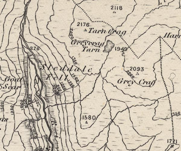 O21NY40Y.jpg "Sleddale Fell" item:- JandMN : 61 Image © see bottom of page |
|
|
|
||
| evidence:- | map:- OS Six Inch (1956) placename:- Sleddale Fell |
|
| source data:- | Map series, various editions with the national grid, scale about
6 inches to 1 mile, published by the Ordnance Survey,
Southampton, Hampshire, scale 1 to 10560 from 1950s to 1960s,
then 1 to 10000 from 1960s to 2000s, superseded by print on
demand from digital data.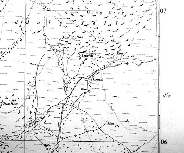 SINY4906.jpg "Sleddale Fell" |
|
|
|
||
 Lakes Guides menu.