Old Cumbria Gazetteer
 |
 |
|
||
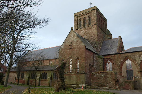
| St Bees | ||||
| civil parish:- | St Bees (formerly Cumberland) | |||
| county:- | Cumbria | |||
| locality type:- | locality | |||
| locality type:- | buildings | |||
| coordinates:- | NX97111185 (etc) | |||
| 1Km square:- | NX9711 | |||
| 10Km square:- | NX91 | |||
| latitude; longitude:- | 3d 35.3m W; 54d 29.4m N | |||
|
|
||||
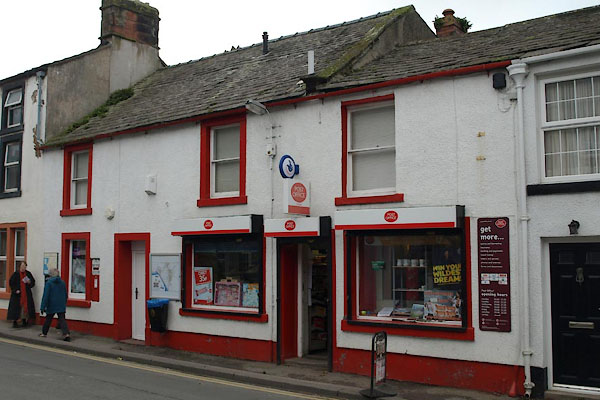
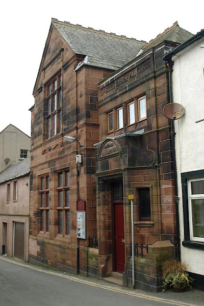
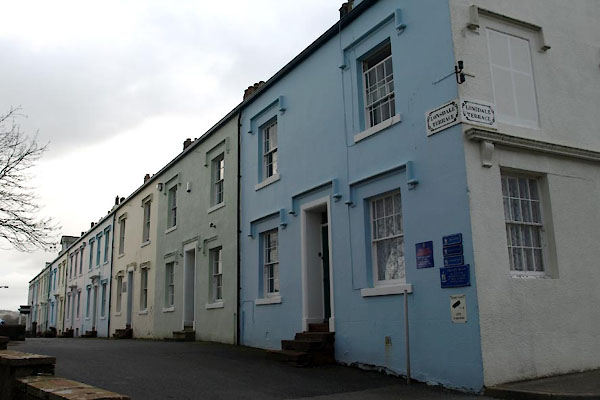
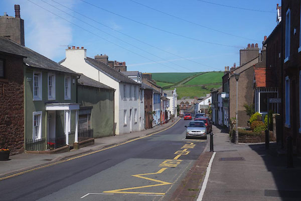
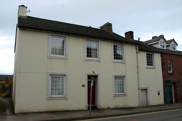
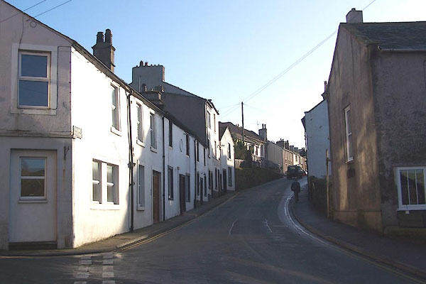 BNC81.jpg Main Street. (taken 2.1.2007) 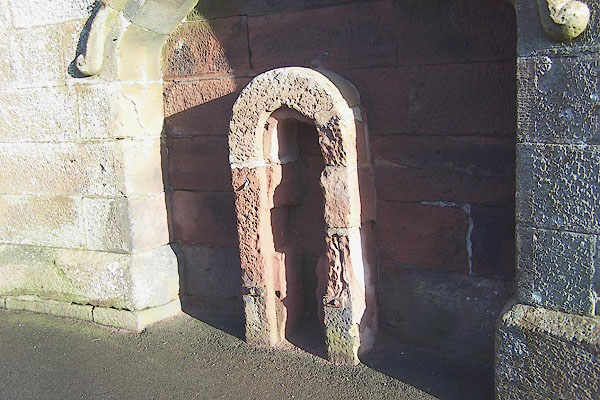 BNC59.jpg Perhaps the remains of a village pump? on the wall of the school, opposite the church. (taken 2.1.2007) |
||||
|
|
||||
| evidence:- | old map:- OS County Series (Cmd 72 2) placename:- St Bees |
|||
| source data:- | Maps, County Series maps of Great Britain, scales 6 and 25
inches to 1 mile, published by the Ordnance Survey, Southampton,
Hampshire, from about 1863 to 1948. |
|||
|
|
||||
| evidence:- | old map:- Lloyd 1573 placename:- St Bees |
|||
| source data:- | Map, hand coloured copper plate engraving, Angliae Regni,
Kingdom of England, with Wales, scale about 24 miles to 1 inch, authored by Humphrey
Lloyd, Denbigh, Clwyd, drawn and engraved
by Abraham Ortelius, Netherlands, 1573.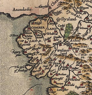 click to enlarge click to enlargeLld1Cm.jpg "St. Bees" item:- Hampshire Museums : FA1998.69 Image © see bottom of page |
|||
|
|
||||
| evidence:- | old map:- Saxton 1579 placename:- St Bees |
|||
| source data:- | Map, hand coloured engraving, Westmorlandiae et Cumberlandiae Comitatus ie Westmorland
and Cumberland, scale about 5 miles to 1 inch, by Christopher Saxton, London, engraved
by Augustinus Ryther, 1576, published 1579-1645.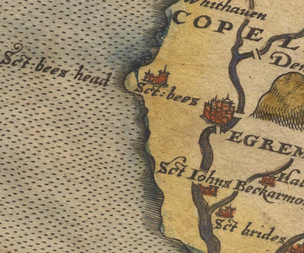 Sax9NX91.jpg Church, symbol for a parish or village, with a parish church. "Sct: bees" item:- private collection : 2 Image © see bottom of page |
|||
|
|
||||
| evidence:- | old map:- Mercator 1595 (edn?) placename:- St Bees |
|||
| source data:- | Map, hand coloured engraving, Northumbria, Cumberlandia, et
Dunelmensis Episcopatus, ie Northumberland, Cumberland and
Durham etc, scale about 6.5 miles to 1 inch, by Gerard Mercator,
Duisberg, Germany, about 1595. MER8CumE.jpg "St. Bees" circle item:- JandMN : 169 Image © see bottom of page |
|||
|
|
||||
| evidence:- | old map:- Speed 1611 (Cum/EW) placename:- St Bees |
|||
| source data:- | Map, hand coloured engraving, Kingdome of Great Britaine and
Ireland, scale about 36 miles to 1 inch, by John Speed, about
1610-11, published by Thomas Bassett, Fleet Street and Richard
Chiswell, St Paul's Churchyard, London, 1676?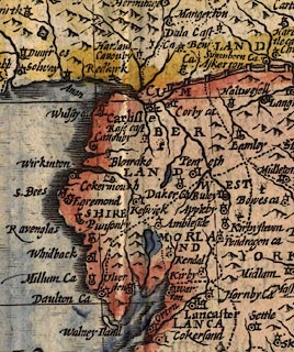 click to enlarge click to enlargeSPD6Cm.jpg "S. Bees" dot, circle, and tower item:- private collection : 85 Image © see bottom of page |
|||
|
|
||||
| evidence:- | old map:- Speed 1611 (Cmd) placename:- St Bees |
|||
| source data:- | Map, hand coloured engraving, Cumberland and the Ancient Citie
Carlile Described, scale about 4 miles to 1 inch, by John Speed,
1610, published by J Sudbury and George Humble, Popes Head
Alley, London, 1611-12. SP11NX91.jpg "St Bees" circle, building, tower item:- private collection : 16 Image © see bottom of page |
|||
|
|
||||
| evidence:- | old map:- Jenner 1643 placename:- St Bees |
|||
| source data:- | Tables of distances with a maps, Westmerland, scale about 16
miles to 1 inch, and Cumberland, scale about 21 miles to 1 inch,
published by Thomas Jenner, London, 1643; published 1643-80. JEN4Sq.jpg "S Bees" circle |
|||
|
|
||||
| evidence:- | old map:- Jansson 1646 placename:- St Bees |
|||
| source data:- | Map, hand coloured engraving, Cumbria and Westmoria, ie
Cumberland and Westmorland, scale about 3.5 miles to 1 inch, by
John Jansson, Amsterdam, Netherlands, 1646.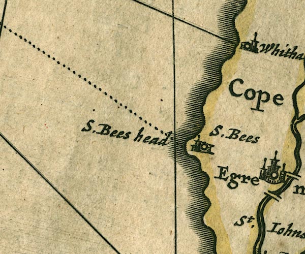 JAN3NX91.jpg "S. Bees" Buildings and tower. item:- JandMN : 88 Image © see bottom of page |
|||
|
|
||||
| evidence:- | old map:- Seller 1694 (Cmd) placename:- St Bees |
|||
| source data:- | Map, uncoloured engraving, Cumberland, scale about 12 miles to 1
inch, by John Seller, 1694. click to enlarge click to enlargeSEL9.jpg "St Bees" circle, italic lowercase text; settlement or house item:- Dove Cottage : 2007.38.89 Image © see bottom of page |
|||
|
|
||||
| evidence:- | old map:- Morden 1695 (Cmd) placename:- St Bees |
|||
| source data:- | Map, uncoloured engraving, Cumberland, scale about 4 miles to 1
inch, by Robert Morden, 1695, published by Abel Swale, the
Unicorn, St Paul's Churchyard, Awnsham, and John Churchill, the
Black Swan, Paternoster Row, London, 1695-1715.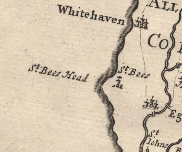 MD12NX91.jpg "St. Bees" Circle, building and tower. item:- JandMN : 90 Image © see bottom of page |
|||
|
|
||||
| evidence:- | descriptive text:- Defoe 1724-26 placename:- |
|||
| source data:- | Tour through England and Wales, by Daniel Defoe, published in
parts, London, 1724-26. "In the little town [St Bees], which bears her name there, is a very good free-school, ..." |
|||
|
|
||||
| evidence:- | old map:- Badeslade 1742 placename:- St Bees |
|||
| source data:- | Map, uncoloured engraving, A Map of Cumberland North from
London, scale about 11 miles to 1 inch, with descriptive text,
by Thomas Badeslade, London, engraved and published by William
Henry Toms, Union Court, Holborn, London, 1742. click to enlarge click to enlargeBD10.jpg "St. Bees" circle, italic lowercase text; village, hamlet or locality item:- JandMN : 115 Image © see bottom of page |
|||
|
|
||||
| evidence:- | old text:- Gents Mag |
|||
| source data:- | Magazine, The Gentleman's Magazine or Monthly Intelligencer or
Historical Chronicle, published by Edward Cave under the
pseudonym Sylvanus Urban, and by other publishers, London,
monthly from 1731 to 1922. goto source goto sourceGentleman's Magazine 1748 p.5 "..." "The town or village of St Bees is pleasantly situated in a vale, where they suppose the sea formerly flowed; here is a good free-school, and a fine retreat for youth; it is equal to several market towns in bigness, but the market of Whitehaven has attracted the business, and left St Bees a village only." |
|||
|
|
||||
| evidence:- | descriptive text:- Simpson 1746 placename:- St Bees |
|||
| source data:- | Atlas, three volumes of maps and descriptive text published as
'The Agreeable Historian, or the Compleat English Traveller
...', by Samuel Simpson, 1746. goto source "..." "Westward, and a little to the N. of Egremond, juts out a Promontory, call'd St. Bees Head, whereon is the Town of St. Bees, made famous for being the Birth Place of Archbishop Grindal, who founded and endow'd a good Grammar School there ..." |
|||
|
|
||||
| evidence:- | old map:- Bowen and Kitchin 1760 placename:- St Bees |
|||
| source data:- | Map, hand coloured engraving, A New Map of the Counties of
Cumberland and Westmoreland Divided into their Respective Wards,
scale about 4 miles to 1 inch, by Emanuel Bowen and Thomas
Kitchin et al, published by T Bowles, Robert Sayer, and John
Bowles, London, 1760. BO18NX90.jpg "St Bees" circle, tower? badly placed item:- Armitt Library : 2008.14.10 Image © see bottom of page |
|||
|
|
||||
| evidence:- | old map:- Donald 1774 (Cmd) placename:- St Bees |
|||
| source data:- | Map, hand coloured engraving, 3x2 sheets, The County of Cumberland, scale about 1
inch to 1 mile, by Thomas Donald, engraved and published by Joseph Hodskinson, 29
Arundel Street, Strand, London, 1774. D4NX91SE.jpg "St. Bees" blocks, and usually a church, labelled in upright lowercase; a village item:- Carlisle Library : Map 2 Image © Carlisle Library |
|||
|
|
||||
| evidence:- | old text:- Camden 1789 (Gough Additions) placename:- St Beges |
|||
| source data:- | Book, Britannia, or A Chorographical Description of the Flourishing Kingdoms of England,
Scotland, and Ireland, by William Camden, 1586, translated from the 1607 Latin edition
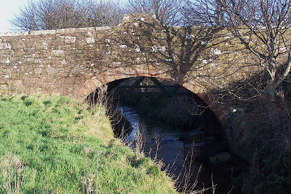
by Richard Gough, published London, 1789. goto source Page 180:- "..." "... St. Beges in Coupland ... Archbishop Grindal, who was born here, ... A bridge leading to the village has the archbishop's initials 1588." |
|||
|
|
||||
| evidence:- | old map:- Cooke 1802 placename:- St Bees |
|||
| source data:- | Map, The Lakes, Westmorland and Cumberland, scale about 8.5
miles to 1 inch, engravedby Neele and Son, published by
Sherwood, Jones and Co, Paternoster Road, London, 1824. click to enlarge click to enlargeGRA1Lk.jpg "St. Bees" blocks, italic lowercase text, village, hamlet, locality item:- Hampshire Museums : FA2000.62.5 Image © see bottom of page |
|||
|
|
||||
| evidence:- | old map:- Cooper 1808 placename:- St Bees |
|||
| source data:- | Map, uncoloured engraving, Cumberland, scale about 10.5 miles to
1 inch, drawn and engraved by Cooper, published by R Phillips,
Bridge Street, Blackfriars, London, 1808. click to enlarge click to enlargeCOP3.jpg "St. Bees" circle; village or hamlet item:- JandMN : 86 Image © see bottom of page |
|||
|
|
||||
| evidence:- | old map:- Otley 1818 placename:- St Bees |
|||
| source data:- | Map, uncoloured engraving, The District of the Lakes,
Cumberland, Westmorland, and Lancashire, scale about 4 miles to
1 inch, by Jonathan Otley, 1818, engraved by J and G Menzies,
Edinburgh, Scotland, published by Jonathan Otley, Keswick,
Cumberland, et al, 1833. OT02NX91.jpg "ST. BEES" item:- JandMN : 48.1 Image © see bottom of page |
|||
|
|
||||
| evidence:- | old map:- Hall 1820 (Cmd) placename:- St Bees |
|||
| source data:- | Map, hand coloured engraving, Cumberland, scale about 21 miles
to 1 inch, engraved by Sidney Hall, published by S Leigh, 18
Strand, London, 1820-31. click to enlarge click to enlargeHA14.jpg "St Bees" circle, italic lowercase text; settlement item:- JandMN : 91 Image © see bottom of page |
|||
|
|
||||
| evidence:- | old text:- Gents Mag |
|||
| source data:- | Magazine, The Gentleman's Magazine or Monthly Intelligencer or
Historical Chronicle, published by Edward Cave under the
pseudonym Sylvanus Urban, and by other publishers, London,
monthly from 1731 to 1922. goto source Gentleman's Magazine 1831 part 1 p.300 "Mr. URBAN," "THE village of Saint Bees is situated on the coast of Cumberland, in that quintuple division of the county called Allerdale Ward above Derwent. ..." |
|||
|
|
||||
| evidence:- | old text:- Gents Mag 1831 item:- population, St Bees; placename, St Bees |
|||
| source data:- | goto source Gentleman's Magazine 1831 part 1 p.301 "... The parish of Saint Bees is large, as will be evident from the number of inhabitants at the following periods, especially when it is considered that in this remote part of England, the habitations are generally far apart:-" "1688. : 1801. : 1811. : 1821." "3,345. : 13,246. : 16,520. : 19,169." "It was part of the kingdom of Cumbria or Strath Cluyd Britons, which was first inhabited, says Mr. Carte, by a Celtic race about 2000 years before the Christian aera. That the genuine ancient Britons posted themselves here, we have the authority of Marianus himself, not to mention that there are many names purely British. Although every part of it, where liable to aggression, was fortified by the Romans, as appears from the ancient ruins, it was frequently the scene of bloody contention. Speed, speaking of Cumberland, says that it was strengthened with twenty-five castles, and preserved by the prayers of six religious houses, in which latter enumeration that of Saint Bees is mentioned. The village was formerly known by the names of BEGOCK, BEGOTH, or BEGHES, and the Church is styled in ancient evidences Kirkby Begog. The derivation of Begoth seems to be, from two ancient British words BEG OG; by our interpretation, little, young, like the Gaelic oig, little. The name is supposed to have originated from the Holy Bega, a pious woman from Ireland, who is said to have founded a small monastery here about the year 650. ..." |
|||
|
|
||||
| evidence:- | old text:- Gents Mag 1831 |
|||
| source data:- | goto source Gentleman's Magazine 1831 part 1 p.302 "..." "The parish of Saint Bees being extensive, the church is the Mother Church for a distance of many miles, including the populous town of Whitehaven, and five other chapelries, namely, Ennerdale, Eskdale, Nether Wasdale, Wasdale Head, and Lowswater, together with numerous other townships. Some of these have been considered to have distinct parish churches, but they are in fact nothing more than chapels of ease. There is an order extant of the time of Bishop Bridgman (A.D. 1622), by which these five chapelries are enjoined to contribute to the repair of the Mother Church, and at the present time yearly payments are made by them respectively." "..." |
|||
|
|
||||
| evidence:- | descriptive text:- Ford 1839 (3rd edn 1843) placename:- St Bees |
|||
| source data:- | Guide book, A Description of Scenery in the Lake District, by
Rev William Ford, published by Charles Thurnam, Carlisle, by W
Edwards, 12 Ave Maria Lane, Charles Tilt, Fleet Street, William
Smith, 113 Fleet Street, London, by Currie and Bowman,
Newcastle, by Bancks and Co, Manchester, by Oliver and Boyd,
Edinburgh, and by Sinclair, Dumfries, 1839. goto source Page 76:- "..." "From Egremont it is four miles to Saint Bees; which is a long village reaching down the side of a ridge into a deep, contracted vale, which embraces in a semi-circular sweep the bold bluff heads. It is chiefly celebrated for its grammar-school, and for its abbey." |
|||
|
|
||||
| evidence:- | old map:- Ford 1839 map placename:- St Bees |
|||
| source data:- | Map, uncoloured engraving, Map of the Lake District of
Cumberland, Westmoreland and Lancashire, scale about 3.5 miles
to 1 inch, published by Charles Thurnam, Carlisle, and by R
Groombridge, 5 Paternoster Row, London, 3rd edn 1843.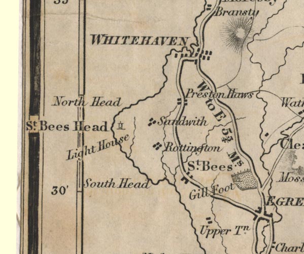 FD02NX91.jpg "St. Bees" item:- JandMN : 100.1 Image © see bottom of page |
|||
|
|
||||
| evidence:- | old map:- Garnett 1850s-60s H placename:- St Bees |
|||
| source data:- | Map of the English Lakes, in Cumberland, Westmorland and
Lancashire, scale about 3.5 miles to 1 inch, published by John
Garnett, Windermere, Westmorland, 1850s-60s.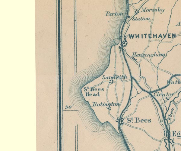 GAR2NX91.jpg "St. Bees" blocks, settlement item:- JandMN : 82.1 Image © see bottom of page |
|||
|
|
||||
| evidence:- | old print:- Bradley 1901 placename:- St Bees |
|||
| source data:- | Print, uncoloured lithograph, St Bees, Cumberland, by Joseph Pennell, published by
Macmillan and Co, London, 1901.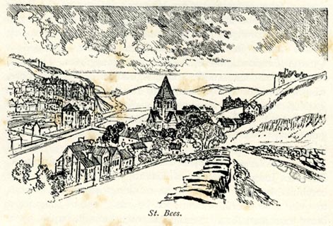 click to enlarge click to enlargeBRL134.jpg On page 155 of Highways and Byways in the Lake District, by A G Bradley. printed at bottom:- "St. Bees." item:- JandMN : 464.34 Image © see bottom of page |
|||
|
|
||||
| evidence:- | old map:- Postlethwaite 1877 (3rd edn 1913) placename:- St Bees |
|||
| source data:- | Map, uncoloured engraving, Map of the Lake District Mining Field, Westmorland, Cumberland,
Lancashire, scale about 5 miles to 1 inch, by John Postlethwaite, published by W H
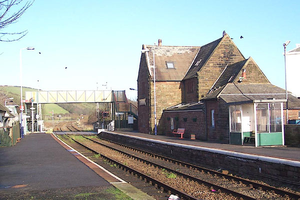
Moss and Sons, 13 Lowther Street, Whitehaven, Cumberland, 1877 edn 1913.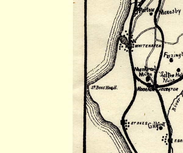 PST2NX91.jpg "ST. BEES" dots, railway and station item:- JandMN : 162.2 Image © see bottom of page |
|||
|
|
||||
| evidence:- | old text:- Admiralty 1933 placename:- St Bees |
|||
| source data:- | goto source Page 385:- "... The village and college of St. Bees, situated about 2 1/2 miles south-eastward of the head, shows up from seaward when abreast of it. The railway line skirts the coast between Seascale and St. Bees village." goto sourcePage 389:- "..." "The village of St. Bees stands on a rise near the coast, about 2 1/2 miles southward of the lighthouse; it is noted for its ancient abbey." |
|||
|
|
||||
| :- |
A limerick out of form:- |
|||
| "There was an old man of St Bees, Who was stung in the arm by a Wasp. When asked, "Does it hurt?" He replied, "No it doesn't; I'm so glad that it wasn't a hornet."" |
||||
| Written by W S Gilbert, of Gilbert and Sullivan fame, who didn't like limericks. |
||||
|
|
||||
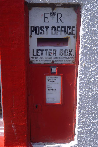
 Post Office maps Post Office maps |
||||
|
|
||||
| evidence:- | old print:- Rumney 1899 placename:- St Bees |
|||
| source data:- | Print, halftone photograph, St Bees, Cumberland, published by George Philip and Son,
32 Fleet Street, London, and Liverpool, 1899.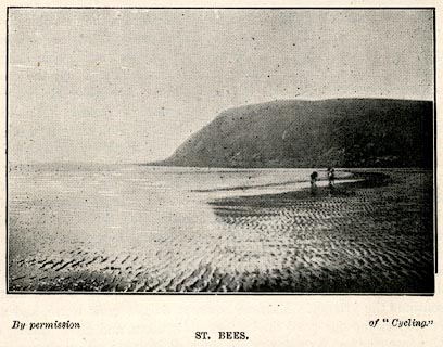 click to enlarge click to enlargeRUM129.jpg On p.65 of the Cyclist's Guide to the English Lake District, by A W Rumney. printed at bottom:- "By permission of "Cycling." / ST. BEES." item:- JandMN : 147.30 Image © see bottom of page |
|||
|
|
||||
| evidence:- | old print:- Linton 1852 placename:- Saint Bees |
|||
| source data:- | Print, engraving, Saint Bees, St Bees, Cumberland, drawn by R Shepherd, engraved by
W H Lizars, Edinburgh, published by Whittaker and Co, London, and by R Gibson and
Son and by Callander and Dixon, Whitehaven, Cumberland, 1852.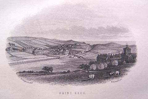 click to enlarge click to enlargeLN1E04.jpg Tipped in opposite p.24 of A Handbook of the Whitehaven and Furness Railway, by John Linton. printed at bottom left, right, centre:- "R. Shepherd delt. / W. H. Lizars sc. / SAINT BEES." item:- Armitt Library : A1158.4 Image © see bottom of page |
|||
|
|
||||
| evidence:- | old print:- placename:- St Bees item:- rail |
|||
| source data:- | Print, uncoloured engraving, Saint Bees, Cumberland, drawn by R Shepherd, published
1850s-60s.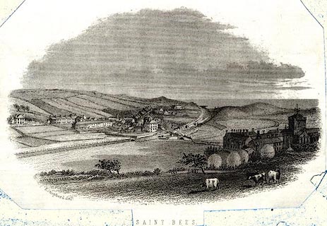 click to enlarge click to enlargePR0572.jpg Notice the Whitehaven and Furness Junction Railway. printed at bottom:- "SAINT BEES" item:- Dove Cottage : 2008.107.520 Image © see bottom of page |
|||
|
|
||||
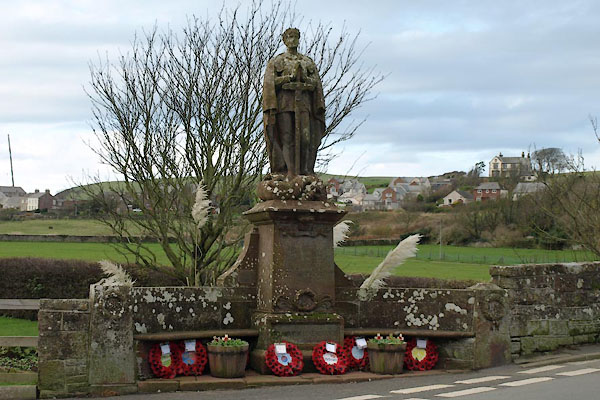
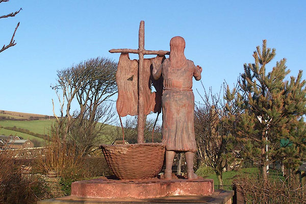 BNC74.jpg Statue of St Bega by Colin Telfer, Maryport, 2000. (taken 2.1.2007) |
||||
|
|
||||
| story:- |
Bega was the daughter of an irish king, 7th-9th century, and fled Ireland in a small
boat when she refused the man her father had chosen for her as husband. She was washed
ashore near here, and when she moved on she left behind an arm ring. The priory founded
here had this relic. |
|||
| After the priory was dissolved at the Dissolution of the Monasteries, 1539, a muddled
version of the story was told. The Bega wanted to found a nunnery here and was granted
as much land the Earl of Egremont, in jest, as would be covered by snow the next day.
Next day was midsummer, and it snowed, so she got her land. |
||||
|
|
||||
| places:- |
|
|||
|
||||
|
||||
|
||||
|
||||
|
||||
|
||||
|
||||
|
||||
|
||||
|
||||
|
||||
|
||||
|
||||
|
||||
|
||||
|
||||
|
||||
|
||||
|
||||
|
||||
|
||||
|
||||
|
||||
|
||||
|
||||
|
||||
|
||||
|
||||
|
||||
|
||||
|
||||
|
||||
|
||||
|
||||
|
||||
|
||||
|
||||
|
||||
|
||||
|
||||
|
||||
|
||||
|
||||
|
||||
|
||||
|
||||
|
||||
|
||||
|
||||
|
||||
|
||||
|
||||
|
||||
|
||||
|
||||
|
||||
Lakes Guides menu.