 Old Cumbria Gazetteer
 |
 |
|
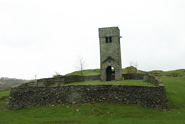
| St Catherine tower, Crook | ||
| St Catherine's Church | ||
| locality:- | Crook | |
| civil parish:- | Crook (formerly Westmorland) | |
| county:- | Cumbria | |
| locality type:- | church (remains) | |
| locality type:- | tower | |
| coordinates:- | SD45009467 | |
| 1Km square:- | SD4594 | |
| 10Km square:- | SD49 | |
|
|
||
 BPC61.jpg (taken 26.4.2008) 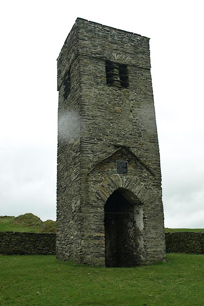 BPC62.jpg (and rain drops) (taken 26.4.2008) |
||
|
|
||
| evidence:- | old map:- OS County Series (Wmd 38 1) placename:- St Catherine's Church |
|
| source data:- | Maps, County Series maps of Great Britain, scales 6 and 25
inches to 1 mile, published by the Ordnance Survey, Southampton,
Hampshire, from about 1863 to 1948. "St Catherine's Church (Per Curacy)" |
|
|
|
||
| evidence:- | old map:- Saxton 1579 placename:- St Katerens |
|
| source data:- | Map, hand coloured engraving, Westmorlandiae et Cumberlandiae Comitatus ie Westmorland
and Cumberland, scale about 5 miles to 1 inch, by Christopher Saxton, London, engraved
by Augustinus Ryther, 1576, published 1579-1645.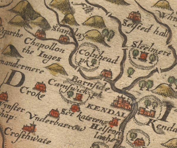 Sax9SD49.jpg Building, symbol for a hamlet, which may or may not have a nucleus. "Sct Katerens" item:- private collection : 2 Image © see bottom of page |
|
|
|
||
| evidence:- | old map:- Speed 1611 (Wmd) placename:- S. Katherines |
|
| source data:- | Map, hand coloured engraving, The Countie Westmorland and
Kendale the Cheif Towne, scale about 2.5 miles to 1 inch, by
John Speed, 1610, published by George Humble, Popes Head Alley,
London, 1611-12.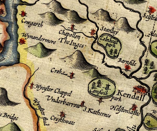 SP14SD49.jpg "S. Katherines" circle item:- Armitt Library : 2008.14.5 Image © see bottom of page |
|
|
|
||
| evidence:- | old map:- Morden 1695 (Wmd) placename:- St Katherines |
|
| source data:- | Map, hand coloured engraving, Westmorland, scale about 2.5 miles to 1 inch, by Robert
Morden, published by Abel Swale, the Unicorn, St Paul's Churchyard, Awnsham, and John
Churchill, the Black Swan, Paternoster Row, London, 1695.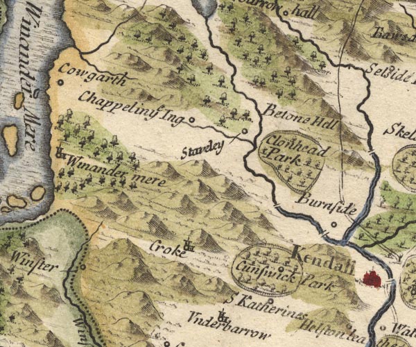 MD10SD49.jpg "S Katherines" Circle. item:- JandMN : 24 Image © see bottom of page |
|
|
|
||
| evidence:- | old map:- Bowen and Kitchin 1760 placename:- St Katherines |
|
| source data:- | Map, hand coloured engraving, A New Map of the Counties of
Cumberland and Westmoreland Divided into their Respective Wards,
scale about 4 miles to 1 inch, by Emanuel Bowen and Thomas
Kitchin et al, published by T Bowles, Robert Sayer, and John
Bowles, London, 1760.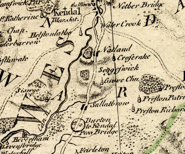 BO18SD48.jpg "St. Katherines" circle, tower item:- Armitt Library : 2008.14.10 Image © see bottom of page |
|
|
|
||
| evidence:- | old map:- Jefferys 1770 (Wmd) |
|
| source data:- | Map, 4 sheets, The County of Westmoreland, scale 1 inch to 1
mile, surveyed 1768, and engraved and published by Thomas
Jefferys, London, 1770.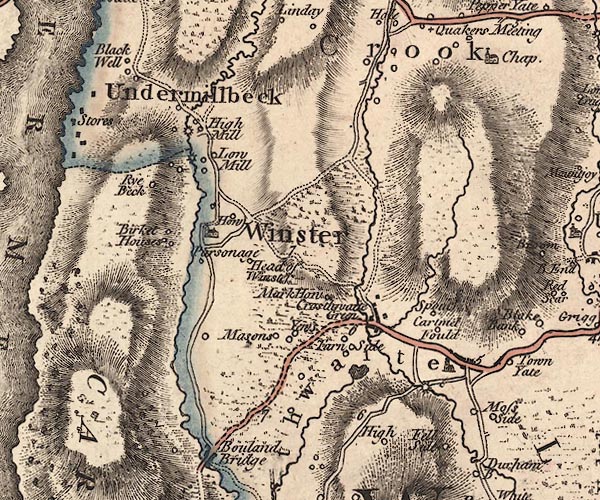 J5SD49SW.jpg "Chap" church item:- National Library of Scotland : EME.s.47 Image © National Library of Scotland |
|
|
|
||
| evidence:- | old map:- Cary 1789 (edn 1805) |
|
| source data:- | Map, uncoloured engraving, Westmoreland, scale about 2.5 miles
to 1 inch, by John Cary, London, 1789; edition 1805.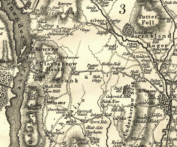 CY24SD49.jpg church symbol; church or chapel item:- JandMN : 129 Image © see bottom of page |
|
|
|
||
| evidence:- | database:- Listed Buildings 2010 |
|
| source data:- | courtesy of English Heritage "TOWER OF OLD PARISH CHURCH OF ST CATHERINE / / / CROOK / SOUTH LAKELAND / CUMBRIA / II / 76395 / SD4498294659" |
|
| source data:- | courtesy of English Heritage "Church Tower, said to have been built in 1620. The remainder of the church was pulled down in 1887. Rubble walls, plain parapet. Partly blocked segmental arch and blocked doorway with segmental head on ground floor; 2 slit lights to 2nd floor; plain rectangular openings with stone louvres to belfry. RCHM page 72. Ancient Monument No. 108." |
|
|
|
||
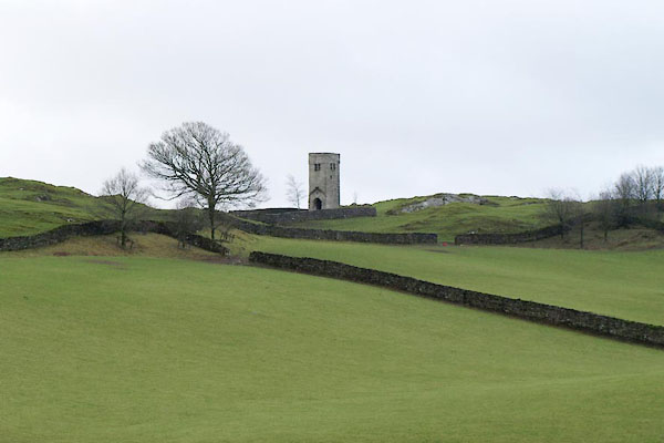 BVU97.jpg From the new church. (taken 27.1.2012) 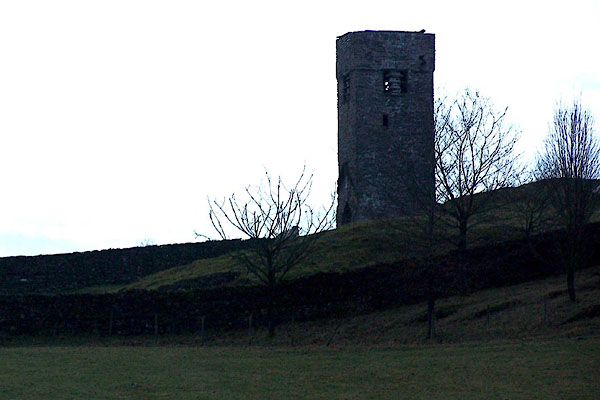 BLN07.jpg Late winter afternoon. (taken 31.12.2005) 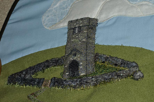 BVV01.jpg Detail from a hainging at St Catherin's Church, Crook. (taken 27.1.2012) |
||
|
|
||
| hearsay:- |
The tower was built about 1620, on the old church which dated from about 1516. The
body of old church had to be demolished in 1887, but the tower was kept. It was restored
in 1993. |
|
|
|
||
 Lakes Guides menu.