 Old Cumbria Gazetteer
 |
 |
|
| included in:- |
 Windermere lake Windermere lake |
|
| viewpoint, Jenkyn's Crag | ||
| site name:- | Jenkin Crag | |
| locality:- | Skelghyll | |
| civil parish:- | Lakes (formerly Westmorland) | |
| county:- | Cumbria | |
| locality type:- | viewpoint | |
| coordinates:- | NY38330288 | |
| 1Km square:- | NY3802 | |
| 10Km square:- | NY30 | |
|
|
||
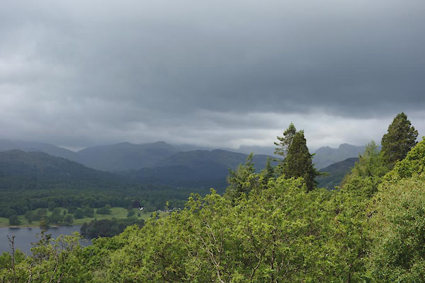 CDJ90.jpg Langdale Pikes etc. (taken 18.6.2015) 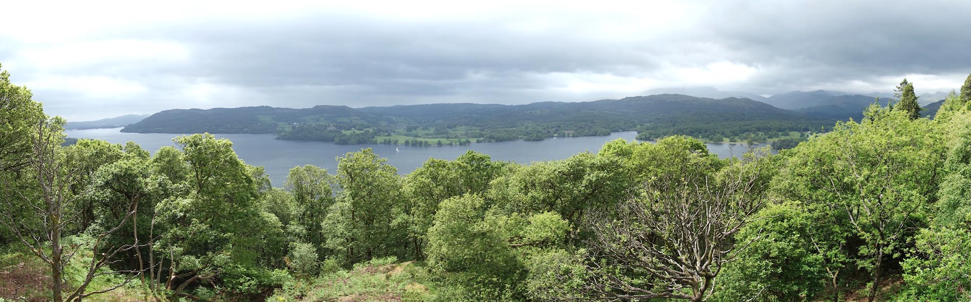 Click to enlarge CDJ91.jpg Windermere lake. (taken 18.6.2015) |
||
|
|
||
| evidence:- | old map:- Crosthwaite 1783-94 (Win/Ble) |
|
| source data:- | Map, uncoloured engraving, An Accurate Map of the Grand Lake of
Windermere, scale about 2 inches to 1 mile, by Peter
Crosthwaite, Keswick, Cumberland, 1783, version published 1819.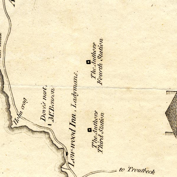 CT9NY30W.jpg "The Authors / Fourth Station" square symbol item:- Armitt Library : 2008.14.102 Image © see bottom of page |
|
|
|
||
| evidence:- | old map:- Crosthwaite 1783-94 (Win/Ble) placename:- station, Windermere, Crosthwaite 4 |
|
| source data:- | Series of maps, An Accurate Map of the Matchless Lake of
Derwent, of the Grand Lake of Windermere, of the Beautiful Lake
of Ullswater, of Broadwater or Bassenthwaite Lake, of Coniston
Lake, of Buttermere, Crummock and Loweswater Lakes, and
Pocklington's Island, by Peter Crosthwaite, Kendal, Cumberland
now Cumbria, 1783 to 1794. marked on the map of lake Windermere, ¾mile NNE of Lowwood Inn "The Author's Fourth Station" |
|
|
|
||
| person:- | map maker : Crosthwaite, Peter |
|
| place:- | Windermere lake | |
| date:- | 1783 |
|
| period:- | 18th century, late | |
| period:- | 1780s | |
| item:- | map; Accurate Map of the Grand Lake of Windermere |
|
|
|
||
Lakes Guides menu.