 Old Cumbria Gazetteer
 |
 |
|
| Stoneraise, Threlkeld | ||
| Stoneraise | ||
| civil parish:- | Threlkeld (formerly Cumberland) | |
| county:- | Cumbria | |
| locality type:- | buildings | |
| coordinates:- | NY34822671 | |
| 1Km square:- | NY3426 | |
| 10Km square:- | NY32 | |
|
|
||
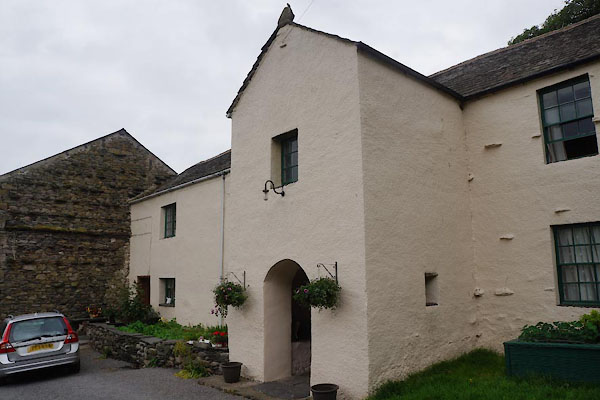 CAX20.jpg (taken 13.6.2014) 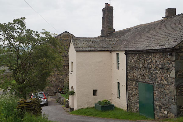 CAX21.jpg (taken 13.6.2014) |
||
|
|
||
| evidence:- | old map:- OS County Series (Cmd 57 13) placename:- Stoneraise |
|
| source data:- | Maps, County Series maps of Great Britain, scales 6 and 25
inches to 1 mile, published by the Ordnance Survey, Southampton,
Hampshire, from about 1863 to 1948. |
|
|
|
||
| evidence:- | old map:- Donald 1774 (Cmd) placename:- Stoneraise |
|
| source data:- | Map, hand coloured engraving, 3x2 sheets, The County of Cumberland, scale about 1
inch to 1 mile, by Thomas Donald, engraved and published by Joseph Hodskinson, 29
Arundel Street, Strand, London, 1774.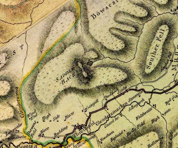 D4NY32NW.jpg "Stoneraise" block or blocks, labelled in lowercase; a hamlet or just a house item:- Carlisle Library : Map 2 Image © Carlisle Library |
|
|
|
||
| evidence:- | old text:- Clarke 1787 placename:- Stone Rays |
|
| source data:- | Guide book, A Survey of the Lakes of Cumberland, Westmorland,
and Lancashire, written and published by James Clarke, Penrith,
Cumberland, and in London etc, 1787; published 1787-93. goto source goto sourcePage 56:- "... About 100 yards beyond the eleventh-mile post [from Penrith], near to Stone-Rays, (an estate belonging to Rowland Stephenson, Esq; one of the Members for the city of Carlisle,) ..." |
|
|
|
||
| evidence:- | database:- Listed Buildings 2010 placename:- Stoneraise |
|
| source data:- | courtesy of English Heritage "STONERAISE / / / THRELKELD / EDEN / CUMBRIA / II / 73570 / NY3481726704" |
|
|
|
||
Lakes Guides menu.