 |
 |
|
|
|
|
|
|
|
Strickland Ketel |
| county:- |
Cumbria |
| old county:- |
Westmorland |
| locality type:- |
parish |
| 1Km square:- |
SD4995 |
| 10Km square:- |
SD49 |
| 10Km square:- |
SD59 |
| references:- |
OS 1974 Admin Areas
|
|
|
| evidence:- |
hearth tax returns:- Hearth Tax 1675
placename:- Strickland Roger and Kettle
|
| source data:- |
Records, hearth tax survey returns, Westmorland, 1674/75.
"Strickland Roger and Kettle"
|
|
|
| evidence:- |
hearth tax returns:- Hearth Tax 1670
placename:- Stricklandfield
|
| source data:- |
Records, hearth tax returns, exchequer duplicates, Westmorland,
1670.
"Stricklandfield"
|
|
|
| evidence:- |
old map:- Jefferys 1770 (Wmd)
placename:- Strickland Kettle
|
| source data:- |
Map, 4 sheets, The County of Westmoreland, scale 1 inch to 1
mile, surveyed 1768, and engraved and published by Thomas
Jefferys, London, 1770.
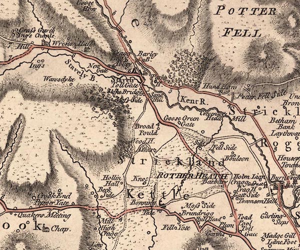
J5SD49NE.jpg
"Strickland Kettle"
area
item:- National Library of Scotland : EME.s.47
Image © National Library of Scotland |
|
|
| evidence:- |
old map:- Cooper 1808
placename:- Strickland Kettle
|
| source data:- |
Map, hand coloured engraving, Westmoreland ie Westmorland, scale
about 9 miles to 1 inch, by H Cooper, 1808, published by R
Phillips, Bridge Street, Blackfriars, London, 1808.
 click to enlarge click to enlarge
COP4.jpg
"Strickland Kettle"
circle; village or hamlet
item:- Dove Cottage : 2007.38.53
Image © see bottom of page
|
|
|
| evidence:- |
census:- Census 1971
|
|
Population: 1020 (1971) |
|
|
|
includes |
| place:- |
Stricklandfield Constablewick (S part of) |
| place:- |
Underbarrow Constablewick (part of) |
| place:- |
Kendal Constablewick (part of) |
|
| places:- |
 |
SD48849529 Bank End, Strickland Ketel |
|
|
|
SD494951 Bannel Head, Strickland Ketel |
|
|
|
SD49419571 Barbary Crag, Strickland Ketel L |
|
|
|
SD47719561 Barn Farm, Strickland Ketel |
|
|
|
SD47979517 Bonning Gate, Strickland Ketel |
|
|
|
SD49879661 Bowston Bridge, Bowston L |
|
|
|
SD49479654 Bowston Farm, Strickland Ketel |
|
|
|
SD49449656 Bowston Hall, Strickland Ketel |
|
|
|
SD49819661 Bowston, Strickland Ketel |
|
|
|
SD50529580 bridge, Burneside |
|
|
|
SD49599572 Brow Foot, Strickland Ketel |
|
|
|
SD50319583 Bryce Institute, Burneside |
|
|
|
SD50369544 Burneside Cricket Club, Burneside |
|
|
|
SD50419537 Burneside Football Club, Burneside |
|
|
|
SD51139581 Burneside Heads, Strickland Ketel |
|
|
|
SD4996 Burneside Junction, Burneside |
|
|
|
SD506956 Burneside Millennium Green, Burneside |
|
|
|
SD50609586 Burneside Papermill, Burneside |
|
|
|
SD50259580 Burneside Station, Burneside |
|
|
|
SD50679579 Burneside: C Green |
|
|
|
SD50639544 Burneside: Ivy Crescent |
|
|
|
SD49269730 Cowan Head Papermill, Strickland Ketel |
|
|
|
SD49269733 Cowan Head, Strickland Ketel |
|
|
|
SD50329562 Crag House, Burneside suggested |
|
|
|
SD49709631 Crockett Head, Strickland Ketel |
|
|
|
SD48259505 Crook Road, Strickland Ketel |
|
|
|
SD497951 Elba Monument, Strickland Ketel L |
|
|
|
SD49999552 Ellergreen, Burneside |
|
|
|
SD48729685 Fell Side, Strickland Ketel |
|
|
|
SD50629569 Ford Bridge, Burneside |
|
|
|
SD50039595 Garnett House, Strickland Ketel |
|
|
|
SD49439546 Gateside, Strickland Ketel |
|
|
|
SD49589469 Gateway Inn, Plumgarths |
|
|
|
SD49259717 Gilthroton, Strickland Ketel |
|
|
|
SD48629499 Halhead Brow, Strickland Ketel |
|
|
|
SD50199570 Halhead Green, Burneside |
|
|
|
SD48909479 Halhead Hall, Strickland Ketel |
|
|
|
SD48789492 Halhead Quarry, Strickland Ketel |
|
|
|
SD50479409 Hallgarth, Kendal |
|
|
|
SD49999383 Helsfell Hall, Strickland Ketel |
|
|
|
SD50179360 Helsfell Nab, Strickland Ketel |
|
|
|
SD49809391 Helsfell, Strickland Ketel L |
|
|
|
SD48469502 High Brundrigg, Strickland Ketel |
|
|
|
SD49359561 High Crag, Strickland Ketel |
|
|
|
SD49499478 High Plumgarths, Plumgarths |
|
|
|
SD50179535 Hollins Lane, Burneside |
|
|
|
SD50259532 Hollins, Burneside L |
|
|
|
SD50339586 Holme Lyon, Burneside |
|
|
|
SD50299585 house, Burneside |
|
|
|
SD50529566 Jolly Anglers, Burneside |
|
|
|
SD50719542 Junction Cottages, Burneside L |
|
|
|
SD49869658 Kent Bank, Bowston |
|
|
|
SD50359434 Lane Foot, Strickland Ketel |
|
|
|
SD48759652 Lane Head, Strickland Ketel |
|
|
|
SD48559659 Lanehead Kennels, Strickland Ketel |
|
|
|
SD47919540 Laneside, Strickland Ketel |
|
|
|
SD50449542 level crossing, Burneside |
|
|
|
SD50149594 level crossing, Burneside (2) |
|
|
|
SD49039718 Lilyfield, Strickland Ketel |
|
|
|
SD48379498 Low Brundrigg, Strickland Ketel L |
|
|
|
SD50259456 Madgegill, Strickland Ketel |
|
|
|
SD49199478 milestone, Strickland Ketel |
|
|
|
SD47859525 milestone, Strickland Ketel (2) L not found |
|
|
|
SD48639627 milestone, Strickland Ketel (3) L gone |
|
|
|
SD49629513 milestone, Strickland Ketel (4) L |
|
|
|
SD48339558 Moss Side Tarn, Strickland Ketel |
|
|
|
SD48479548 Moss Side, Strickland Ketel |
|
|
|
SD47919532 Oakhill, Strickland Ketel |
|
|
|
SD48019516 Orchard Cottage, Bonning Gate |
|
|
|
SD47999515 Owert Beck, Bonning Gate |
|
|
|
SD50459576 Parsonage, Burneside |
|
|
|
SD51129489 Pepperhag Wood, Strickland Ketel |
|
|
|
SD511949 Pepperhag, Strickland Ketel |
|
|
|
SD48459659 pinfold, Strickland Ketel gone |
|
|
|
SD49579461 Plumgarths Cottages, Strickland Ketel L |
|
|
|
SD49489471 Plumgarths Farm, Plumgarths |
|
|
|
SD49359454 Plumgarths Quarry, Plumgarths |
|
|
|
SD49519469 Plumgarths, Strickland Ketel |
|
|
|
SD50569547 police station, Burneside |
|
|
|
SD49829660 post box, Bowston |
|
|
|
SD50869446 railway bridge, Kendal (13) |
|
|
|
SD50719468 railway bridge, Kendal (14) |
|
|
|
SD50589494 railway bridge, Kendal (15) |
|
|
|
SD49489650 railway bridge, Strickland Ketel |
|
|
|
SD49199657 railway bridge, Strickland Ketel (2) |
|
|
|
SD50289575 railway milepost, Burneside |
|
|
|
SD48149610 Rather Heath, Strickland Ketel |
|
|
|
SD4896 Ratherheath Beck |
|
|
|
SD48439585 Ratherheath Tarn, Strickland Ketel |
|
|
|
SD50499578 school, Burneside |
|
|
|
SD48449600 Scream Point Tarn, Strickland Ketel |
|
|
|
SD50109591 Sharps Lane, Strickland Ketel |
|
|
|
SD48589683 Side, Strickland Ketel suggested |
|
|
|
SD50479573 St Oswald, Burneside |
|
|
|
SD50589554 St Oswald's CofE Primary School, Burneside |
|
|
|
SD48649561 Strickland Ketel Common, Strickland Ketel |
|
|
|
SD50059628 summer house, Strickland Ketel L |
|
|
|
SD49709496 Toadpool, Strickland Ketel |
|
|
|
SD50729471 Todd's Barn, Strickland Ketel gone? |
|
|
|
SD50989484 Todds, Strickland Ketel |
|
|
|
SD49689542 Tolson Hall, Strickland Ketel L |
|
|
|
SD50469571 war memorial, Burneside |
|
|
|
SD49719680 weir, Bowston |
|
|
|
SD49449537 Whale's Jaw Bones, Strickland Ketel |
|
|
|
SD50059628 Whitefoot, Strickland Ketel |
|
|
|
SD49689676 Winstanley Row, Bowston |
|
|
|
SD48989690 Winter Lane, Strickland Ketel |
|
|
|
SD50569560 Burneside, Strickland Ketel |
|
|
|
Kendal and Windermere Railway |
|
|
|
NY4506 Kent, River |
|
|
|
SD49769460 toll house, Plumgarths gone |
|
|
|
SD49399655 barn, Bowston |
|
|
|
Burneside tramway |
|
