 Old Cumbria Gazetteer
 |
 |
|
| Tarn House, Ravenstonedale | ||
| Tarn House | ||
| civil parish:- | Ravenstonedale (formerly Westmorland) | |
| county:- | Cumbria | |
| locality type:- | buildings | |
| coordinates:- | NY74980338 | |
| 1Km square:- | NY7403 | |
| 10Km square:- | NY70 | |
|
|
||
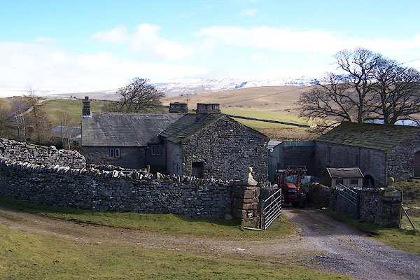 BLQ32.jpg (taken 25.2.2006) |
||
|
|
||
| evidence:- | old map:- OS County Series (Wmd 30 10) placename:- Tarn House |
|
| source data:- | Maps, County Series maps of Great Britain, scales 6 and 25
inches to 1 mile, published by the Ordnance Survey, Southampton,
Hampshire, from about 1863 to 1948. |
|
|
|
||
| evidence:- | old map:- Jefferys 1770 (Wmd) placename:- Tarn House |
|
| source data:- | Map, 4 sheets, The County of Westmoreland, scale 1 inch to 1
mile, surveyed 1768, and engraved and published by Thomas
Jefferys, London, 1770.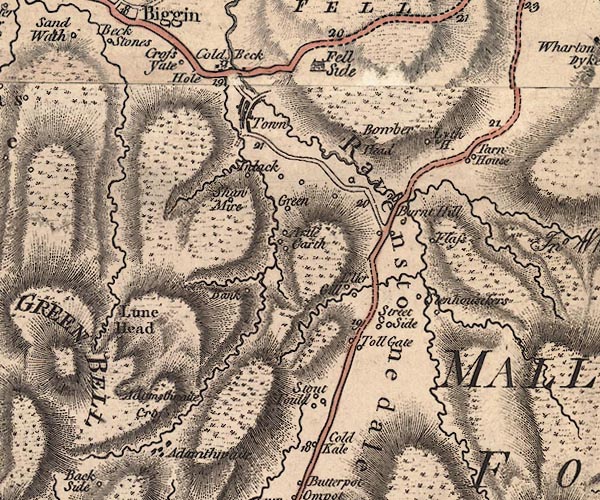 J5NY70SW.jpg "Tarn House" circle, labelled in italic lowercase text; settlement, farm, house, or hamlet? item:- National Library of Scotland : EME.s.47 Image © National Library of Scotland |
|
|
|
||
| evidence:- | database:- Listed Buildings 2010 placename:- Tarn House item:- date stone (1664) |
|
| source data:- | courtesy of English Heritage "TARN HOUSE AND STABLE ADJOINING WEST RETURN / / A683 / RAVENSTONEDALE / EDEN / CUMBRIA / II[star] / 74105 / NY7497403396" |
|
|
|
||
| evidence:- | database:- Listed Buildings 2010 |
|
| source data:- | courtesy of English Heritage "RAMP BARN IN FARMYARD TO SOUTH OF TARN HOUSE / / A683 / RAVENSTONEDALE / EDEN / CUMBRIA / II / 74106 / NY7497303376" |
|
|
|
||
| notes:- |
site of 14th century hall |
|
| Perriam, D R &Robinson, J: 1998: Medieval Fortified Buildings of Cumbria: CWAAS::
ISBN 1 873124 23 6; plan |
||
|
|
||
 Lakes Guides menu.