 Old Cumbria Gazetteer
 |
 |
|
| Threlkeld Quarry, St John's Castlerigg etc | ||
| Threlkeld Quarry | ||
| civil parish:- | St John's Castlerigg and Wythburn (formerly Cumberland) | |
| county:- | Cumbria | |
| locality type:- | granite quarry | |
| locality type:- | quarry | |
| coordinates:- | NY32792428 (etc) | |
| 1Km square:- | NY3224 | |
| 10Km square:- | NY32 | |
|
|
||
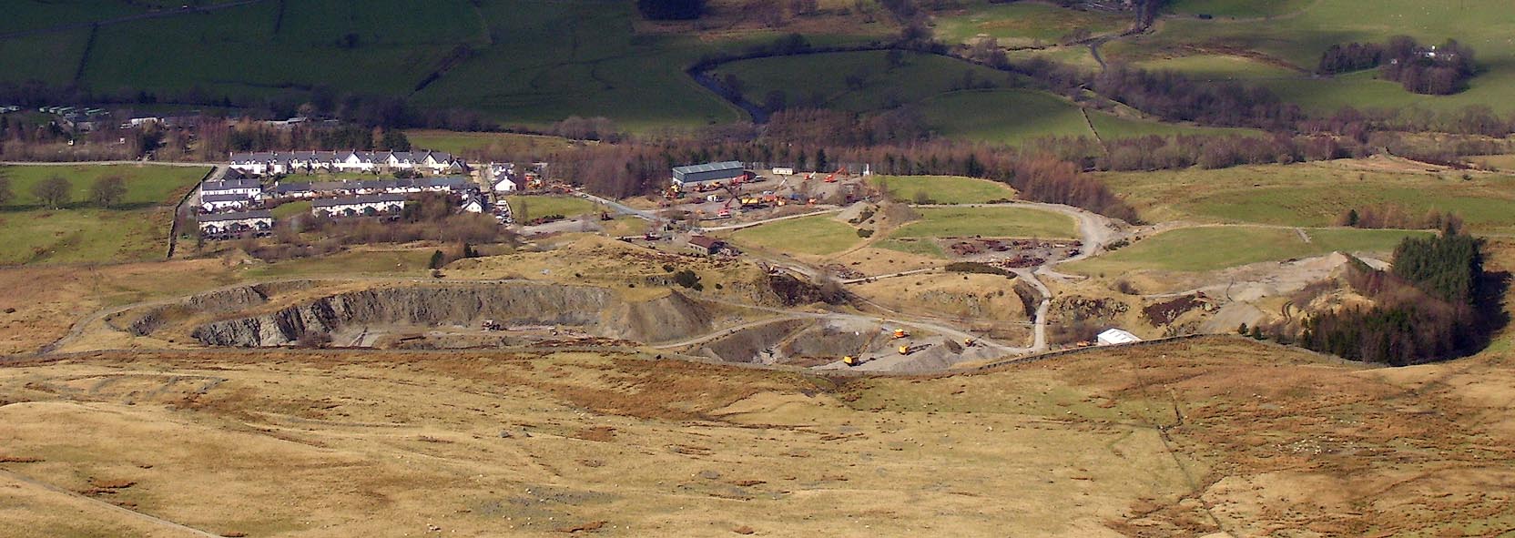 Click to enlarge BOV17.jpg (taken 17.3.2008) |
||
|
|
||
| evidence:- | old map:- Postlethwaite 1877 (3rd edn 1913) placename:- Threlkeld Quarry |
|
| source data:- | Map, uncoloured engraving, Map of the Lake District Mining Field, Westmorland, Cumberland,
Lancashire, scale about 5 miles to 1 inch, by John Postlethwaite, published by W H
Moss and Sons, 13 Lowther Street, Whitehaven, Cumberland, 1877 edn 1913.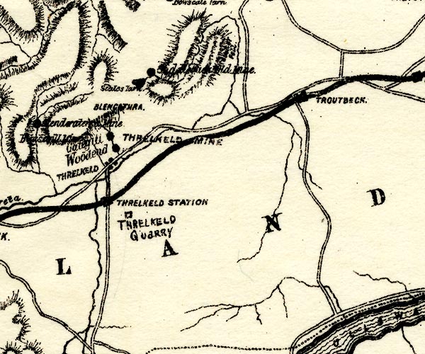 PST2NY32.jpg "THRELKELD QUARRY" quarry symbol item:- JandMN : 162.2 Image © see bottom of page |
|
|
|
||
| evidence:- | old advertisement:- Postlethwaite 1877 |
|
| source data:- | Advertisement, for the Threlkeld Granite Co, Threlkeld Quarry, Threlkeld, Cumberland,
published by W H Moss and Sons, 13 Lowther Street, Whitehaven, Cumberland, 1877 edn
1913.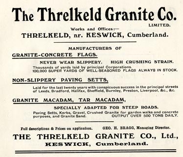 click to enlarge click to enlargePST3A7.jpg item:- JandMN : 162.49 Image © see bottom of page |
|
|
|
||
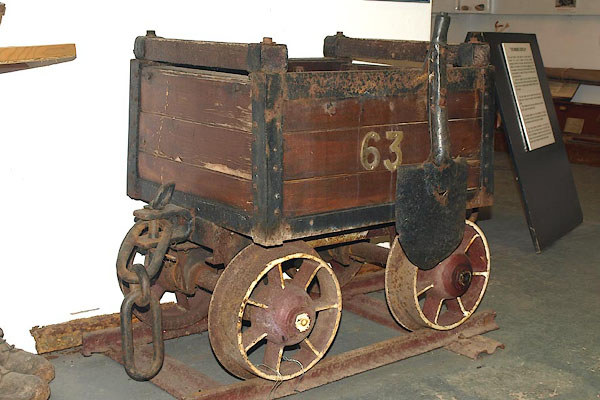 BPC73.jpg Mine tub. Courtesy Threlkeld Mining Museum. 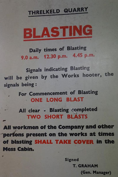 CFJ84.jpg "... BLASTING ..." Courtesy Threlkeld Mining Museum. |
||
|
|
||
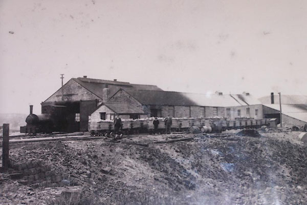 BMH33.jpg Threlkeld Quarry, early 1900s. Courtesy Threlkeld Mining Museum. 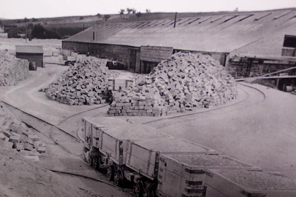 BMH34.jpg Threlkeld Quarry, early 1900s. Courtesy Threlkeld Mining Museum. 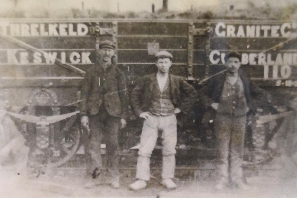 CFJ81.jpg Private owners wagon' "THRELKELD GRANITE Co. [lTD.] / KESWICK C[UM]BERLA[D]" Courtesy Threlkeld Mining Museum. |
||
|
|
||
| Glover, David: 2014: Quarries of Lakeland: Bookcase (Carlisle, Cumbria) |
||
|
|
||
 Lakes Guides menu.