Old Cumbria Gazetteer
 |
 |
|
||
| Torpenhow | ||||
| Trepena | ||||
| Trepanna | ||||
| civil parish:- | Blennerhasset and Torpenhow (formerly Cumberland) | |||
| county:- | Cumbria | |||
| locality type:- | locality | |||
| locality type:- | buildings | |||
| coordinates:- | NY20403973 (etc) | |||
| 1Km square:- | NY2039 | |||
| 10Km square:- | NY23 | |||
|
|
||||
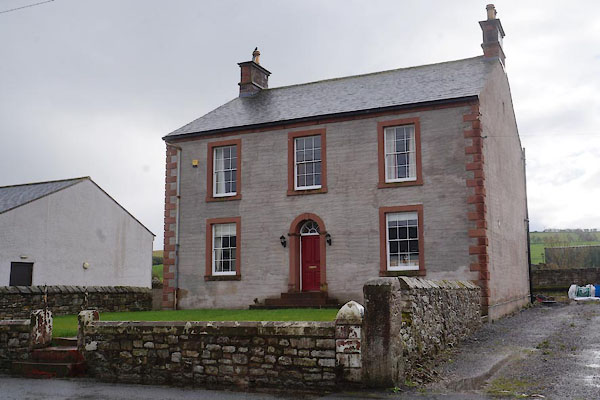
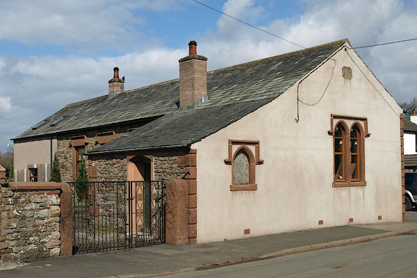
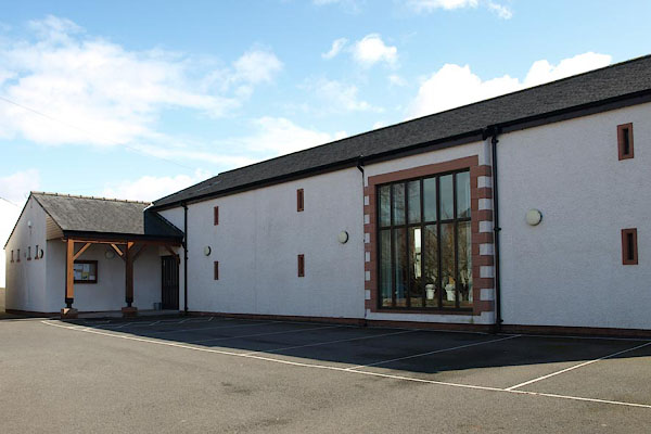
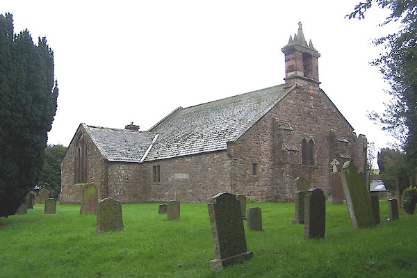
 CBV41.jpg (taken 10.10.2014) |
||||
|
|
||||
| evidence:- | old map:- OS County Series (Cmd 36 15) placename:- Torpenhow |
|||
| source data:- | Maps, County Series maps of Great Britain, scales 6 and 25
inches to 1 mile, published by the Ordnance Survey, Southampton,
Hampshire, from about 1863 to 1948. |
|||
|
|
||||
| evidence:- | old map:- Saxton 1579 placename:- Torpenny |
|||
| source data:- | Map, hand coloured engraving, Westmorlandiae et Cumberlandiae Comitatus ie Westmorland
and Cumberland, scale about 5 miles to 1 inch, by Christopher Saxton, London, engraved
by Augustinus Ryther, 1576, published 1579-1645.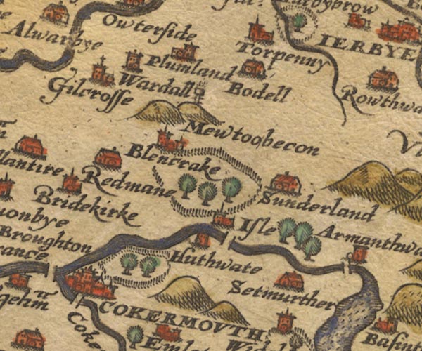 Sax9NY13.jpg Church, symbol for a parish or village, with a parish church. "Torpenny" item:- private collection : 2 Image © see bottom of page |
|||
|
|
||||
| evidence:- | old map:- Mercator 1595 (edn?) placename:- Torpenny |
|||
| source data:- | Map, hand coloured engraving, Northumbria, Cumberlandia, et
Dunelmensis Episcopatus, ie Northumberland, Cumberland and
Durham etc, scale about 6.5 miles to 1 inch, by Gerard Mercator,
Duisberg, Germany, about 1595.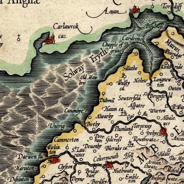 MER8CumB.jpg "Torpenny" circle item:- JandMN : 169 Image © see bottom of page |
|||
|
|
||||
| evidence:- | old map:- Speed 1611 (Cmd) placename:- Torpenny |
|||
| source data:- | Map, hand coloured engraving, Cumberland and the Ancient Citie
Carlile Described, scale about 4 miles to 1 inch, by John Speed,
1610, published by J Sudbury and George Humble, Popes Head
Alley, London, 1611-12.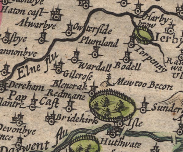 SP11NY13.jpg "Torpenny" circle, tower item:- private collection : 16 Image © see bottom of page |
|||
|
|
||||
| evidence:- | old map:- Jansson 1646 placename:- Torpenny |
|||
| source data:- | Map, hand coloured engraving, Cumbria and Westmoria, ie
Cumberland and Westmorland, scale about 3.5 miles to 1 inch, by
John Jansson, Amsterdam, Netherlands, 1646.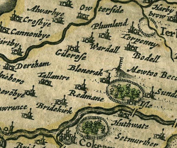 JAN3NY13.jpg "Torpenny" Buildings and tower. item:- JandMN : 88 Image © see bottom of page |
|||
|
|
||||
| evidence:- | old map:- Ogilby 1675 (plate 96) placename:- Torpeny |
|||
| source data:- | Road strip map, hand coloured engraving, the Road from Kendal to
Cockermouth, and the Road from Egremond to Carlisle, scale about
1 inch to 1 mile, by John Ogilby, London, 1675.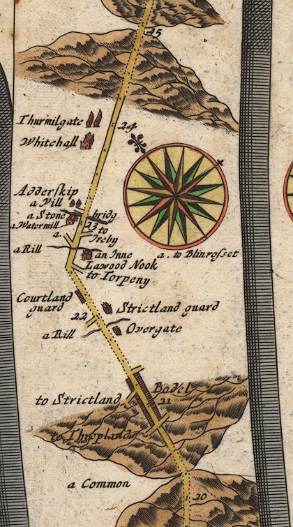 OG96Bm20.jpg In mile 22, Cumberland. Turning right:- "to Torpeny" item:- JandMN : 22 Image © see bottom of page |
|||
|
|
||||
| evidence:- | old map:- Morden 1695 (Cmd) placename:- Torpenhow |
|||
| source data:- | Map, uncoloured engraving, Cumberland, scale about 4 miles to 1
inch, by Robert Morden, 1695, published by Abel Swale, the
Unicorn, St Paul's Churchyard, Awnsham, and John Churchill, the
Black Swan, Paternoster Row, London, 1695-1715.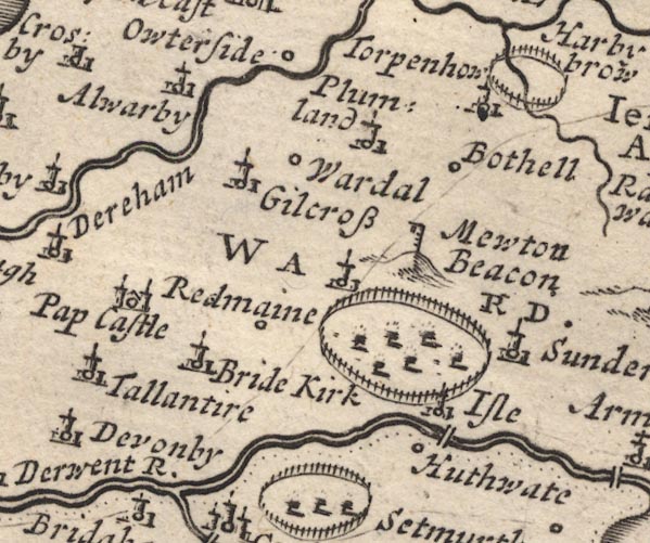 MD12NY13.jpg "Torpenhow" Circle, building and tower. item:- JandMN : 90 Image © see bottom of page |
|||
|
|
||||
| evidence:- | old map:- Bowen and Kitchin 1760 placename:- Torpenhow |
|||
| source data:- | Map, hand coloured engraving, A New Map of the Counties of
Cumberland and Westmoreland Divided into their Respective Wards,
scale about 4 miles to 1 inch, by Emanuel Bowen and Thomas
Kitchin et al, published by T Bowles, Robert Sayer, and John
Bowles, London, 1760.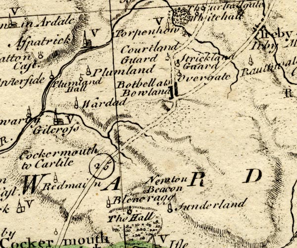 BO18NY13.jpg "Torpenhow / V" circle, tower, vicarage item:- Armitt Library : 2008.14.10 Image © see bottom of page |
|||
|
|
||||
| evidence:- | old map:- Donald 1774 (Cmd) placename:- Torpenhow |
|||
| source data:- | Map, hand coloured engraving, 3x2 sheets, The County of Cumberland, scale about 1
inch to 1 mile, by Thomas Donald, engraved and published by Joseph Hodskinson, 29
Arundel Street, Strand, London, 1774.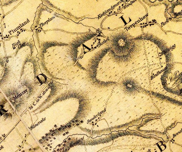 D4NY13NE.jpg "Torpenhow" block or blocks, labelled in lowercase; a hamlet or just a house item:- Carlisle Library : Map 2 Image © Carlisle Library |
|||
|
|
||||
| evidence:- | old map:- Cooper 1808 placename:- Torpenhow |
|||
| source data:- | Map, uncoloured engraving, Cumberland, scale about 10.5 miles to
1 inch, drawn and engraved by Cooper, published by R Phillips,
Bridge Street, Blackfriars, London, 1808. click to enlarge click to enlargeCOP3.jpg "Torpenhow" circle; village or hamlet item:- JandMN : 86 Image © see bottom of page |
|||
|
|
||||
| evidence:- | old map:- Otley 1818 placename:- Torpenhow |
|||
| source data:- | Map, uncoloured engraving, The District of the Lakes,
Cumberland, Westmorland, and Lancashire, scale about 4 miles to
1 inch, by Jonathan Otley, 1818, engraved by J and G Menzies,
Edinburgh, Scotland, published by Jonathan Otley, Keswick,
Cumberland, et al, 1833.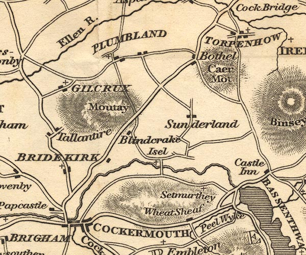 OT02NY13.jpg "TORPENHOW" item:- JandMN : 48.1 Image © see bottom of page |
|||
|
|
||||
| evidence:- | old map:- Ford 1839 map placename:- Torpenhow |
|||
| source data:- | Map, uncoloured engraving, Map of the Lake District of
Cumberland, Westmoreland and Lancashire, scale about 3.5 miles
to 1 inch, published by Charles Thurnam, Carlisle, and by R
Groombridge, 5 Paternoster Row, London, 3rd edn 1843.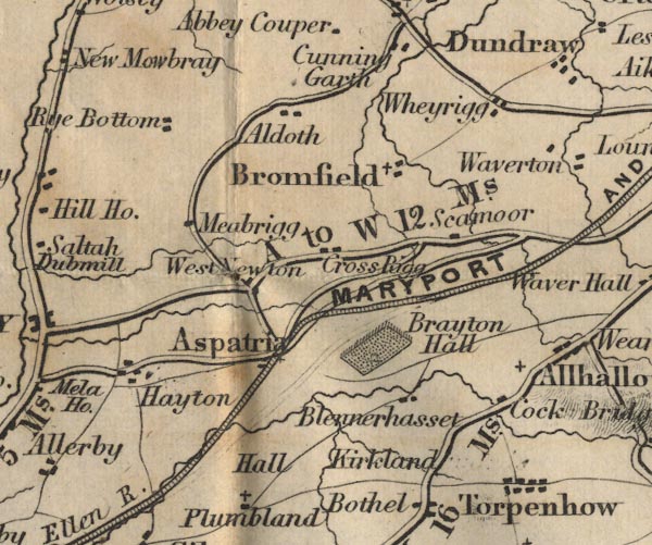 FD02NY14.jpg "Torpenhow" item:- JandMN : 100.1 Image © see bottom of page |
|||
|
|
||||
| evidence:- | old map:- Garnett 1850s-60s H placename:- Torpenhow |
|||
| source data:- | Map of the English Lakes, in Cumberland, Westmorland and
Lancashire, scale about 3.5 miles to 1 inch, published by John
Garnett, Windermere, Westmorland, 1850s-60s.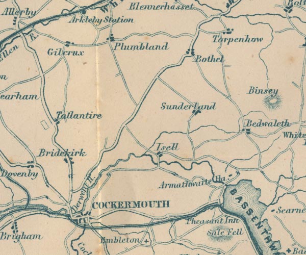 GAR2NY13.jpg "Torpenhow" blocks, settlement item:- JandMN : 82.1 Image © see bottom of page |
|||
|
|
||||
| hearsay:- |
Daniel Brocklebank was born here, son of a curate, 1742. He became a shipbuilder in
Whitehaven and founded a shipping line, the Brocklebank Line. As T and J Brocklebank
the company moved to Liverpool, and later amalgamated with the Cunard Line. |
|||
|
|
||||
| personal | ||||
| person:- | shipbuilder : Brocklebank, Daniel, Captain |
|||
| place:- | birthplace | |||
| date:- | 1742 |
|||
|
|
||||
| places:- |
|
|||
|
||||
|
||||
|
||||
|
||||
|
||||
|
||||
|
||||
|
||||
|
||||
|
||||
|
||||
|
||||
|
||||
|
||||
|
||||
 Lakes Guides menu.