 Old Cumbria Gazetteer
 |
 |
|
| Wads Howe, Longsleddale | ||
| Wads Howe | ||
| Wad's Howe | ||
| civil parish:- | Longsleddale (formerly Westmorland) | |
| county:- | Cumbria | |
| locality type:- | buildings | |
| coordinates:- | NY49540320 | |
| 1Km square:- | NY4903 | |
| 10Km square:- | NY40 | |
|
|
||
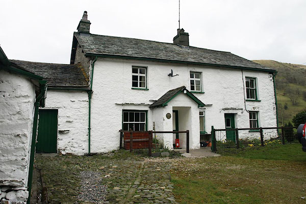 BOZ95.jpg (taken 9.4.2008) 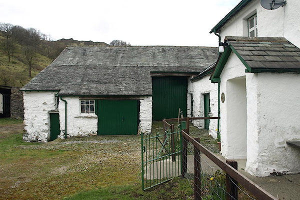 BOZ96.jpg (taken 9.4.2008) |
||
|
|
||
| evidence:- | old map:- OS County Series (Wmd 27 11) placename:- Wad's Howe |
|
| source data:- | Maps, County Series maps of Great Britain, scales 6 and 25
inches to 1 mile, published by the Ordnance Survey, Southampton,
Hampshire, from about 1863 to 1948.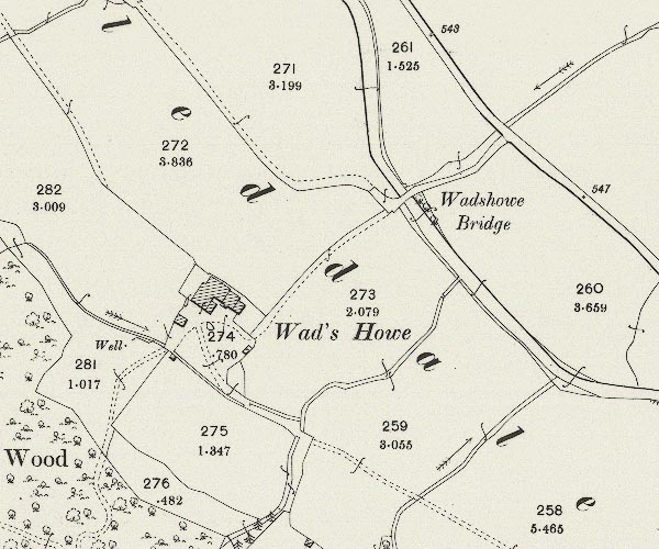 C5E014.jpg "Wads Howe" |
|
|
|
||
| evidence:- | census returns:- placename:- Wadshow |
|
|
|
||
 old parish registers (formerly ) old parish registers (formerly ) |
||
|
|
||
| evidence:- | old map:- Jefferys 1770 (Wmd) placename:- Wads How |
|
| source data:- | Map, 4 sheets, The County of Westmoreland, scale 1 inch to 1
mile, surveyed 1768, and engraved and published by Thomas
Jefferys, London, 1770.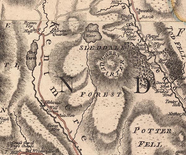 J5NY40SE.jpg "Wads How" circle, labelled in italic lowercase text; settlement, farm, house, or hamlet? item:- National Library of Scotland : EME.s.47 Image © National Library of Scotland |
|
|
|
||
| evidence:- | old map:- Hodgson 1828 placename:- Wads How |
|
| source data:- | Map, hand coloured engraving, 4 sheets mounted together on linen and rolled, Plan
of the County of Westmorland, scale about 1.25 inches to 1 mile, by Thomas Hodgson,
engraved by W R Gardner, Harpur Street, London, published by Thomas Hodgson, Lancaster,
and perhaps by C Smith, 172 Strand, London,1828.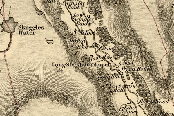 HDG6lsl2.jpg map courtesy of Mark Cropper "Wads How" item:- private collection : 371 Image © see bottom of page |
|
|
|
||
| evidence:- | old map:- Kendal Corn Rent Act 1836 placename:- Wads How |
|
| source data:- | Tithe map, Plan of part of the Township of Longsleddale, Westmorland, made regarding
the Kendal Corn Rent Act, ie a tithe award map, scale about 20 inches to 1 mile, Kendal,
Westmorland, 1836.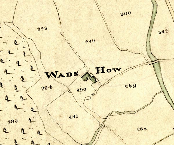 KCR214.jpg courtesy of Mark Cropper Plan of part of the Township of Longsleddale, Westmorland, made regarding the Kendal Corn Rent Act, ie a tithe award map, scale about 20 inches to 1 mile, Kendal, Westmorland, 1836. "WADS HOW" item:- private collection : 370 Image © see bottom of page |
|
|
|
||
| Kendal Corn Rent Act 1836 |
||
|
|
||
| evidence:- | old map:- OS 1881-82 New Series (outline edition) placename:- Wads Howe |
|
| source data:- | Map, engraving, area north of Kendal, Westmorland, New Series
one inch map, outline edition, sheet 39, scale 1 inch to 1 mile,
published by the Ordnance Survey, Southampton, Hampshire,
1881-82.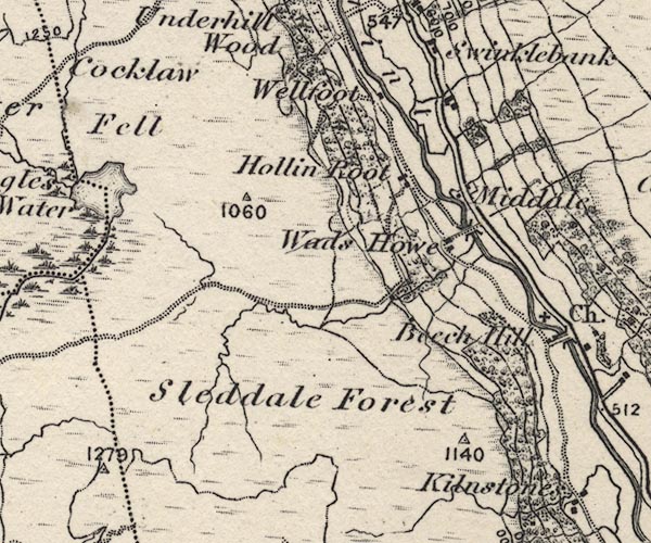 O21NY40W.jpg "Wads Howe" item:- JandMN : 61 Image © see bottom of page |
|
|
|
||
| evidence:- | records:- Farrer and Curwen 1923 placename:- Waddshow item:- marriage settlement |
|
| source data:- | Records Relating to the Barony of Kendale, edited by William
Farrer and John F Curwen, published by Titus Wilson and Son,
Kendal, Westmorland, 1923. "1647 : Indentures of a marriage settlement dated 2 February, 23 Charles 1, 1647, between Richard Bennison of Longsleddall, yeoman (1), George Bennison, his son, of Beethon, schoolmaster (2); reciting that in consideration of a marriage to be solemnized between the said George Bennison and Elizabeth Bacchouse of Haverbracke "on this side and before the feast day of Pentecoste," the said Richard hath granted to the said George a messuage tenement in Longsleddall at a place called Waddshow in Longsleddall, in the tenure of the said Richard Bennison parcel of the land of Sir Henry Bellingham knt., and "barronett," of the yearly rent of 11s. 8d., to the said George and his heirs immediately after the death of the said George Bennison and Cecilie his wife; D. at Levens." |
|
|
|
||
| evidence:- | textbook:- EPNS Westmorland 1967 placename:- Waddshow |
|
| source data:- | Book, The Place Names of Westmorland, two volumes, by A H Smith,
published for the English Place Name Society by Cambridge
University Press, Cambridgeshire, 1967 |
|
|
|
||
| census records |
||
|
|
||
| directory entries |
||
|
|
||
| evidence:- | map:- OS Six Inch (1956) placename:- Wad's Howe |
|
| source data:- | Map series, various editions with the national grid, scale about
6 inches to 1 mile, published by the Ordnance Survey,
Southampton, Hampshire, scale 1 to 10560 from 1950s to 1960s,
then 1 to 10000 from 1960s to 2000s, superseded by print on
demand from digital data.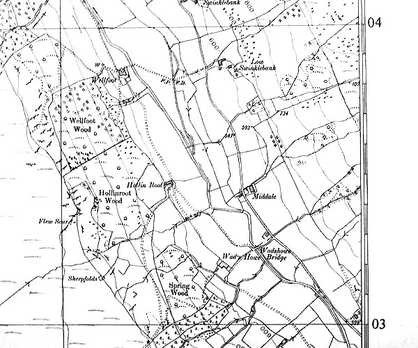 SINY4903.jpg "Wad's Howe" |
|
|
|
||
| evidence:- | shepherds guide:- Wilson 1913 placename:- Wadshow |
|
| source data:- | Book, New Shepherd's Guide for Cumberland, Westmorland, and
Lancashire, by Thomas Wilson, 1913.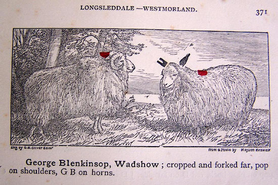 WL1p371a.jpg "George Blenkinsop, Wadshow; cropped and forked far, pop on shoulder, G B on horns." item:- private collection : 329 Image © see bottom of page |
|
|
|
||
| evidence:- | shepherds guide:- Gate 1879 placename:- Wadshow |
|
| source data:- | Book, New Shepherd's Guide for Cumberland, Westmoreland, and
Lancashire, published by Daniel Gate, Keswick, Cumberland, 1879.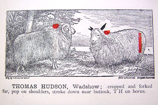 GT1p387b.jpg "THOMAS HUDSON, Wadshow; cropped and forked far, pop on shoulders, stroke down near buttock, TH on horns." item:- Kendal Library : 38 Image © see bottom of page |
|
|
|
||
| evidence:- | shepherds guide:- Hodgson 1849 placename:- Wadshow |
|
| source data:- | Book, Shepherd's Guide, or a Delineation of the Wool and Ear
Marks of the Different Stocks of Sheep, Lancashire, Cumberland,
and Westmorland, by William Hodgson, Normoss, Corney,
Cumberland, 1849. HG2p595c.jpg "THOMAS HUDSON, Wadshow." "Cropped and forked far ear, a red pop on the shoulders, and a stroke down the near buttock TH on the horns." item:- Kendal Library : 39 Image © see bottom of page |
|
|
|
||
| evidence:- | shepherds guide:- Lamb 1937 placename:- Wadshow |
|
| source data:- | Book, Lamb's Shepherds' Guide for Cumberland, Westmorland and
Lancashire, by R H Lamb, published by the Herald Printing Co,
Penrith, Cumberland, 1937.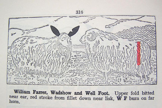 LM1p316a.jpg "William Farrer, Wadshow and Well Foot. Upper fold bitted near ear, red stroke from fillet down near lisk, W F burn on far horn." item:- Kendal Library : 40 Image © see bottom of page |
|
|
|
||
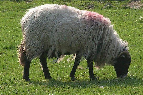 BMC84.jpg Sheep with the Wadshowe flock mark, in the pasture by Middale. Red pop on shoulder. (taken 12.5.2006) |
||
|
|
||
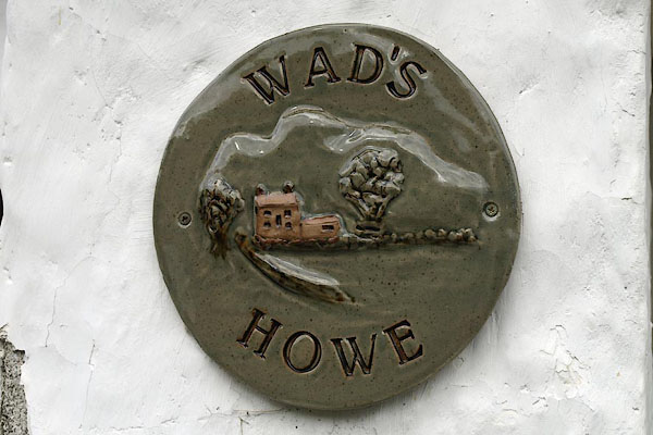 BOZ97.jpg Pottery house name sign on the house:- "WAD'S HOWE" (taken 9.4.2008) 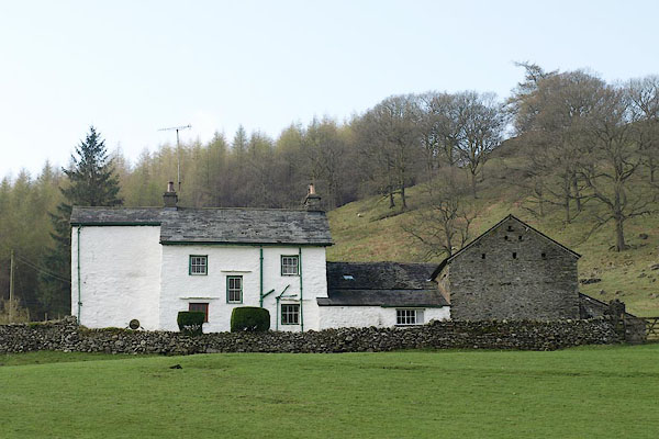 BSN75.jpg (taken 16.4.2010) 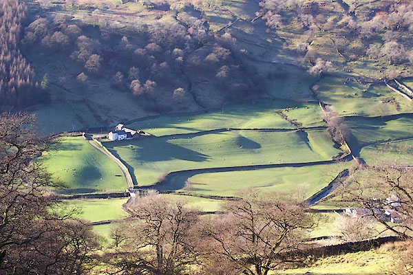 BXS58.jpg (taken 29.11.2012) |
||
|
|
||
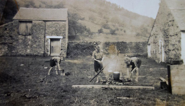 BYZ08.jpg Boy Scouts camping. |
||
|
|
||
 Lakes Guides menu.