 Old Cumbria Gazetteer
 |
 |
|
| Wanthwaite Bridge, Wanthwaite | ||
| Wanthwaite Bridge | ||
| site name:- | St John's Beck | |
| locality:- | Wanthwaite | |
| locality:- | St John's in the Vale | |
| civil parish:- | St John's Castlerigg and Wythburn (formerly Cumberland) | |
| county:- | Cumbria | |
| locality type:- | bridge | |
| coordinates:- | NY31402314 | |
| 1Km square:- | NY3123 | |
| 10Km square:- | NY32 | |
|
|
||
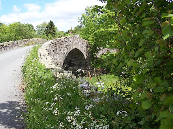 BJQ01.jpg (taken 10.6.2005) 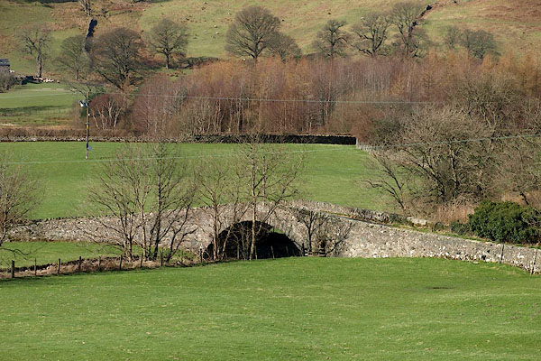 BOU73.jpg (taken 17.3.2008) |
||
|
|
||
| evidence:- | old map:- OS County Series (Cmd 64 8) placename:- Wanthwaite Bridge |
|
| source data:- | Maps, County Series maps of Great Britain, scales 6 and 25
inches to 1 mile, published by the Ordnance Survey, Southampton,
Hampshire, from about 1863 to 1948. |
|
|
|
||
| evidence:- | old map:- Donald 1774 (Cmd) |
|
| source data:- | Map, hand coloured engraving, 3x2 sheets, The County of Cumberland, scale about 1
inch to 1 mile, by Thomas Donald, engraved and published by Joseph Hodskinson, 29
Arundel Street, Strand, London, 1774.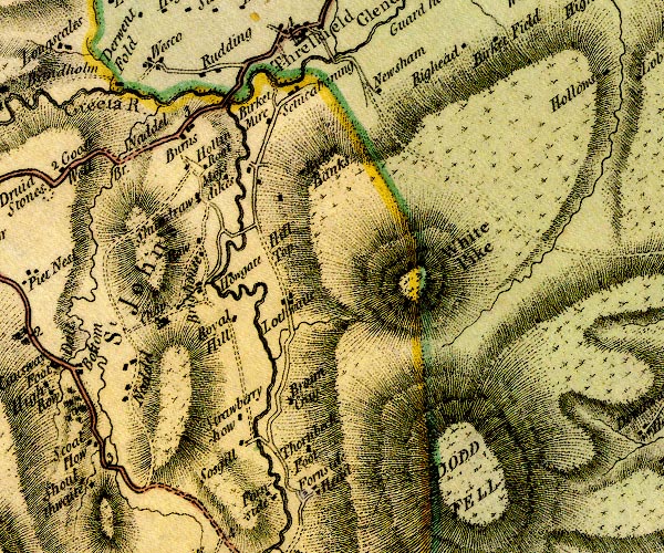 D4NY32SW.jpg double line across a river; a bridge near Hill Top item:- Carlisle Library : Map 2 Image © Carlisle Library |
|
|
|
||
 Lakes Guides menu.