Old Cumbria Gazetteer
 |
 |
|
||
| Wasdale Head, Nether Wasdale | ||||
| Wasdale Head | ||||
| Row | ||||
| locality:- | Wasdale | |||
| civil parish:- | Nether Wasdale (formerly Cumberland) | |||
| county:- | Cumbria | |||
| locality type:- | locality | |||
| locality type:- | buildings | |||
| coordinates:- | NY18690880 (etc) | |||
| 1Km square:- | NY1808 | |||
| 10Km square:- | NY10 | |||
|
|
||||
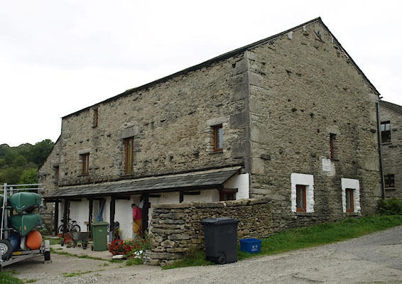
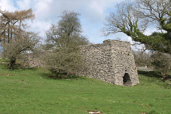
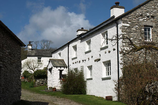
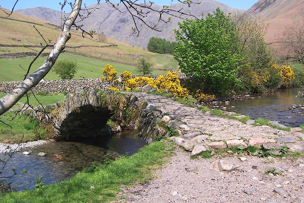
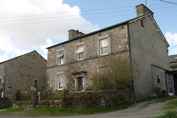
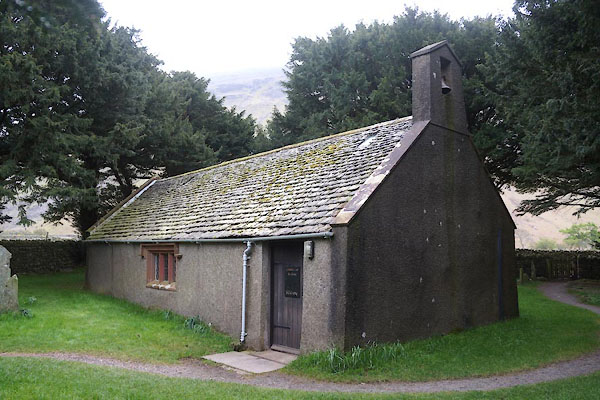
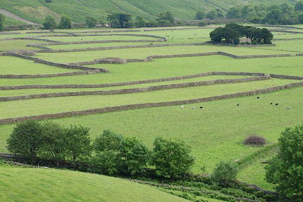
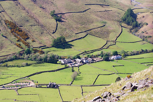 BQO28.jpg (taken 12.5.2009) 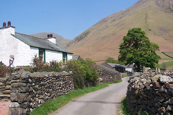 BMB51.jpg (taken 11.5.2006) |
||||
|
|
||||
| evidence:- | old map:- Saxton 1579 placename:- Wasdale Chapel |
|||
| source data:- | Map, hand coloured engraving, Westmorlandiae et Cumberlandiae Comitatus ie Westmorland
and Cumberland, scale about 5 miles to 1 inch, by Christopher Saxton, London, engraved
by Augustinus Ryther, 1576, published 1579-1645.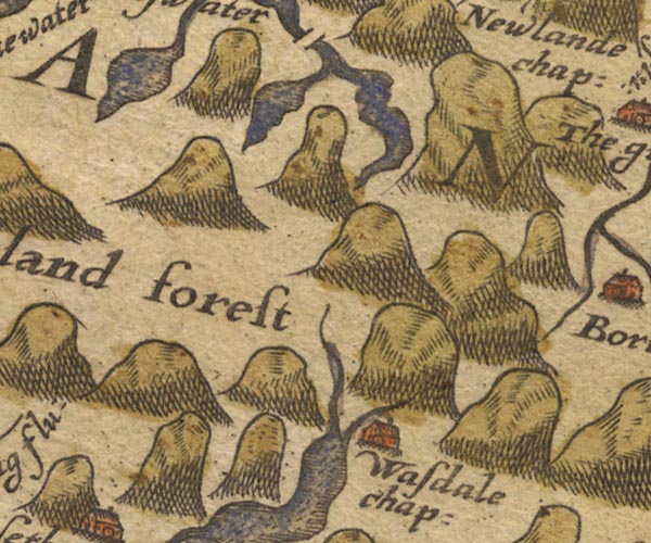 Sax9NY11.jpg Building, symbol for a hamlet, which may or may not have a nucleus. "Wasdale chap:" item:- private collection : 2 Image © see bottom of page |
|||
|
|
||||
| evidence:- | old map:- Mercator 1595 (edn?) placename:- Wasdale Chapelry |
|||
| source data:- | Map, hand coloured engraving, Northumbria, Cumberlandia, et
Dunelmensis Episcopatus, ie Northumberland, Cumberland and
Durham etc, scale about 6.5 miles to 1 inch, by Gerard Mercator,
Duisberg, Germany, about 1595. MER8CumE.jpg "Wasdale chap." circle item:- JandMN : 169 Image © see bottom of page |
|||
|
|
||||
| evidence:- | perhaps old map:- Keer 1605 placename:- Wasdale Chapel |
|||
| source data:- | Map, hand coloured engraving, Westmorland and Cumberland, scale
about 16 miles to 1 inch, probably by Pieter van den Keere, or
Peter Keer, about 1605 edition perhaps 1676. click to enlarge click to enlargeKER8.jpg "Wasdale chap" dot, circle and tower; village item:- Dove Cottage : 2007.38.110 Image © see bottom of page |
|||
|
|
||||
| evidence:- | old map:- Jenner 1643 placename:- Wasdale Chapel |
|||
| source data:- | Tables of distances with a maps, Westmerland, scale about 16
miles to 1 inch, and Cumberland, scale about 21 miles to 1 inch,
published by Thomas Jenner, London, 1643; published 1643-80.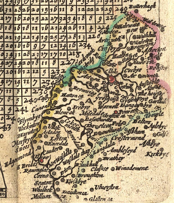 JEN4Sq.jpg "Wasdale chap" circle |
|||
|
|
||||
| evidence:- | old map:- Seller 1694 (Cmd) placename:- Wasdale Chapel |
|||
| source data:- | Map, uncoloured engraving, Cumberland, scale about 12 miles to 1
inch, by John Seller, 1694. click to enlarge click to enlargeSEL9.jpg "Wasdale Chap." circle, italic lowercase text; settlement or house item:- Dove Cottage : 2007.38.89 Image © see bottom of page |
|||
|
|
||||
| evidence:- | old map:- Badeslade 1742 placename:- Warsdale Chapel |
|||
| source data:- | Map, uncoloured engraving, A Map of Cumberland North from
London, scale about 11 miles to 1 inch, with descriptive text,
by Thomas Badeslade, London, engraved and published by William
Henry Toms, Union Court, Holborn, London, 1742. click to enlarge click to enlargeBD10.jpg "Warsdale C." circle, italic lowercase text; village, hamlet or locality, at the head of Wast Water item:- JandMN : 115 Image © see bottom of page |
|||
|
|
||||
| evidence:- | old map:- Simpson 1746 map (Wmd) placename:- Warsdale |
|||
| source data:- | Map, uncoloured engraving, Westmorland, scale about 8 miles to 1
inch, printed by R Walker, Fleet Lane, London, 1746.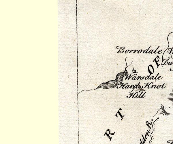 SMP2NYA.jpg "Warsdale" Building. item:- Dove Cottage : 2007.38.59 Image © see bottom of page |
|||
|
|
||||
| evidence:- | old map:- Donald 1774 (Cmd) placename:- Wastdale Head placename:- Row |
|||
| source data:- | Map, hand coloured engraving, 3x2 sheets, The County of Cumberland, scale about 1
inch to 1 mile, by Thomas Donald, engraved and published by Joseph Hodskinson, 29
Arundel Street, Strand, London, 1774.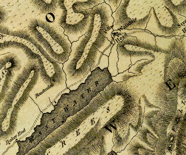 D4NY10NE.jpg "Wastdale Head" blocks, and usually a church, labelled in upright lowercase; a village "Row" block or blocks, labelled in lowercase; a hamlet or just a house item:- Carlisle Library : Map 2 Image © Carlisle Library |
|||
|
|
||||
| evidence:- | old text:- Clarke 1787 placename:- Wasdalehead item:- Herdwick sheep; sheep; storm; snow |
|||
| source data:- | Guide book, A Survey of the Lakes of Cumberland, Westmorland,
and Lancashire, written and published by James Clarke, Penrith,
Cumberland, and in London etc, 1787; published 1787-93. goto source goto sourcePage 98:- "... There is a kind of sheep in these mountains called Herdwicks, which when fed to the highest growth, seldom exceed nine or ten pounds a quarter; they, contrary to all other sheep I have met with, are seen before a storm, especially of snow, to ascend against the coming blast, and take the stormy side of the mountain, which, fortunately for themselves, saves them from being over-blown. This valuable instinct was first discovered by the people of Wasdalehead, a small village, whose limits join those of Borrowdale. They, to keep this breed as much as possible in their own village, bound themselves in a bond, that no one of them should sell above five ewe (or female) lambs in one year; means, however, were found to smuggle more, so that all the shepherds now have either the whole or half breed of them; especially where the mountains are very high, as in Borrowdale, Newlands, and Skiddow, where they have not hay for them in winter. These sheep lye upon the very tops of the mountains in that season as well as in summer; and, as I said before, keep to the stormy side, where the wind blows the snow off the surface of the ground." "If a calm snow fall, the shepherds take a harrow, and drag it themselves over the tallest heath, or ling; the snow then falls to the bottom, and the sheep feed upon the tops of it, and the moss which grows upon the stones. They are so remarkably wild and stupid in their temper, that in forcing them by dogs to washing, shearing, &c. they have laid down and died without much fatigue." "Whence this breed first came I cannot learn; the inhabitants of Nether Wasdale say they were taken from on board a stranded ship, however, till within these few years, their number was very small: they grow very little wool; eight or nine of them jointly not producing more than a stone, yet their wool is pretty good." |
|||
|
|
||||
| evidence:- | old map:- Cooke 1802 placename:- Wastedale Head |
|||
| source data:- | Map, The Lakes, Westmorland and Cumberland, scale about 8.5
miles to 1 inch, engravedby Neele and Son, published by
Sherwood, Jones and Co, Paternoster Road, London, 1824. click to enlarge click to enlargeGRA1Lk.jpg "Wastedale Head" blocks, italic lowercase text, village, hamlet, locality item:- Hampshire Museums : FA2000.62.5 Image © see bottom of page |
|||
|
|
||||
| evidence:- | old map:- Laurie and Whittle 1806 placename:- Wastdale Head |
|||
| source data:- | Road map, Completion of the Roads to the Lakes, scale about 10
miles to 1 inch, by Nathaniel Coltman? 1806, published by Robert
H Laurie, 53 Fleet Street, London, 1834. click to enlarge click to enlargeLw18.jpg "Wastdale Head 279¾" village or other place; distance from London item:- private collection : 18.18 Image © see bottom of page |
|||
|
|
||||
| evidence:- | old text:- Green 1810 placename:- Wastdale Head |
|||
| source data:- | Set of prints, soft ground etchings, Sixty Studies from Nature,
by William Green, Ambleside, Westmorland, drawn 1808-10,
published 1810. goto source page 81:- "..." "At Wastdale Head are six dwellings: In this dale the wood is scanty, but as it thrives well, it is a pity the shepherds do not plant more; for, by so doing, they would make this sequestered region a pastoral Paradise: From the highest house in the valley it is scarcely two miles to the head of Wast Water." "..." goto sourcepage 86:- "..." "Speaking of Wastdale Head, it may be necessary to observe that the worthy inhabitants of that at once hospitable and inhospitable region, occasionally accommodate the weary traveller with lodging, and with food and raiment too, from their kine and fleecy stores; for which, however, (with the Swiss minister on the like occasion) they will accept a gratuity; and, who would not offer it with thanks for such hospitality, particularly when conferred with a politeness that would little be expected by a southern Englishman." |
|||
|
|
||||
| evidence:- | old print:- Wilkinson 1810 (plate 42) item:- walker |
|||
| source data:- | Print, uncoloured soft ground etching, View on the Banks of Wast Water, Cumberland,
by Joseph Wilkinson, engraved by William Frederick Wells, published by R Ackermann,
Repository of Arts, 101 Strand, London, 1810.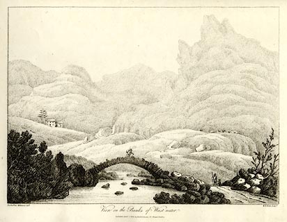 click to enlarge click to enlargeWKN142.jpg Perhaps Sca Fell behind. Plate 42 in Select Views in Cumberland, Westmoreland, and Lancashire. printed at bottom left, right, centre:- "The Revd. Jos. Wilkenson delt. / W. F. Wells sculpt. / View on the Banks of Wast-water. / Published April. 1. 1810. by R. Ackermann. 101. Strand. London." item:- Fell and Rock Climbing Club : MN4.42 Image © see bottom of page |
|||
|
|
||||
| evidence:- | old print with text:- Farington 1816 placename:- Wasdale Village |
|||
| source data:- | Print, uncoloured engraving and descriptive text, Wastdale Village, Nether Wasdale,
Cumberland, drawn by Joseph Farington, engraved by J Landseer, published by T Cadell
and W Davies, Strand, London, 1815.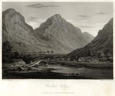 click to enlarge click to enlargeFA0418.jpg printed, bottom left, right, centre "Drawn by J. Farington R.A. / Engraved by J. Landseer A.R.A. / Wastdale Village. / London Published Septr. 15, 1815, by T. Cadell &W. Davies, Strand." Descriptive text:- "WASTDALE VILLAGE," "IS situated among the western mountains of Cumberland, about two miles north from Eskdale; and has in its front the Lake of Wast-Water. From the difficulty of access to these interesting objects, except on the side of Egremont, this Village and Lake are seldom visited by strangers, but the traveller will be well rewarded on approaching the secluded and truly alpine valley in which the village is situated. Here every thing is rural, and seen in the true style of pastoral beauty and simplicity. Excepting the opening towards the Lake the valley is closely surrounded by mountains. ..." item:- Armitt Library : A6666.18 Image © see bottom of page |
|||
|
|
||||
| evidence:- | old map:- Otley 1818 placename:- Wasdale Head |
|||
| source data:- | Map, uncoloured engraving, The District of the Lakes,
Cumberland, Westmorland, and Lancashire, scale about 4 miles to
1 inch, by Jonathan Otley, 1818, engraved by J and G Menzies,
Edinburgh, Scotland, published by Jonathan Otley, Keswick,
Cumberland, et al, 1833. OT02NY10.jpg item:- JandMN : 48.1 Image © see bottom of page |
|||
|
|
||||
| evidence:- | old map:- Hall 1820 (Cmd) placename:- Wasdale Head |
|||
| source data:- | Map, hand coloured engraving, Cumberland, scale about 21 miles
to 1 inch, engraved by Sidney Hall, published by S Leigh, 18
Strand, London, 1820-31. click to enlarge click to enlargeHA14.jpg "Wasdale Hd." circle, italic lowercase text; settlement item:- JandMN : 91 Image © see bottom of page |
|||
|
|
||||
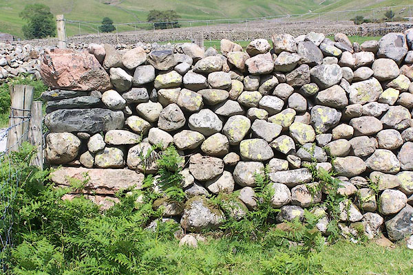
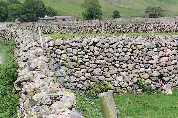
| evidence:- | descriptive text:- Otley 1823 (5th edn 1834) item:- stone wall; population, Wasdale Head; development; rusticity; poverty; geology |
|||
| source data:- | Guide book, A Concise Description of the English Lakes, the
mountains in their vicinity, and the roads by which they may be
visited, with remarks on the mineralogy and geology of the
district, by Jonathan Otley, published by the author, Keswick,
Cumberland now Cumbria, by J Richardson, London, and by Arthur
Foster, Kirkby Lonsdale, Cumbria, 1823; published 1823-49,
latterly as the Descriptive Guide to the English Lakes. goto source Page 30:- "Wasdale Head consists of about half a dozen dwellings sheltered by trees, and a small Chapel, in the midst of an area of arable land, encircled by the loftiest mountains. A public house here is much wanted by travellers; on which account the hospitality of the inhabitants is not unfrequently drawn upon by strangers." "..." goto sourcePage 130:- "Wasdale Head comprises a level area of 400 acres of land, divided by stone walls into small irregular fields, which have been cleared with great industry and labour; as appears from the enormous heaps of stones, piled up from the surplus after completing the inclosures. Here six or seven families have their Chapel, of a size proportionate to the number of inhabitants, and in a style according with the situation; and what Mr. Gray formerly said of Grasmere, may with equal propriety be applied to this vale: 'Not a single red tile, no gentleman's flaring house, or garden walls, break in upon the repose of this little unsuspected paradise; but all is peace, rusticity, and happy poverty, in its neatest, most becoming attire.'" "..." goto sourcePage 149:- "A variety of granite with reddish felspar, and which from a deficiency of mica, has sometimes been" goto sourcePage 151:- "called sienite, ... may be seen shooting up in places, almost as far as Bootle, and also at Wasdale Head. ... It contains veins of red hematite and micaceous iron ore. ..." |
|||
|
|
||||
| evidence:- | descriptive text:- Ford 1839 (3rd edn 1843) placename:- Wastdale Head |
|||
| source data:- | Guide book, A Description of Scenery in the Lake District, by
Rev William Ford, published by Charles Thurnam, Carlisle, by W
Edwards, 12 Ave Maria Lane, Charles Tilt, Fleet Street, William
Smith, 113 Fleet Street, London, by Currie and Bowman,
Newcastle, by Bancks and Co, Manchester, by Oliver and Boyd,
Edinburgh, and by Sinclair, Dumfries, 1839. goto source Page 71:- "..." "... the deep, confined, and fruitful valley of Wastdale Head, with its chapel and half-dozen houses scattered upon a plain of meadow and corn-ground, divided into chequers by stone walls. Beyond, within a bed of steep rocky mountains of pure, unmixed, impenetrable sterility, is the long, narrow, stern, and desolate lake of Wast Water, to the head of which from these houses it is two miles. Refreshment may be had at any of these very respectable statesmen, and the tourist will not offend them by offer-" goto sourcePage 72:- "[offer]ing a sufficient remuneration for their civility and trouble. Near their dwelling is the humble Chapel of Ease, past which a mountain track leads under Scafell by Burnmoor Tarn into Eskdale." goto sourcePage 171:- "... country is more distinguished by sublimity." "Wastdale Head contains only a few scattered houses; and its small chapel has only eight pews, and is without a burial-ground." |
|||
|
|
||||
| evidence:- | old map:- Ford 1839 map placename:- Wastdale Head |
|||
| source data:- | Map, uncoloured engraving, Map of the Lake District of
Cumberland, Westmoreland and Lancashire, scale about 3.5 miles
to 1 inch, published by Charles Thurnam, Carlisle, and by R
Groombridge, 5 Paternoster Row, London, 3rd edn 1843. FD02NY11.jpg "Wastdale Head" item:- JandMN : 100.1 Image © see bottom of page |
|||
|
|
||||
| evidence:- | old map:- Garnett 1850s-60s H placename:- Wasdale Head |
|||
| source data:- | Map of the English Lakes, in Cumberland, Westmorland and
Lancashire, scale about 3.5 miles to 1 inch, published by John
Garnett, Windermere, Westmorland, 1850s-60s. GAR2NY10.jpg "Wasdale Hd." cross, a church item:- JandMN : 82.1 Image © see bottom of page |
|||
|
|
||||
 Martineau Directory 1855 Martineau Directory 1855 |
||||
|
|
||||
| evidence:- | old photograph:- Bell 1880s-1940s |
|||
| source data:- | Photograph, black and white, Wasdale Head, Nether Wasdale, Cumberland, by Herbert
Bell, photographer, Ambleside, Westmorland, 1890s.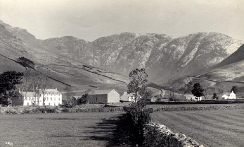 click to enlarge click to enlargeHB0773.jpg internegative at lower left:- "H. Bell" stamped at reverse:- "HERBERT BELL / Photographer / AMBLESIDE" item:- Armitt Library : ALPS436 Image © see bottom of page |
|||
|
|
||||
| evidence:- | old photograph:- Bell 1880s-1940s |
|||
| source data:- | Photograph, black and white, Wasdale Head and Great Gable, Nether Wasdale, Cumberland,
by Herbert Bell, photographer, Ambleside, Westmorland, 1890s.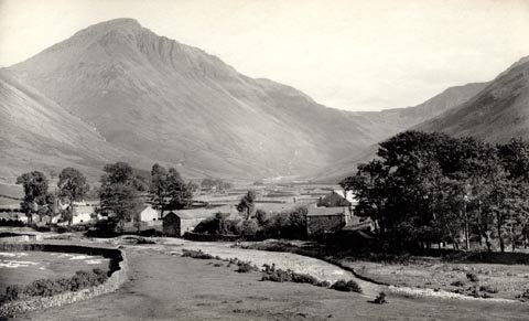 click to enlarge click to enlargeHB0774.jpg stamped at reverse:- "HERBERT BELL / Photographer / AMBLESIDE" item:- Armitt Library : ALPS437 Image © see bottom of page |
|||
|
|
||||
| evidence:- | old photograph:- Bell 1880s-1940s |
|||
| source data:- | Photograph, black and white, Wasdale Head, Kirk Fell behind, Nether Wasdale, Cumberland,
by Herbert Bell, photographer, Ambleside, Westmorland, 1890s.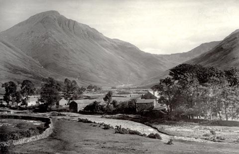 click to enlarge click to enlargeHB0905.jpg item:- Armitt Library : ALPS580 Image © see bottom of page |
|||
|
|
||||
| evidence:- | old print:- Heaton Cooper 1905 (edn 1908) placename:- Wastdalehead |
|||
| source data:- | Print, colour halftone, Wastdalehead, Wastwater, Nether Wasdale, Cumberland, from
a watercolour painting by Alfred Heaton Cooper, published by Adam and Charles Black,
London, 2nd edn 1908.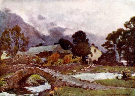 click to enlarge click to enlargeHC0136.jpg Opposite p.94 of The English Lakes, painted by Alfred Heaton Cooper, described by William T Palmer. printed at tissue opposite the print:- "WASTDALEHEAD, WASTWATER" printed at signed lower right:- "A HEATON COOPER" item:- JandMN : 468.36 Image © see bottom of page |
|||
|
|
||||
| evidence:- | old map:- Post Office 1850s-1900s placename:- Wasdale Head |
|||
| source data:- | Post road maps, General Post Office Circulation Map for England
and Wales, for the General Post Office, London, 1850s-1900s. click to enlarge click to enlargePOF7Cm.jpg "Wasdale Head" map date 1909 |
|||
|
|
||||
| :- |
images courtesy of the British Postal Museum and Hampshire CC Museums |
|||
|
|
||||
| evidence:- | old print:- Barber and Atkinson 1927 |
|||
| source data:- | Print, halftone photograph, Looking into Mosedale, view of Wasdale Head, Nether Wasdale,
Cumberland, published by James Atkinson, Caxton Printing Works, Ulverston, Lancashire,
1928.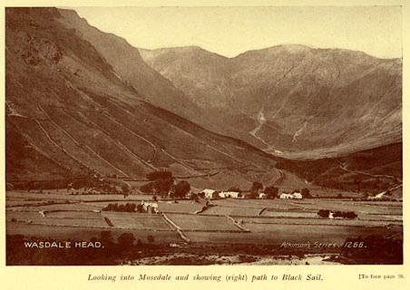 click to enlarge click to enlargeAK0408.jpg Tipped in opposite p.38 of Lakeland Passes, by John B Barber and George Atkinson, 1927, 3rd edn 1928. at inter negative:- "WASDALE HEAD. / Atkinsons Series 1266." printed at bottom:- "Looking into Mosedale and showing (right) path to Black Sail. (To face page 38." item:- JandMN : 350.9 Image © see bottom of page |
|||
|
|
||||
| evidence:- | old photograph:- Bogg 1898 item:- climbing |
|||
| source data:- | Photograph, halftone print, Wasdale Head and Great Gable, Nether Wasdale, Cumberland,
by F Leach, published by Edmund Bogg, 3 Woodhouse Lane, and James Miles, Guildford
Street, Leeds, Yorkshire, 1898.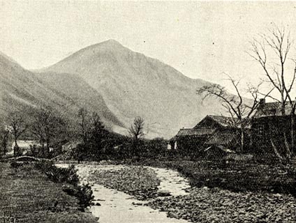 click to enlarge click to enlargeBGG157.jpg Included on p.168 of Lakeland and Ribblesdale, by Edmund Bogg. item:- JandMN : 231.57 Image © see bottom of page |
|||
|
|
||||
| evidence:- | old print:- Sylvan 1847 placename:- Wastdale Head |
|||
| source data:- | Print, engraving, Wastdale Head, Nether Wasdale, Cumberland, published by John Johnstone,
Paternoster Row, London, et al, 1847.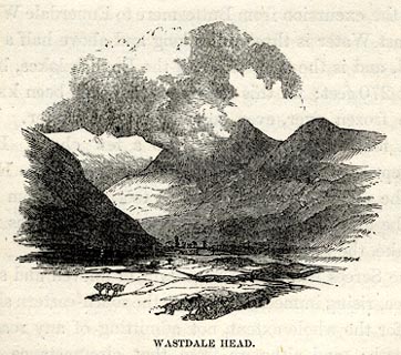 click to enlarge click to enlargeSYL156.jpg On p.216 of Sylvan's Pictorial Guide to the English Lakes. printed at bottom:- "WASTDALE HEAD." item:- Armitt Library : A1201.56 Image © see bottom of page |
|||
|
|
||||
| evidence:- | old print:- Rose 1832-35 placename:- Wastdale Head |
|||
| source data:- | Print, engraving, Wastdale Head, Scawfell Pikes, Cumberland, by Thomas Allom, engraved
by S Lacey, 1833.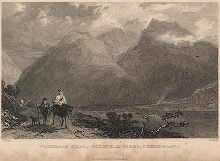 click to enlarge click to enlargeR258.jpg "Wastdale Head, Scawfell Pikes, Cumberland" item:- JandMN : 96.19 Image © see bottom of page |
|||
|
|
||||
| evidence:- | old print with text:- Farington 1816 (plate 25) placename:- Wastdale Village |
|||
| source data:- | Print, uncoloured engraving, Wastdale Village, drawn by Joseph Farington, engraved
by J Landseer, published by T Cadell and W Davies, Strand, London, 1815.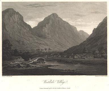 click to enlarge click to enlargeBNV37.jpg Plate 25 in The Lakes of Lancashire, Westmorland and Cumberland ... with text by Thomas Hartwell Horne:- "WASTDALE VILLAGE, / IS situated among the western mountains of Cumberland, about two miles north from Eskdale; and has in its front the Lake of Wast-Water. From the difficulty of access to these interesting objects, except on the side of Egremont, this Village and Lake are seldom visited by strangers, but the traveller will be well rewarded on approaching the secluded and truly alpine valley in which the village is situated. Here every thing is rural, and seen in the true style of pastoral beauty and simplicity. ..." item:- private collection : 76 Image © see bottom of page |
|||
|
|
||||
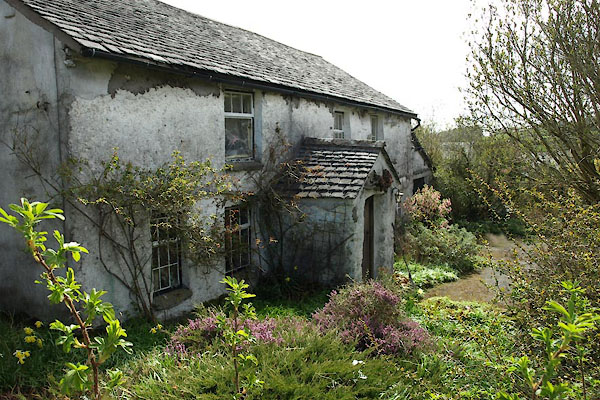
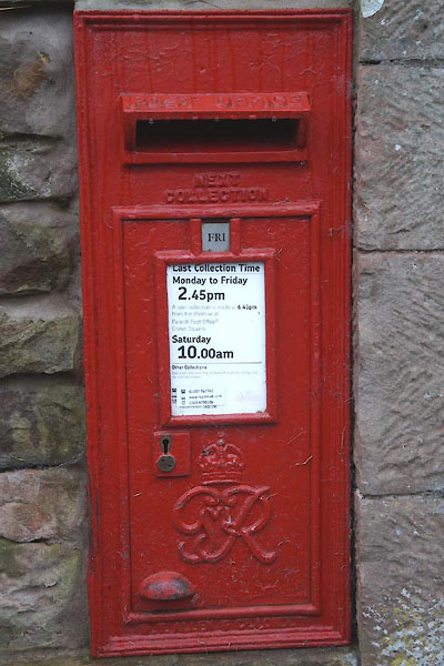
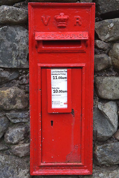
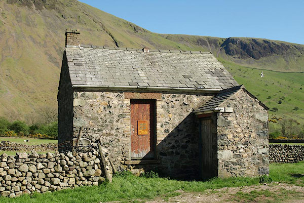
 BQX08.jpg (taken 25.6.2009) 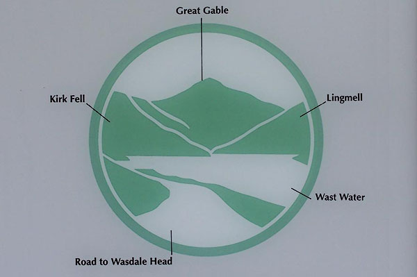 BMB52.jpg The emblem of the Lake District National Park. (taken 11.5.2006) |
||||
|
|
||||
| places:- |
|
|||
|
||||
|
||||
|
||||
|
||||
|
||||
|
||||
|
||||
|
||||
|
||||
|
||||
|
||||
|
||||
|
||||
|
||||
|
||||
|
||||
|
||||
|
||||
|
||||
|
||||
|
||||
|
||||
|
||||
|
||||
|
||||
|
||||
|
||||
|
||||
|
||||
|
||||
|
||||
|
||||
|
||||
|
||||
Lakes Guides menu.