Old Cumbria Gazetteer
 |
 |
|
||
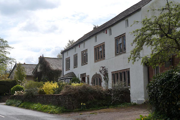
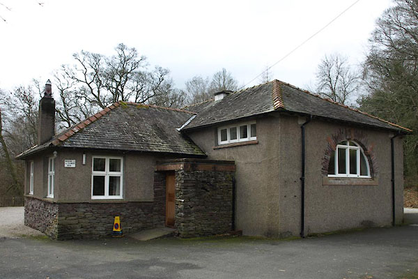
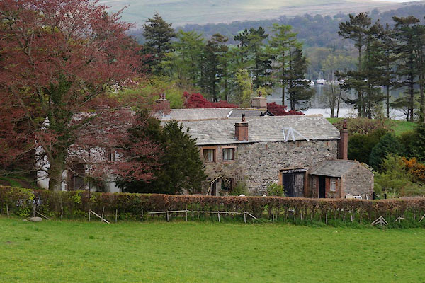
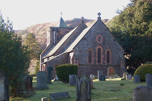
| Watermillock, Matterdale | ||||
| Watermillock | ||||
| civil parish:- | Matterdale (formerly Cumberland) | |||
| county:- | Cumbria | |||
| locality type:- | locality | |||
| locality type:- | buildings | |||
| coordinates:- | NY44622243 (etc) | |||
| 1Km square:- | NY4422 | |||
| 10Km square:- | NY42 | |||
|
|
||||
| evidence:- | old map:- OS County Series (Cmd 66 5) placename:- Watermillock |
|||
| source data:- | Maps, County Series maps of Great Britain, scales 6 and 25
inches to 1 mile, published by the Ordnance Survey, Southampton,
Hampshire, from about 1863 to 1948. |
|||
|
|
||||
| evidence:- | old map:- Saxton 1579 placename:- Wethermelake |
|||
| source data:- | Map, hand coloured engraving, Westmorlandiae et Cumberlandiae Comitatus ie Westmorland
and Cumberland, scale about 5 miles to 1 inch, by Christopher Saxton, London, engraved
by Augustinus Ryther, 1576, published 1579-1645.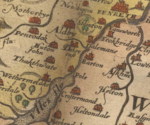 Sax9NY42.jpg Church, symbol for a parish or village, with a parish church. "Wethermelake" item:- private collection : 2 Image © see bottom of page |
|||
|
|
||||
| evidence:- | probably old map:- Mercator 1595 (edn?) placename:- Nether Malak placename:- Malak, Nether |
|||
| source data:- | Map, hand coloured engraving, Northumbria, Cumberlandia, et
Dunelmensis Episcopatus, ie Northumberland, Cumberland and
Durham etc, scale about 6.5 miles to 1 inch, by Gerard Mercator,
Duisberg, Germany, about 1595.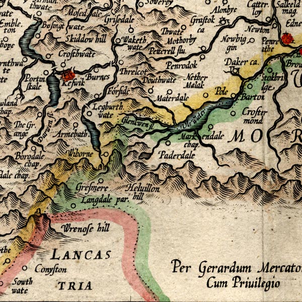 MER8CumF.jpg "Nether Malak" circle item:- JandMN : 169 Image © see bottom of page |
|||
|
|
||||
| evidence:- | old map:- Speed 1611 (Cmd) placename:- Wathermelake |
|||
| source data:- | Map, hand coloured engraving, Cumberland and the Ancient Citie
Carlile Described, scale about 4 miles to 1 inch, by John Speed,
1610, published by J Sudbury and George Humble, Popes Head
Alley, London, 1611-12. SP11NY42.jpg "Wathermelake" circle, buildings, tower item:- private collection : 16 Image © see bottom of page |
|||
|
|
||||
| evidence:- | old map:- Speed 1611 (Wmd) placename:- Wethermilak |
|||
| source data:- | Map, hand coloured engraving, The Countie Westmorland and
Kendale the Cheif Towne, scale about 2.5 miles to 1 inch, by
John Speed, 1610, published by George Humble, Popes Head Alley,
London, 1611-12. SP14NY42.jpg "Wetherm'lak" circle, towers item:- Armitt Library : 2008.14.5 Image © see bottom of page |
|||
|
|
||||
| evidence:- | old map:- Jansson 1646 placename:- Wathermelake |
|||
| source data:- | Map, hand coloured engraving, Cumbria and Westmoria, ie
Cumberland and Westmorland, scale about 3.5 miles to 1 inch, by
John Jansson, Amsterdam, Netherlands, 1646. JAN3NY42.jpg "Wathermelake" Buildings and tower. item:- JandMN : 88 Image © see bottom of page |
|||
|
|
||||
| evidence:- | old map:- Morden 1695 (Cmd) placename:- Wathermalach |
|||
| source data:- | Map, uncoloured engraving, Cumberland, scale about 4 miles to 1
inch, by Robert Morden, 1695, published by Abel Swale, the
Unicorn, St Paul's Churchyard, Awnsham, and John Churchill, the
Black Swan, Paternoster Row, London, 1695-1715.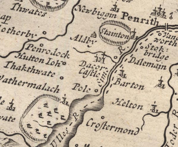 MD12NY42.jpg "Wathermalach" Circle, building and tower, on edge of Gowbarrow Park. item:- JandMN : 90 Image © see bottom of page |
|||
|
|
||||
| evidence:- | old map:- Simpson 1746 map (Wmd) placename:- Watermalack |
|||
| source data:- | Map, uncoloured engraving, Westmorland, scale about 8 miles to 1
inch, printed by R Walker, Fleet Lane, London, 1746.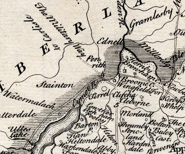 SMP2NYL.jpg "Watermalack" Circle. item:- Dove Cottage : 2007.38.59 Image © see bottom of page |
|||
|
|
||||
| evidence:- | old map:- Bowen and Kitchin 1760 placename:- Wathermalack |
|||
| source data:- | Map, hand coloured engraving, A New Map of the Counties of
Cumberland and Westmoreland Divided into their Respective Wards,
scale about 4 miles to 1 inch, by Emanuel Bowen and Thomas
Kitchin et al, published by T Bowles, Robert Sayer, and John
Bowles, London, 1760.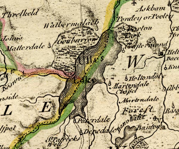 BO18NY31.jpg "Wathermalack" circle, tower item:- Armitt Library : 2008.14.10 Image © see bottom of page |
|||
|
|
||||
| evidence:- | old map:- Jefferys 1770 (Wmd) placename:- Watermillock |
|||
| source data:- | Map, 4 sheets, The County of Westmoreland, scale 1 inch to 1
mile, surveyed 1768, and engraved and published by Thomas
Jefferys, London, 1770. J5NY42SW.jpg "Watermillock" blocks, labelled in italic lowercase text; settlement, village? item:- National Library of Scotland : EME.s.47 Image © National Library of Scotland |
|||
|
|
||||
| evidence:- | old map:- Donald 1774 (Cmd) placename:- Watermelock |
|||
| source data:- | Map, hand coloured engraving, 3x2 sheets, The County of Cumberland, scale about 1
inch to 1 mile, by Thomas Donald, engraved and published by Joseph Hodskinson, 29
Arundel Street, Strand, London, 1774.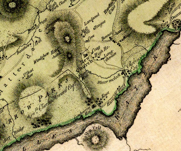 D4NY42SW.jpg "Watermelock" block or blocks, labelled in lowercase; a hamlet or just a house item:- Carlisle Library : Map 2 Image © Carlisle Library |
|||
|
|
||||
| evidence:- | descriptive text:- West 1778 (11th edn 1821) placename:- Watermillock |
|||
| source data:- | Guide book, A Guide to the Lakes, by Thomas West, published by
William Pennington, Kendal, Cumbria once Westmorland, and in
London, 1778 to 1821. goto source goto sourceAddendum; Mr Gray's Journal, 1769 Page 202:- "It is soon again interrupted by the root of Helvellyn, ... and spreading again, turns off to the south-east, and is lost among the deep recesses of the hills. To this second turning I pursued my way about four miles along its border, beyond a village scattered among trees, and called Watermillock, in a pleasant grave day, perfectly calm and warm, but without a gleam of sunshine; ..." |
|||
|
|
||||
| evidence:- | old map:- Crosthwaite 1783-94 (Ull) placename:- Watermillock |
|||
| source data:- | Map, uncoloured engraving, Accurate Map of the Beautiful Lake of
Ullswater, scale about 3 inches to 1 mile, by Peter Crosthwaite,
Keswick, Cumberland, 1783, version published 1800.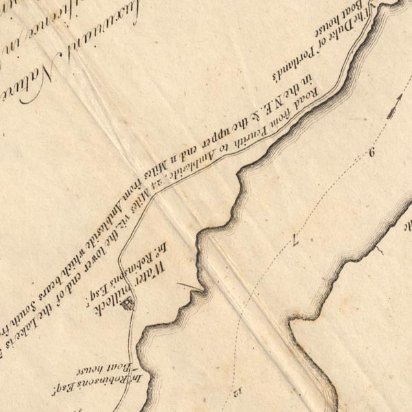 CT5NY42L.jpg "Watermillock / Ino. Robinson's Esqr." item:- Armitt Library : 1959.191.7 Image © see bottom of page |
|||
|
|
||||
| evidence:- | old map:- West 1784 map placename:- Watermillock |
|||
| source data:- | Map, hand coloured engraving, A Map of the Lakes in Cumberland,
Westmorland and Lancashire, scale about 3.5 miles to 1 inch,
engraved by Paas, 53 Holborn, London, about 1784.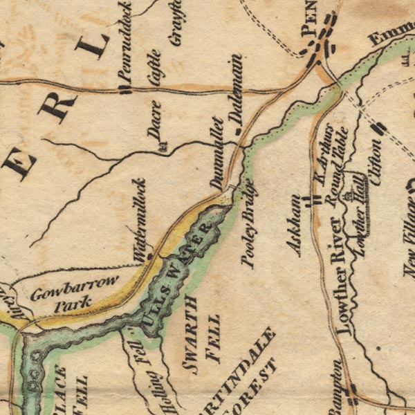 Ws02NY42.jpg item:- Armitt Library : A1221.1 Image © see bottom of page |
|||
|
|
||||
| evidence:- | old text:- Clarke 1787 placename:- Water Millock item:- fishing; angling; gun; echoes |
|||
| source data:- | Guide book, A Survey of the Lakes of Cumberland, Westmorland,
and Lancashire, written and published by James Clarke, Penrith,
Cumberland, and in London etc, 1787; published 1787-93. goto source Page 25:- "..." "... It will also much enhance the pleasure [visiting Ullswater], if they previously send notice to the fishermen at How-Town, or Water-Millock, to prepare their boats and nets; so that at their return, which will be about five hours, they may see the manner of taking the different kinds of fish. The price of these fishermen is three draughts for five shillings, and the fish they take is the property of their employers. Those who are fond of angling will do well to take their tackle with them, as perhaps they can no where meet with better sport. I one day caught, in this manner, between Powley and the small island, twenty-nine trouts." "..." goto sourcepage 25:- "..." "The next remarkable place is the village of Water-Millock, the seat and manor of John Robinson, Esq; [seat of John Robinson, Esq.] it is held under the Earl of Surrey as parcel of the barony of Greystock, and is one of the most beautiful situations our Island affords. It is compleatly sheltered from every inclement blast by mountains and groves, and every window in the house presents you with a beautiful landscape, each varied from another both in" goto sourcePage 26:- "objects and stile. On one side is the lake; on another a beautiful and cultivated scene, composed of water, wood, and hills; on another, high, rugged, and broken rocks, interspersed with here and there a green shrub; and on the other is a beautiful view up the lake, including the rugged and varied hills on the opposite side, together with Helveylin and its craggy inferiors." "Here fire a gun or two to rouse the echoes from the hills; the traveller will be astonished to hear them like repeated peals of thunder, some linger, some shorter, now seeming like the crash of worlds, now reverberating only in hollow murmurs. The effect of martial music is inconceivable, more particularly when joined to the reports of the guns. Every note is re-echoed in ten thousand varied tones; sometimes the ear fancies it perceives something of a regular strain, then again all relapses into such a mixture of wildness and harmony as is beyond the reach of art; whilst that savage uproar which the guns occasion, disturbs at intervals the softer harmony, and impresses the mind with ideas awfully pleasing." |
|||
|
|
||||
| evidence:- | old map:- Clarke 1787 map (Ullswater) placename:- Watermelock |
|||
| source data:- | Map, A Map of the Lake Ullswater and its Environs, scale about
6.5 ins to 1 mile, by James Clarke, engraved by S J Neele, 352
Strand, published by James Clarke, Penrith, Cumberland and in
London etc, 1787. CL4NY42L.jpg "WATERMELOCK" item:- private collection : 10.4 Image © see bottom of page |
|||
|
|
||||
| evidence:- | old map:- Cary 1789 (edn 1805) placename:- Watermillock |
|||
| source data:- | Map, uncoloured engraving, Westmoreland, scale about 2.5 miles
to 1 inch, by John Cary, London, 1789; edition 1805. CY24NY42.jpg "Watermillock" block/s, labelled in italic lowercase; house, or hamlet item:- JandMN : 129 Image © see bottom of page |
|||
|
|
||||
| evidence:- | old map:- Otley 1818 placename:- Watermillock |
|||
| source data:- | Map, uncoloured engraving, The District of the Lakes,
Cumberland, Westmorland, and Lancashire, scale about 4 miles to
1 inch, by Jonathan Otley, 1818, engraved by J and G Menzies,
Edinburgh, Scotland, published by Jonathan Otley, Keswick,
Cumberland, et al, 1833. OT02NY42.jpg item:- JandMN : 48.1 Image © see bottom of page |
|||
|
|
||||
| evidence:- | old text:- Gents Mag placename:- Water Millock |
|||
| source data:- | Magazine, The Gentleman's Magazine or Monthly Intelligencer or
Historical Chronicle, published by Edward Cave under the
pseudonym Sylvanus Urban, and by other publishers, London,
monthly from 1731 to 1922. goto source Gentleman's Magazine 1819 part 1 p.506 From the Compendium of County History:- "Brown, Dr. Joseph, biographer and editor of Cardinal Bererini, Water Millock, 1700." |
|||
|
|
||||
| evidence:- | old map:- Ford 1839 map placename:- Watermillock |
|||
| source data:- | Map, uncoloured engraving, Map of the Lake District of
Cumberland, Westmoreland and Lancashire, scale about 3.5 miles
to 1 inch, published by Charles Thurnam, Carlisle, and by R
Groombridge, 5 Paternoster Row, London, 3rd edn 1843. FD02NY42.jpg "Watermillock" item:- JandMN : 100.1 Image © see bottom of page |
|||
|
|
||||
| evidence:- | old map:- Garnett 1850s-60s H placename:- Watermillock |
|||
| source data:- | Map of the English Lakes, in Cumberland, Westmorland and
Lancashire, scale about 3.5 miles to 1 inch, published by John
Garnett, Windermere, Westmorland, 1850s-60s. GAR2NY42.jpg "Watermillock" blocks, settlement item:- JandMN : 82.1 Image © see bottom of page |
|||
|
|
||||
| evidence:- | old map:- Post Office 1850s-1900s placename:- Watermillock |
|||
| source data:- | Post road maps, General Post Office Circulation Map for England
and Wales, for the General Post Office, London, 1850s-1900s. click to enlarge click to enlargePOF7Cm.jpg "Watermillock" map date 1909 |
|||
|
|
||||
| :- |
images courtesy of the British Postal Museum and Hampshire CC Museums |
|||
|
|
||||
| places:- |
|
|||
|
||||
|
||||
|
||||
|
||||
|
||||
|
||||
|
||||
|
||||
|
||||
|
||||
|
||||
|
||||
|
||||
|
||||
|
||||
|
||||
|
||||
|
||||
Lakes Guides menu.