 Old Cumbria Gazetteer
 |
 |
|
| Waver Bridge, Waverbridge | ||
| Waver Bridge | ||
| site name:- | Waver, River | |
| locality:- | Waverbridge | |
| civil parish:- | Waverton (formerly Cumberland) | |
| civil parish:- | Dundraw (formerly Cumberland) | |
| county:- | Cumbria | |
| locality type:- | bridge | |
| coordinates:- | NY22284908 | |
| 1Km square:- | NY2249 | |
| 10Km square:- | NY24 | |
|
|
||
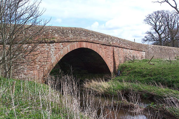 BNO18.jpg (taken 11.4.2007) |
||
|
|
||
| evidence:- | old map:- OS County Series (Cmd 28 8) placename:- Waver Bridge |
|
| source data:- | Maps, County Series maps of Great Britain, scales 6 and 25
inches to 1 mile, published by the Ordnance Survey, Southampton,
Hampshire, from about 1863 to 1948. |
|
|
|
||
| evidence:- | old map:- OS County Series placename:- Waver Bridge |
|
| source data:- | Maps, County Series maps of Great Britain, scales 6 and 25
inches to 1 mile, published by the Ordnance Survey, Southampton,
Hampshire, from about 1863 to 1948. "Waver Bridge" |
|
|
|
||
| evidence:- | old map:- Donald 1774 (Cmd) |
|
| source data:- | Map, hand coloured engraving, 3x2 sheets, The County of Cumberland, scale about 1
inch to 1 mile, by Thomas Donald, engraved and published by Joseph Hodskinson, 29
Arundel Street, Strand, London, 1774.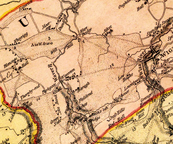 D4NY24NW.jpg double line across a river; a bridge at Ware Bridge item:- Carlisle Library : Map 2 Image © Carlisle Library |
|
|
|
||
| evidence:- | road book:- Cary 1798 (2nd edn 1802) placename:- Ware Bridge |
|
| source data:- | Road book, itineraries, Cary's New Itinerary, by John Cary, 181
Strand, London, 2nd edn 1802. goto source goto source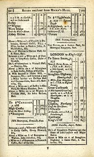 click to enlarge click to enlargeC38321.jpg page 321-322 "Ware Bridge / Cross the Waver River" item:- JandMN : 228.1 Image © see bottom of page |
|
|
|
||
| evidence:- | old map:- Bell 1892 placename:- Waver Bridge |
|
| source data:- | Map, colour lithograph, Road Map of Cumberland, by George Joseph
Bell, scale about 2.5 miles to 1 inch, printed by Charles
Thurnam and Sons, Carlisle, Cumberland, 1892.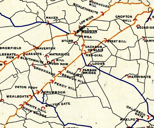 BEL9NY24.jpg "WAVER" bridge symbol Road map of Cumberland showing County Bridges item:- Carlisle Library : Map 38 Image © Carlisle Library |
|
|
|
||
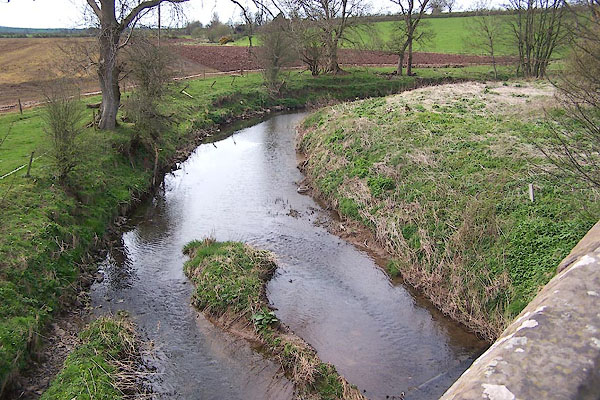 BNO19.jpg View of river. (taken 11.4.2007) |
||
|
|
||
Lakes Guides menu.