 Old Cumbria Gazetteer
 |
 |
|
| Whins, Ennerdale and Kinniside | ||
| Whins | ||
| Eirrin Talla | ||
| civil parish:- | Ennerdale and Kinniside (formerly Cumberland) | |
| county:- | Cumbria | |
| locality type:- | buildings | |
| coordinates:- | NY09861664 | |
| 1Km square:- | NY0916 | |
| 10Km square:- | NY01 | |
|
|
||
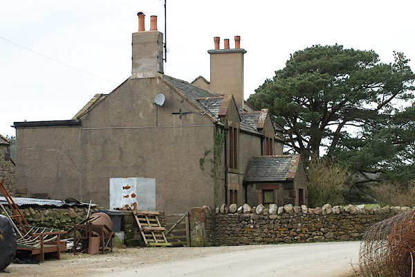 BPA36.jpg (taken 16.4.2008) 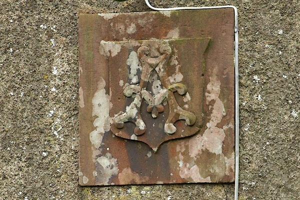 BPA37.jpg Shield over the porch, letter, "A" (taken 16.4.2008) |
||
|
|
||
| evidence:- | old map:- OS County Series (Cmd 68 7) placename:- Whins |
|
| source data:- | Maps, County Series maps of Great Britain, scales 6 and 25
inches to 1 mile, published by the Ordnance Survey, Southampton,
Hampshire, from about 1863 to 1948. |
|
|
|
||
| evidence:- | old map:- Donald 1774 (Cmd) placename:- Whins |
|
| source data:- | Map, hand coloured engraving, 3x2 sheets, The County of Cumberland, scale about 1
inch to 1 mile, by Thomas Donald, engraved and published by Joseph Hodskinson, 29
Arundel Street, Strand, London, 1774.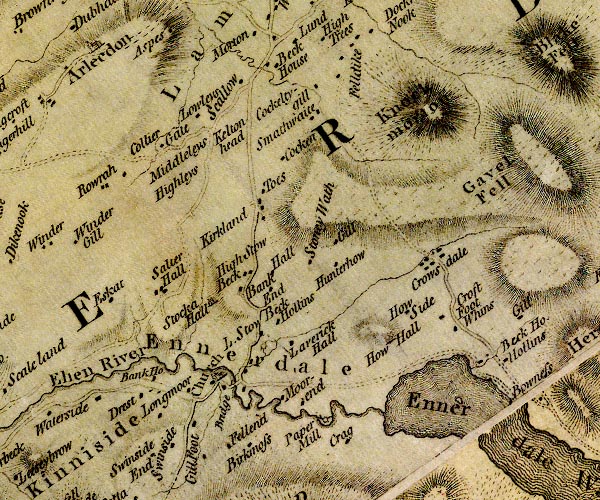 D4NY01NE.jpg "Whins" block or blocks, labelled in lowercase; a hamlet or just a house item:- Carlisle Library : Map 2 Image © Carlisle Library |
|
|
|
||
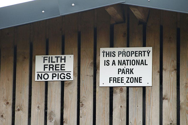 BPA38.jpg Notices on a barn. (taken 16.4.2008)  BPA39.jpg Verge opposite. (taken 16.4.2008) |
||
|
|
||
 Lakes Guides menu.