 Old Cumbria Gazetteer
 |
 |
|
| Willyshaw Rigg, Alston Moor | ||
| Willyshaw Rigg | ||
| civil parish:- | Alston Moor (formerly Cumberland) | |
| county:- | Cumbria | |
| locality type:- | hill | |
| locality type:- | county boundary mark | |
| coordinates:- | NY736514 (etc) | |
| 1Km square:- | NY7351 | |
| 10Km square:- | NY75 | |
| altitude:- | 1629 feet | |
| altitude:- | 497m | |
| county:- | Northumberland | |
| current boundary | ||
| locality:- | Cumbria boundary | |
| coordinates:- | NY73685138 | |
| old boundary | ||
| locality:- | Cumberland boundary | |
|
|
||
| evidence:- | old map:- OS County Series (Cmd 26A 13) placename:- Willyshaw Rigg |
|
| source data:- | Maps, County Series maps of Great Britain, scales 6 and 25
inches to 1 mile, published by the Ordnance Survey, Southampton,
Hampshire, from about 1863 to 1948. |
|
|
|
||
| evidence:- | old map:- Donald 1774 (Cmd) placename:- Willishaw Rigg |
|
| source data:- | Map, hand coloured engraving, 3x2 sheets, The County of Cumberland, scale about 1
inch to 1 mile, by Thomas Donald, engraved and published by Joseph Hodskinson, 29
Arundel Street, Strand, London, 1774.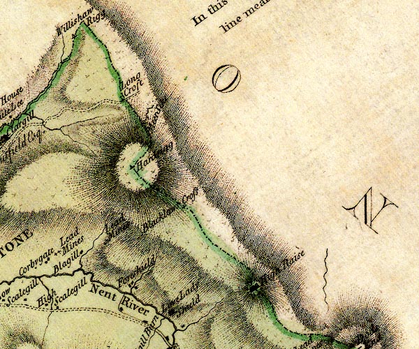 D4NY74NE.jpg "Willishaw Rigg" triangle on county boundary item:- Carlisle Library : Map 2 Image © Carlisle Library |
|
|
|
||
 Lakes Guides menu.