Old Cumbria Gazetteer
 |
 |
|
||
| Woodhouse, Heversham | ||||
| Woodhouse | ||||
| civil parish:- | Heversham (formerly Westmorland) | |||
| county:- | Cumbria | |||
| locality type:- | locality | |||
| locality type:- | buildings | |||
| coordinates:- | SD51038342 (etc) | |||
| 1Km square:- | SD5183 | |||
| 10Km square:- | SD58 | |||
|
|
||||
| evidence:- | old map:- OS County Series (Wmd 42 16) placename:- Woodhouse |
|||
| source data:- | Maps, County Series maps of Great Britain, scales 6 and 25
inches to 1 mile, published by the Ordnance Survey, Southampton,
Hampshire, from about 1863 to 1948. |
|||
|
|
||||
| evidence:- | hearth tax returns:- Hearth Tax 1675 placename:- Wood house |
|||
| source data:- | Records, hearth tax survey returns, Westmorland, 1674/75. "Wood house" in "Millthorp" |
|||
|
|
||||
| evidence:- | old map:- Jefferys 1770 (Wmd) placename:- Wood Houses |
|||
| source data:- | Map, 4 sheets, The County of Westmoreland, scale 1 inch to 1
mile, surveyed 1768, and engraved and published by Thomas
Jefferys, London, 1770.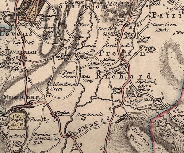 J5SD58SW.jpg "Wood Houses" blocks, labelled in italic lowercase text; settlement, village? item:- National Library of Scotland : EME.s.47 Image © National Library of Scotland |
|||
|
|
||||
| evidence:- | old map:- Cary 1789 (edn 1805) placename:- Wool Houses |
|||
| source data:- | Map, uncoloured engraving, Westmoreland, scale about 2.5 miles
to 1 inch, by John Cary, London, 1789; edition 1805.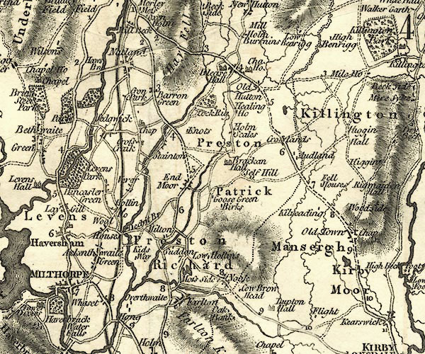 CY24SD58.jpg "Wool Houses" block/s, labelled in italic lowercase; house, or hamlet item:- JandMN : 129 Image © see bottom of page |
|||
|
|
||||
| places:- |
|
|||
|
||||
|
||||
|
||||
|
||||
|
||||
|
||||
 Lakes Guides menu.