 Old Cumbria Gazetteer
 |
 |
|
| Wreay Station, Wreay | ||
| Wreay Station | ||
| site name:- | Lancaster and Carlisle Railway | |
| locality:- | Wreay | |
| civil parish:- | St Cuthbert Without (formerly Cumberland) | |
| county:- | Cumbria | |
| locality type:- | railway station | |
| coordinates:- | NY43764874 | |
| 1Km square:- | NY4348 | |
| 10Km square:- | NY44 | |
| SummaryText:- | Opened 1853; closed 1943. | |
|
|
||
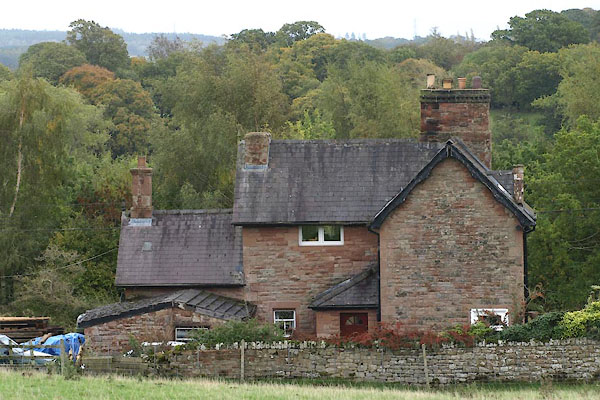 BTS13.jpg (taken 22.10.2010) |
||
|
|
||
| evidence:- | old map:- OS County Series (Cmd 31 5) placename:- Wreay Station item:- railway signal |
|
| source data:- | Maps, County Series maps of Great Britain, scales 6 and 25
inches to 1 mile, published by the Ordnance Survey, Southampton,
Hampshire, from about 1863 to 1948. "Wreay Station / Signal Post / S.P." |
|
|
|
||
| evidence:- | old map:- LMS 1920s maps |
|
| source data:- | Railway map, lithograph, 23 pages of strip maps, The Journey in
Brief, the Route London to Carlisle, published by the London
Midland and Scottish Railway, LMS, 1920s.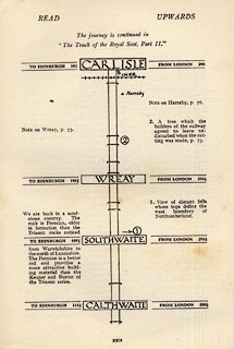 click to enlarge click to enlargeLS3p29.jpg "TO EDINBURGH 105¾ / WREAY / FROM LONDON 294¼" item:- JandMN : 95.2 Image © see bottom of page |
|
|
|
||
 Lakes Guides menu.