 Old Cumbria Gazetteer
 |
 |
|
| Yew Tree Farm, St John's Castlerigg etc | ||
| Yew Tree Farm | ||
| locality:- | St John's in the Vale | |
| civil parish:- | St John's Castlerigg and Wythburn (formerly Cumberland) | |
| county:- | Cumbria | |
| locality type:- | buildings | |
| coordinates:- | NY30872301 | |
| 1Km square:- | NY3023 | |
| 10Km square:- | NY32 | |
|
|
||
| evidence:- | old map:- OS County Series (Cmd 64 8) placename:- Yew Tree |
|
| source data:- | Maps, County Series maps of Great Britain, scales 6 and 25
inches to 1 mile, published by the Ordnance Survey, Southampton,
Hampshire, from about 1863 to 1948. |
|
|
|
||
| evidence:- | probably old map:- Donald 1774 (Cmd) placename:- Raw |
|
| source data:- | Map, hand coloured engraving, 3x2 sheets, The County of Cumberland, scale about 1
inch to 1 mile, by Thomas Donald, engraved and published by Joseph Hodskinson, 29
Arundel Street, Strand, London, 1774.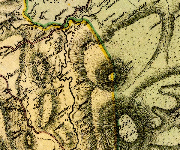 D4NY32SW.jpg "Raw" block or blocks, labelled in lowercase; a hamlet or just a house item:- Carlisle Library : Map 2 Image © Carlisle Library |
|
|
|
||
| evidence:- | old text:- Clarke 1787 placename:- Ew Tree |
|
| source data:- | Guide book, A Survey of the Lakes of Cumberland, Westmorland,
and Lancashire, written and published by James Clarke, Penrith,
Cumberland, and in London etc, 1787; published 1787-93. goto source goto sourcePage 61:- "... a cottage surrounded with trees, which goes by the name of Ew Tree ..." |
|
|
|
||
 BRV39.jpg Swaledale sheep, and smit mark:- "two red strokes over back at loins" (taken 11.11.2009) 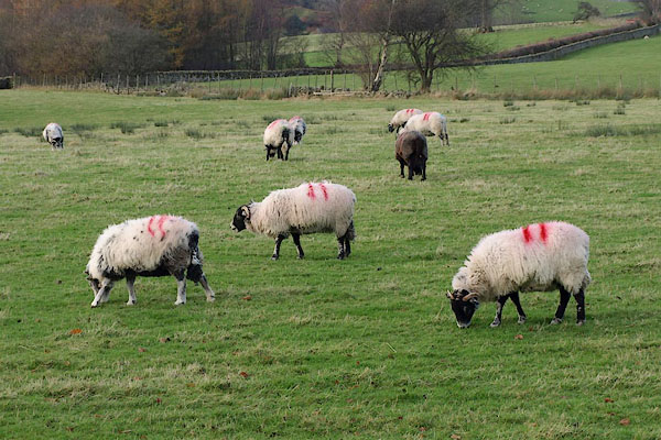 BRV40.jpg Swaledale sheep, and smit mark:- "two red strokes over back at loins" (taken 11.11.2009) |
||
|
|
||
Lakes Guides menu.