 Old Cumbria Gazetteer
 |
 |
|
| Hall Bridge, Dunnerdale | ||
| Hall Bridge | ||
| site name:- | Duddon, River | |
| locality:- | Hall Dunnerdale | |
| civil parish:- | Dunnerdale-with-Seathwaite (formerly Lancashire) | |
| civil parish:- | Ulpha (formerly Cumberland) | |
| county:- | Cumbria | |
| locality type:- | bridge | |
| coordinates:- | SD21309533 | |
| 1Km square:- | SD2195 | |
| 10Km square:- | SD29 | |
| old boundary | ||
| locality:- | Cumberland boundary | |
| locality:- | Lancashire boundary | |
|
|
||
| MN photo:- |
Rebuilt 1938. |
|
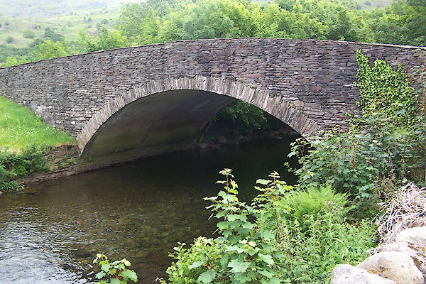 BMG35.jpg (taken 12.6.2006) 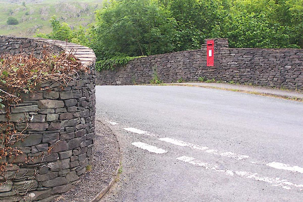 BMG36.jpg (taken 12.6.2006) |
||
|
|
||
| evidence:- | old map:- OS County Series (Cmd 83 12) placename:- Hall Bridge |
|
| source data:- | Maps, County Series maps of Great Britain, scales 6 and 25
inches to 1 mile, published by the Ordnance Survey, Southampton,
Hampshire, from about 1863 to 1948. |
|
|
|
||
| evidence:- | old map:- Donald 1774 (Cmd) |
|
| source data:- | Map, hand coloured engraving, 3x2 sheets, The County of Cumberland, scale about 1
inch to 1 mile, by Thomas Donald, engraved and published by Joseph Hodskinson, 29
Arundel Street, Strand, London, 1774.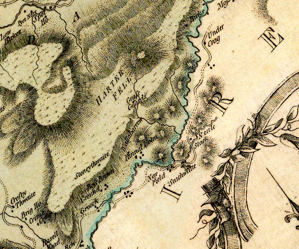 D4SD29NW.jpg double line across a river; a bridge over the Duddon item:- Carlisle Library : Map 2 Image © Carlisle Library |
|
|
|
||
| evidence:- | old photograph:- Bell 1880s-1940s |
|
| source data:- | Photograph, black and white, Hall Bridge, sepia, Hall Dunnerdale, Dunnerdale-with-Seathwaite,
Lancashire, by Herbert Bell, Ambleside, Westmorland, 1890s.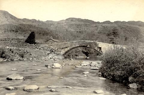 click to enlarge click to enlargeHB0504.jpg stamped at reverse:- "HERBERT BELL / Photographer / AMBLESIDE" item:- Armitt Library : ALPS167 Image © see bottom of page |
|
|
|
||
 Lakes Guides menu.