 Old Cumbria Gazetteer
 |
 |
|
| Snowball Fold, Dalton-in-Furness | ||
| Snowball Fold | ||
| locality:- | Dalton-in-Furness | |
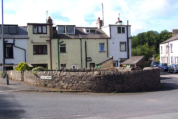
| locality:- | Goose GReen | |
| civil parish:- | Dalton Town with Newton (formerly Lancashire) | |
| county:- | Cumbria | |
| locality type:- | pinfold | |
| locality type:- | sheepfold (?) | |
| coordinates:- | SD22627380 | |
| 1Km square:- | SD2273 | |
| 10Km square:- | SD27 | |
|
|
||
 BMO44.jpg (taken 30.8.2006) 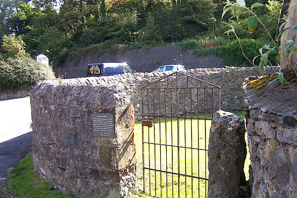 BMO45.jpg (taken 30.8.2006) |
||
|
|
||
| evidence:- | old map:- OS County Series (Lan 16 13) |
|
| source data:- | Maps, County Series maps of Great Britain, scales 6 and 25
inches to 1 mile, published by the Ordnance Survey, Southampton,
Hampshire, from about 1863 to 1948. "Pound" |
|
|
|
||
| evidence:- | database:- Listed Buildings 2010 |
|
| source data:- | courtesy of English Heritage "PINFOLD / / GOOSE GREEN / DALTON TOWN WITH NEWTON / BARROW IN FURNESS / CUMBRIA / II / 388472 / SD2262873794" |
|
| source data:- | courtesy of English Heritage "Pinfold. Late C18-early C19. Limestone rubble. Circular enclosure wall approx 10m in diameter and 1-2m in height. Opening in west side with limestone gatepost and C20 iron gate. Triangular copings. Shown on Merryweather's town plan of Dalton surveyed 1825. (Barnes F: Barrow and District: Barrow in Furness: 1968-: 72)." |
|
|
|
||
| :- |
Built in the 18th century; put under the charge of a 'pinder' employed by the town. |
|
| Renewed by Andy Goldsworthy as part of the Sheepfolds project, 1996-2002. |
||
| Site of a snowball event, 1999; by the Chequers inn. |
||
| : 2002 (?): Andy Goldsworthy Sheepfolds: Cumbria CC (?):: leaflet from TIC www.sheepfolds.org |
||
|
|
||
| hearsay:- |
In the Civil War a group of Parliamentary soldiers, landed from ships at Piel Hardbour,
together with local men, occupied the pinfold in an attack on the town, 1643. |
|
|
|
||
 Lakes Guides menu.