 Old Cumbria Gazetteer
 |
 |
|
| Micklam Clay Mine, Lowca | ||
| Micklam Clay Mine | ||
| locality:- | Micklam | |
| civil parish:- | Lowca (formerly Cumberland) | |
| county:- | Cumbria | |
| locality type:- | mine | |
| locality type:- | clay pit (?) | |
| locality type:- | coal mine (?) | |
| coordinates:- | NX98042232 (about) | |
| 1Km square:- | NX9822 | |
| 10Km square:- | NX92 | |
|
|
||
| evidence:- | old map:- OS County Series (Cmd 61 9) |
|
| source data:- | Maps, County Series maps of Great Britain, scales 6 and 25
inches to 1 mile, published by the Ordnance Survey, Southampton,
Hampshire, from about 1863 to 1948. "Old Coal Pit" |
|
|
|
||
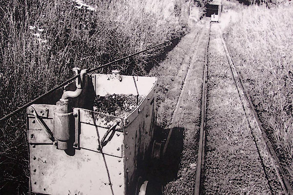 BML02.jpg Continuous haulage tubs, about 1970. Courtesy of Keswick Mining Museum. |
||
|
|
||
 Lakes Guides menu.