 Old Cumbria Gazetteer
 |
 |
|
| Brampton Park, Brampton | ||
| Brampton Park | ||
| civil parish:- | Brampton (formerly Cumberland) | |
| county:- | Cumbria | |
| locality type:- | park | |
| coordinates:- | NY51646117 (etc) | |
| 1Km square:- | NY5161 | |
| 10Km square:- | NY56 | |
| SummaryText:- | cf Park Barns at NY506597. | |
| references:- | OS County Series |
|
|
|
||
| evidence:- | old map:- OS County Series (Cmd 17 8) placename:- Brampton Park |
|
| source data:- | Maps, County Series maps of Great Britain, scales 6 and 25
inches to 1 mile, published by the Ordnance Survey, Southampton,
Hampshire, from about 1863 to 1948. |
|
|
|
||
| evidence:- | old map:- Ogilby 1675 (plate 86) |
|
| source data:- | Road strip map, uncoloured engraving, the Road from Tinmouth ...
to Carlisle, scale about 1 inch to 1 mile, by John Ogilby,
London, 1675.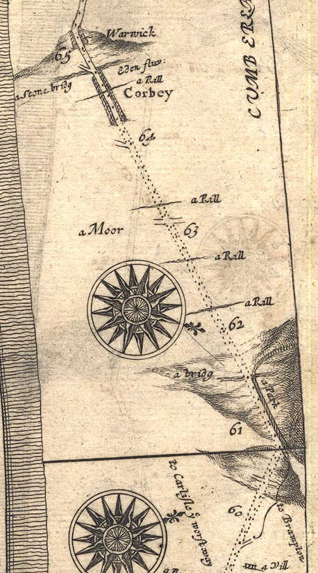 OG86m060.jpg In mile 61, Cumberland. "a Park" paling fence on the right of the road for most of a mile. item:- JandMN : 73 Image © see bottom of page |
|
|
|
||
| evidence:- | old map:- Bowen 1720 (plate 232) |
|
| source data:- | Road strip map, road map, pl.232, part of The Road from Tinmouth
to Carlisle, scale about 2 miles to 1 inch, with sections in
Northumberland and Cumberland, published by Emanuel Bowen, St
Katherines, London, 1720.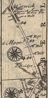 B232m60.jpg "a Park" Line of fence palings north of road; about mile 61. item:- JandMN : 65.232 Image © see bottom of page |
|
|
|
||
 Lakes Guides menu.