 Old Cumbria Gazetteer
 |
 |
|
||
| Greenhead, Northumberland | ||||
| Greenhead | ||||
| county:- | Northumberland | |||
| locality type:- | locality | |||
| locality type:- | buildings | |||
| coordinates:- | NY660654 | |||
| 1Km square:- | NY6665 | |||
| 10Km square:- | NY66 | |||
|
|
||||
| evidence:- | old map:- Ogilby 1675 (plate 86) placename:- Goomholt |
|||
| source data:- | Road strip map, uncoloured engraving, the Road from Tinmouth ...
to Carlisle, scale about 1 inch to 1 mile, by John Ogilby,
London, 1675.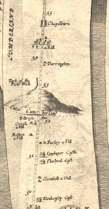 OG86m050.jpg In mile 50, Northumberland. "Goomholt a Vill" houses to the right of the road. item:- JandMN : 73 Image © see bottom of page |
|||
|
|
||||
| evidence:- | old map:- Ford 1839 map placename:- Greenhead |
|||
| source data:- | Map, uncoloured engraving, Map of the Lake District of
Cumberland, Westmoreland and Lancashire, scale about 3.5 miles
to 1 inch, published by Charles Thurnam, Carlisle, and by R
Groombridge, 5 Paternoster Row, London, 3rd edn 1843.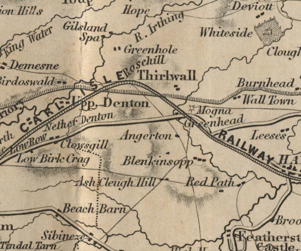 FD02NY66.jpg "Greenhead" item:- JandMN : 100.1 Image © see bottom of page |
|||
|
|
||||
| places:- |
|
|||
|
||||
|
||||
 Lakes Guides menu.