 Old Cumbria Gazetteer
 |
 |
|
| Powmaughan Bridge, Wetheral | ||
| Powmaughan Bridge | ||
| site name:- | Pow Maughan | |
| locality:- | Aglionby | |
| civil parish:- | Wetheral (formerly Cumberland) | |
| county:- | Cumbria | |
| locality type:- | bridge | |
| coordinates:- | NY44255622 | |
| 1Km square:- | NY4456 | |
| 10Km square:- | NY45 | |
|
|
||
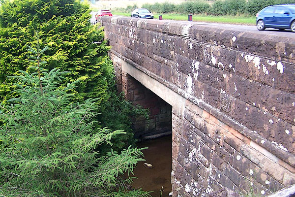 BMN72.jpg (taken 25.8.2006) 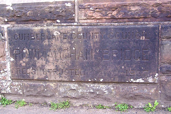 BMN73.jpg Inscribed stone:- "CUMBERLAND COUNTY COUNCIL / POWMAUGHAN BRIDGE / RECONSTRUCTED 1937" (taken 25.8.2006) |
||
|
|
||
| evidence:- | old map:- OS County Series (Cmd 24 1) placename:- Powmaughan Bridge |
|
| source data:- | Maps, County Series maps of Great Britain, scales 6 and 25
inches to 1 mile, published by the Ordnance Survey, Southampton,
Hampshire, from about 1863 to 1948. |
|
|
|
||
| evidence:- | old map:- Ogilby 1675 (plate 86) |
|
| source data:- | Road strip map, uncoloured engraving, the Road from Tinmouth ...
to Carlisle, scale about 1 inch to 1 mile, by John Ogilby,
London, 1675.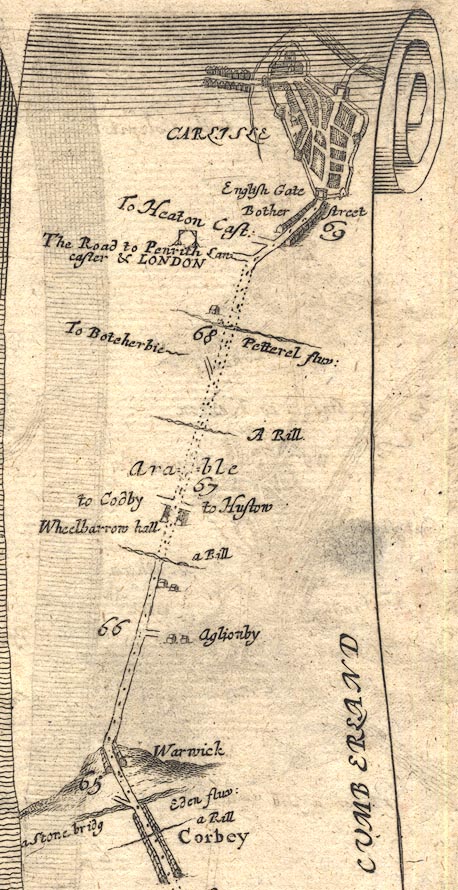 OG86m065.jpg In mile 66, Cumberland. "a Rill" drawn across the road, no bridge. item:- JandMN : 73 Image © see bottom of page |
|
|
|
||
| evidence:- | old map:- Bell 1892 placename:- Powmaughan Bridge |
|
| source data:- | Map, colour lithograph, Road Map of Cumberland, by George Joseph
Bell, scale about 2.5 miles to 1 inch, printed by Charles
Thurnam and Sons, Carlisle, Cumberland, 1892.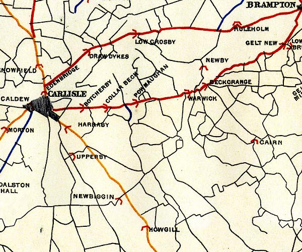 BEL9NY45.jpg "POWMAUGHAN" bridge symbol Road map of Cumberland showing County Bridges item:- Carlisle Library : Map 38 Image © Carlisle Library |
|
|
|
||
 Lakes Guides menu.