 Old Cumbria Gazetteer
 |
 |
|
| Rough How Bridge, St John's Castlerigg etc | ||
| Rough How Bridge | ||
| site name:- | Naddle Beck | |
| site name:- | road, Ambleside to Keswick | |
| civil parish:- | St John's Castlerigg and Wythburn (formerly Cumberland) | |
| county:- | Cumbria | |
| locality type:- | bridge | |
| coordinates:- | NY30042064 | |
| 1Km square:- | NY3020 | |
| 10Km square:- | NY32 | |
| SummaryText:- | This is the middle of three bridges crossing the stream here. | |
|
|
||
 BMX16.jpg (taken 23.10.2006) 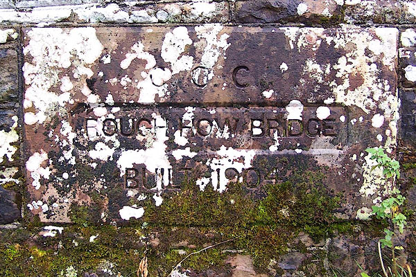 BMX17.jpg Inscribed stone:- "C.C.C. / ROUGH HOW BRIDGE / BUILT 1904" (taken 23.10.2006) |
||
|
|
||
| evidence:- | old map:- OS County Series (Cmd 64 11) placename:- Roughow Bridge |
|
| source data:- | Maps, County Series maps of Great Britain, scales 6 and 25
inches to 1 mile, published by the Ordnance Survey, Southampton,
Hampshire, from about 1863 to 1948. |
|
|
|
||
| evidence:- | old map:- Ogilby 1675 (plate 96) |
|
| source data:- | Road strip map, hand coloured engraving, the Road from Kendal to
Cockermouth, and the Road from Egremond to Carlisle, scale about
1 inch to 1 mile, by John Ogilby, London, 1675.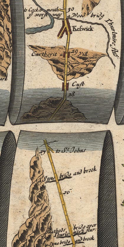 OG96m025.jpg In mile 26, Cumberland. Road crosses:- "a Stone bridg and brook" no bridge drawn. item:- JandMN : 22 Image © see bottom of page |
|
|
|
||
| evidence:- | descriptive text:- Ford 1839 (3rd edn 1843) placename:- Rougha Bridge |
|
| source data:- | Guide book, A Description of Scenery in the Lake District, by
Rev William Ford, published by Charles Thurnam, Carlisle, by W
Edwards, 12 Ave Maria Lane, Charles Tilt, Fleet Street, William
Smith, 113 Fleet Street, London, by Currie and Bowman,
Newcastle, by Bancks and Co, Manchester, by Oliver and Boyd,
Edinburgh, and by Sinclair, Dumfries, 1839. goto source goto sourcePage 50:- "... Rougha Bridge is another sketch with its neighbouring crags, that should grace the portfolio." |
|
|
|
||
Lakes Guides menu.