 Old Cumbria Gazetteer
 |
 |
|
| Trough School, Solport | ||
| Trough School | ||
| civil parish:- | Solport (formerly Cumberland) | |
| county:- | Cumbria | |
| locality type:- | school | |
| locality type:- | chapel (once?) | |
| coordinates:- | NY49247502 | |
| 1Km square:- | NY4975 | |
| 10Km square:- | NY47 | |
|
|
||
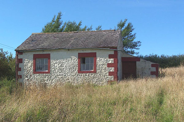 BMQ56.jpg (taken 15.9.2006) 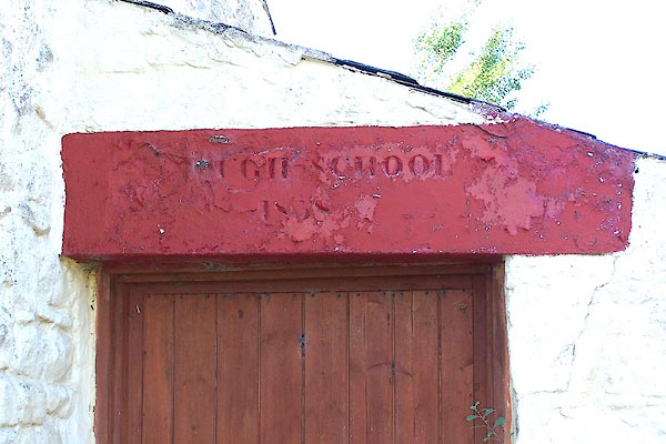 BMQ57.jpg Over the door:- "[ U]GH SCHOOL [ 8 8]" (taken 15.9.2006) |
||
| OS Explorer Map 324 shows a church here? |
||
|
|
||
| evidence:- | old map:- OS County Series (Cmd 7) placename:- Trough School |
|
| source data:- | Maps, County Series maps of Great Britain, scales 6 and 25
inches to 1 mile, published by the Ordnance Survey, Southampton,
Hampshire, from about 1863 to 1948. "Trough School" |
|
|
|
||
 Lakes Guides menu.