 Old Cumbria Gazetteer
 |
 |
|
| Woodhead Ford, Kirklinton Middle | ||
| Woodhead Ford | ||
| site name:- | Lyne, River | |
| locality:- | Woodhead | |
| civil parish:- | Kirklinton Middle (formerly Cumberland) | |
| civil parish:- | Arthuret (formerly Cumberland) | |
| county:- | Cumbria | |
| locality type:- | ford | |
| coordinates:- | NY42726713 | |
| 1Km square:- | NY4267 | |
| 10Km square:- | NY46 | |
|
|
||
| evidence:- | old map:- OS County Series (Cmd 10 8) |
|
| source data:- | Maps, County Series maps of Great Britain, scales 6 and 25
inches to 1 mile, published by the Ordnance Survey, Southampton,
Hampshire, from about 1863 to 1948. "Ford" |
|
|
|
||
| evidence:- | old map:- Ogilby 1675 (plate 62) |
|
| source data:- | Raod strip map, uncoloured engraving, the Road from Carlisle to
Barwick, scale about 1 inch to 1 mile, by John Ogilby, London,
1675.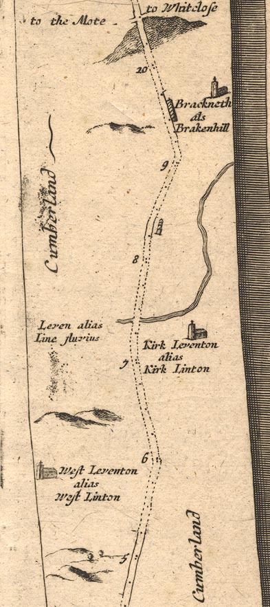 OG62m005.jpg In mile 7, Cumberland. Road crosses:- "Leven alias Line fluvius" no bridge is drawn. item:- JandMN : 83 Image © see bottom of page |
|
|
|
||
| evidence:- | probably old map:- Bowen 1720 (plate 161) |
|
| source data:- | Road strip map, uncoloured engraving, pl.161, part of The Road
from Carlisle to Barwick, scale about 2 miles to 1 inch, with
sections in Cumberland, and Scotland, published by Emanuel
Bowen, St Katherines, London, 1720.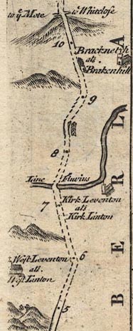 B161m05.jpg Over the Line Fluvius, drawn as a bridge. item:- JandMN : 65.161 Image © see bottom of page |
|
|
|
||
 Lakes Guides menu.