 Old Cumbria Gazetteer
 |
 |
|
| Keppelcove Tarn, Patterdale | ||
| Keppelcove Tarn | ||
| locality:- | Keppel Cove | |
| civil parish:- | Patterdale (formerly Westmorland) | |
| county:- | Cumbria | |
| locality type:- | tarn (gone) | |
| locality type:- | flood | |
| coordinates:- | NY34511650 (etc) | |
| 1Km square:- | NY3416 | |
| 10Km square:- | NY31 | |
| altitude:- | 1805 feet | |
| altitude:- | 550m | |
|
|
||
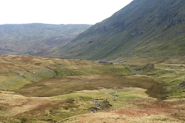 CCD20.jpg (taken 18.11.2014) 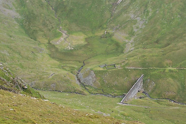 BUV14.jpg The failed earth barrier; newer concrete dam, breached 1931; and the drained tarn above. (taken 20.6.2011) |
||
|
|
||
| evidence:- | old map:- OS County Series (Wmd 12 9) placename:- Keppelcove Tarn |
|
| source data:- | Maps, County Series maps of Great Britain, scales 6 and 25
inches to 1 mile, published by the Ordnance Survey, Southampton,
Hampshire, from about 1863 to 1948. |
|
|
|
||
| evidence:- | old map:- Donald 1774 (Cmd) |
|
| source data:- | Map, hand coloured engraving, 3x2 sheets, The County of Cumberland, scale about 1
inch to 1 mile, by Thomas Donald, engraved and published by Joseph Hodskinson, 29
Arundel Street, Strand, London, 1774.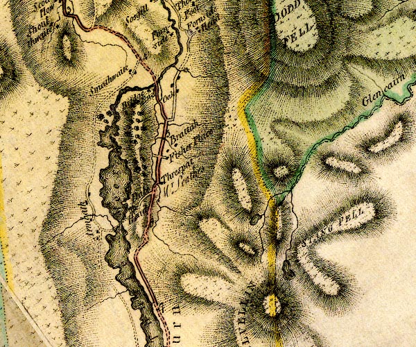 D4NY31NW.jpg lake item:- Carlisle Library : Map 2 Image © Carlisle Library |
|
|
|
||
| evidence:- | old map:- Otley 1818 |
|
| source data:- | Map, uncoloured engraving, The District of the Lakes,
Cumberland, Westmorland, and Lancashire, scale about 4 miles to
1 inch, by Jonathan Otley, 1818, engraved by J and G Menzies,
Edinburgh, Scotland, published by Jonathan Otley, Keswick,
Cumberland, et al, 1833.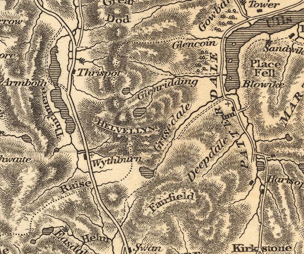 OT02NY31.jpg item:- JandMN : 48.1 Image © see bottom of page |
|
|
|
||
| evidence:- | descriptive text:- Otley 1823 (5th edn 1834) placename:- Keppel Cove Tarn |
|
| source data:- | Guide book, A Concise Description of the English Lakes, the
mountains in their vicinity, and the roads by which they may be
visited, with remarks on the mineralogy and geology of the
district, by Jonathan Otley, published by the author, Keswick,
Cumberland now Cumbria, by J Richardson, London, and by Arthur
Foster, Kirkby Lonsdale, Cumbria, 1823; published 1823-49,
latterly as the Descriptive Guide to the English Lakes. goto source goto sourcePage 35:- "... Keppel Cove Tarn is posited in a singular manner, not in the bottom of the glen, but, in a kind of recess formed on one side; it is separated from Red Tarn by a narrow mountain ridge, called Swirrel Edge, which branches off from Helvellyn and is terminated by a peak called Catsty Cam, modernized into Catchedecam; below which the two streams unite to form the brook of Glenridding. All these tarns afford good diversion for the angler; Keppel Cove produces a bright well shapen trout ..." |
|
|
|
||
| evidence:- | old map:- Garnett 1850s-60s H placename:- Keppel Cove Tarn |
|
| source data:- | Map of the English Lakes, in Cumberland, Westmorland and
Lancashire, scale about 3.5 miles to 1 inch, published by John
Garnett, Windermere, Westmorland, 1850s-60s.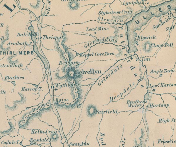 GAR2NY31.jpg "Keppel Cove Tarn" outline with shore form lines, lake or tarn item:- JandMN : 82.1 Image © see bottom of page |
|
|
|
||
| notes:- |
Notes from a contemporary report in a Mining journal. |
|
| Keppelcove Tarn covered about 7 acres, and was up to 30 feet deep; it was a tarn in
a cirque 1750 feet above sea level. The glacial moraine holding back the water was
rocks and boulders in gravel and clay. This had a gentle slope, and no sign of seepage
in living memory. The natural overflow at one side of the dam had been paved, and
a sluice erected. The outfall was not above its original, natural level, and was safely
below the top of the moraine. The water was used to power a hydroelectric plant for
Greenside Lead Mines. |
||
| A cast iron pipe had been inserted through the moraine somewhen in the 19th century,
and had remained watertight. The internal end of the pipe had been carried well into
the tarn; it had been well packed with peat and clay; and no sign of seepage round
the pipe had ever been seen. |
||
| On the night of the storm, 29/30 October 1927, the sluice had been raised and the
water level was well below maximum. Early in the morning the whole mass of water came
down the valley, sweeping everything before it. A couple of hours later Glenridding
Back was back to its ordinary flood level. |
||
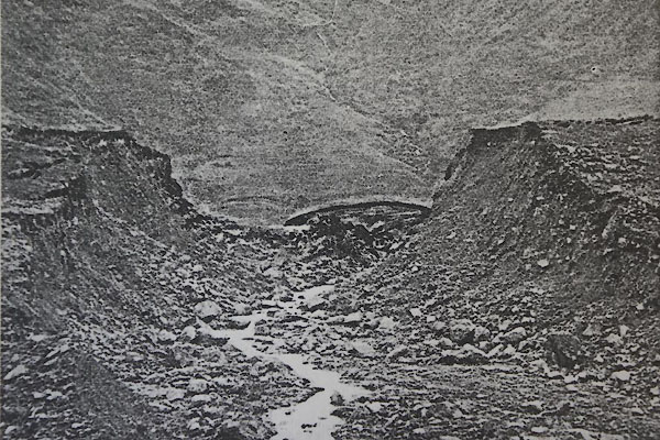 CCD48.jpg |
||
| The failure of the moraine was a natural event. The theory is that a known phenomenon
of winds forming a vortext in the cove during storms was intensified by the violent
weather. The swirling winds caused swirling water, and large amounts of spray from
waves were carried over the moraine, cut into it, and led to its failure. A new channel
deepened so rapidly that the 'dam' burst and all the water was releaed to flow down
the valley. |
||
| Although there were no deaths of people in the valley, destruction was considerable.
At one shop the counter was washed half way through a plate glass window, the foodstuffs
ended in the street, or in Ullswater. The post office and bank were both partly wrecked. |
||
|
|
||
| hearsay:- |
This was a typical combe tarn held in by a terminal moraine. Water was drawn off for
Greenside Lead Mines down the valley by a bore in the moraine. |
|
| The OS County Series sheet 1890s.shows the tarn fed by extra water channelled from
the Brown Cove and other becks, and having a sluice at the SE. It is not clear how
much the natural moraine had been built up with earth and cobbles - it has been suggested
that this was done in 1870. |
||
| The earth barrier of the tarn failed in a storm the night of Saturday 29/30 October
1927 at 1.45am; a huge wave of water from the tarn caused a lot of damage in Glenridding.
Bridges, trees and animals were carried into Ullswater. The roof of a hay barn above
Glenridding Bridge was found lying on its hay 20 feet down the field, the walls gone.
People found their beds floating up to their ceilings, and had to break out through
windows - but no one was drowned. |
||
|
|
||
| evidence:- | outline view:- Jenkinson 1875 placename:- Keppelcove Tarn |
|
| source data:- | Print, lithograph, outline view, Panoramic Sketches from Helvellyn, Westmorland, by
Edwin A Pettitt, London, published by Edward Stanford, 55 Charing Cross, London, 1875.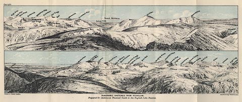 click to enlarge click to enlargeJk01E1.jpg "... Keppelcove Tarn ..." item:- JandMN : 28.5 Image © see bottom of page |
|
|
|
||
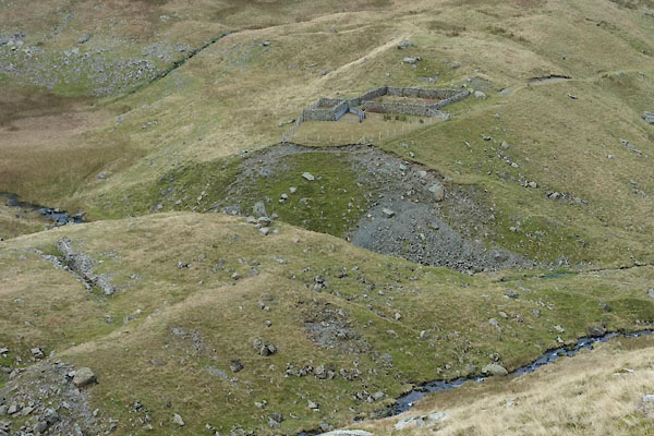 CCD19.jpg Gap in the moraine. (taken 18.11.2014) 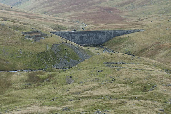 CCD18.jpg Gap in the moraine. (taken 18.11.2014) |
||
|
|
||
| notes:- |
The original earth barrier was breached by storm water, Saturday 29 October 1927.
The flood waters swept in Glenridding village. |
|
|
|
||
| also see:- | dam, Keppel Cove |
|
|
|
||
Lakes Guides menu.