 Old Cumbria Gazetteer
 |
 |
|
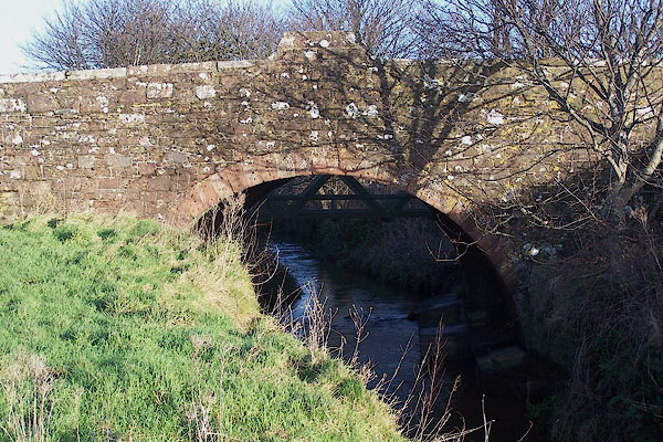
| Pow Bridge, St Bees | ||
| Pow Bridge | ||
| site name:- | Pow Beck (3) | |
| locality:- | St Bees | |
| civil parish:- | St Bees (formerly Cumberland) | |
| county:- | Cumbria | |
| locality type:- | bridge | |
| coordinates:- | NX97011202 | |
| 1Km square:- | NX9712 | |
| 10Km square:- | NX91 | |
|
|
||
 BNC71.jpg (taken 2.1.2007) 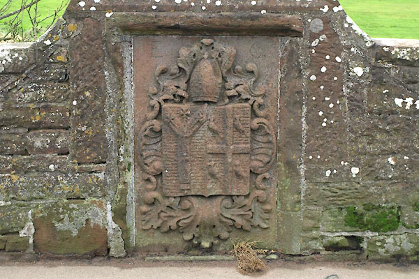 BXQ13.jpg Stone with coat of arms of Edmund Grindal, Archbishop of Canterbury, S side. This is a replacement made 1912. (taken 16.11.2012) 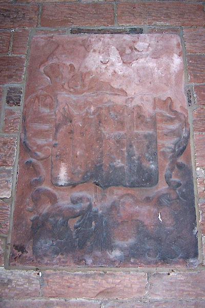 BNC82.jpg Original stone, now in St Bees School. Coat of arms, E G 1585. (taken 2.1.2007) |
||
|
|
||
| evidence:- | old map:- OS County Series (Cmd 72 2) placename:- Pow Bridge |
|
| source data:- | Maps, County Series maps of Great Britain, scales 6 and 25
inches to 1 mile, published by the Ordnance Survey, Southampton,
Hampshire, from about 1863 to 1948. |
|
|
|
||
| evidence:- | old map:- Donald 1774 (Cmd) |
|
| source data:- | Map, hand coloured engraving, 3x2 sheets, The County of Cumberland, scale about 1
inch to 1 mile, by Thomas Donald, engraved and published by Joseph Hodskinson, 29
Arundel Street, Strand, London, 1774.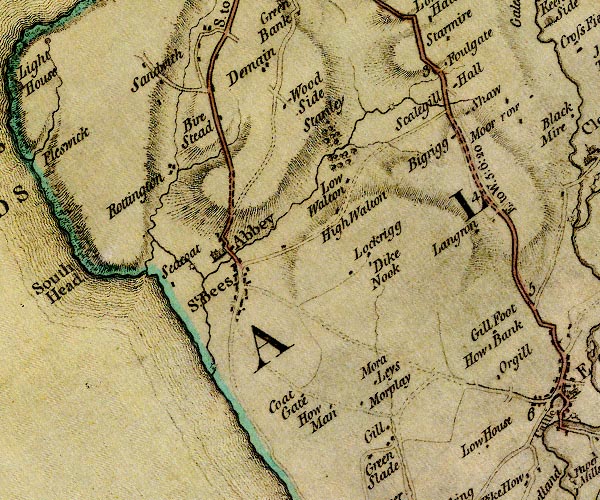 D4NX91SE.jpg double line across a river; a bridge near St Bees Priory item:- Carlisle Library : Map 2 Image © Carlisle Library |
|
|
|
||
| evidence:- | old map:- Bell 1892 placename:- St Bees Bridge |
|
| source data:- | Map, colour lithograph, Road Map of Cumberland, by George Joseph
Bell, scale about 2.5 miles to 1 inch, printed by Charles
Thurnam and Sons, Carlisle, Cumberland, 1892.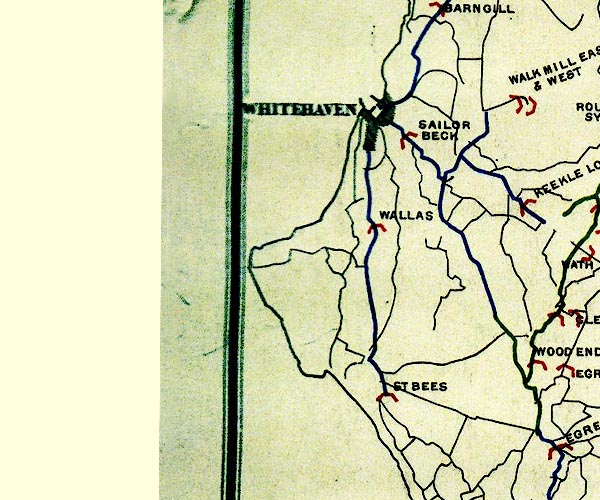 BEL9NX91.jpg "ST BEES" bridge symbol Road map of Cumberland showing County Bridges item:- Carlisle Library : Map 38 Image © Carlisle Library |
|
|
|
||
| evidence:- | database:- Listed Buildings 2010 placename:- Pow Bridge |
|
| source data:- | courtesy of English Heritage "POW BRIDGE OVER POW BECK / / B5345 / ST BEES / COPELAND / CUMBRIA / II[star] / 76172 / NX9701312028" |
|
| source data:- | courtesy of English Heritage "Roadbridge, dated 1585. Built for Archbishop Grindal whose coat of arms and initials appear on dated panel (1912 copy of original, moved to school) set in centre of west parapet; badly weathered inscription on panel to eastern parapet. Bridge shown in Buck's 1739 engraving of Priory Church; since widened. Single elliptical arch of c12 ft span. East side is original work of coursed, squared rubble with single stone projecting to either side of radiating arch voussoirs (water-shutes from original road surface?). Original width 12 ft, now doubled (straight joint runs around soffit). Snecked rubble used on west side and for parapets, c3 ft high with flat copings rising to accommodate inscribed panels." |
|
|
|
||
| evidence:- | old print:- item:- coat of arms |
|
| source data:- | Print, Arms of Archbishop Grindle, on a Bridge at St Bees, Cumberland, by Samuel Bough,
engraved by Lizars, Edinburgh, published by S Jefferson, Carlisle, Cumberland, about
1842.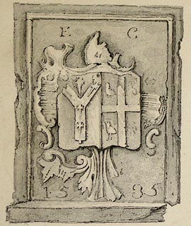 click to enlarge click to enlargePR1099.jpg Coat of arms dated 1535 carved on a stone panel. inscribed at bottom left:- "THE ARMS OF ARCHBISHOP GRINDLE. ON A BRIDGE AT ST BEES." inscribed at bottom centre on print:- "S. Jefferson Carlisle 1842. Lizars sc" item:- Tullie House Museum : 1970.80.26.1 Image © Tullie House Museum |
|
|
|
||
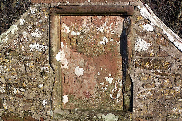 BNC73.jpg Inscribed stone, N side. (taken 2.1.2007) 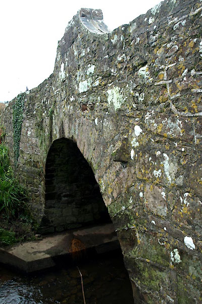 BXQ12.jpg (taken 16.11.2012) |
||
|
|
||
 Lakes Guides menu.