 Old Cumbria Gazetteer
 |
 |
|
| Stockdalewath Bridge, Stockdalewath | ||
| Stockdalewath Bridge | ||
| site name:- | Roe, River | |
| locality:- | Stockdalewath | |
| civil parish:- | Dalston (formerly Cumberland) | |
| county:- | Cumbria | |
| locality type:- | bridge | |
| coordinates:- | NY38764503 | |
| 1Km square:- | NY3845 | |
| 10Km square:- | NY34 | |
|
|
||
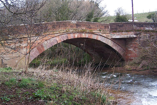 BNH91.jpg (taken 9.3.2007) |
||
|
|
||
| evidence:- | old map:- OS County Series (Cmd 30 15) placename:- Stockdalewath Bridge |
|
| source data:- | Maps, County Series maps of Great Britain, scales 6 and 25
inches to 1 mile, published by the Ordnance Survey, Southampton,
Hampshire, from about 1863 to 1948. |
|
|
|
||
| evidence:- | old map:- Bell 1892 placename:- Stockdalewath Bridge |
|
| source data:- | Map, colour lithograph, Road Map of Cumberland, by George Joseph
Bell, scale about 2.5 miles to 1 inch, printed by Charles
Thurnam and Sons, Carlisle, Cumberland, 1892.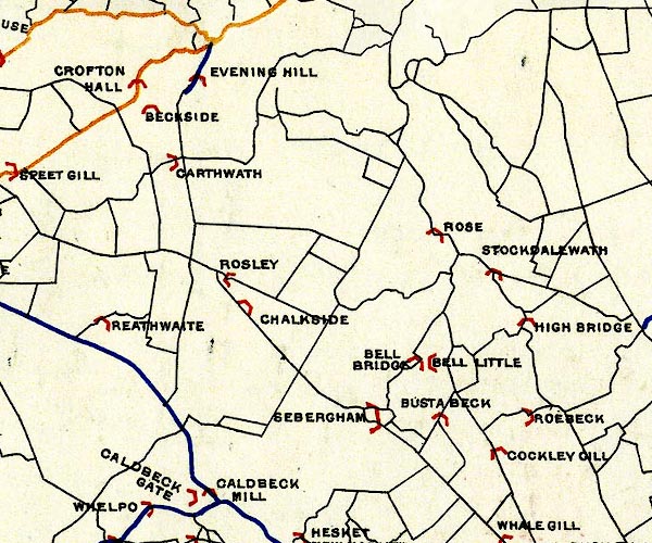 BEL9NY34.jpg "STOCKDALEWATH" bridge symbol Road map of Cumberland showing County Bridges item:- Carlisle Library : Map 38 Image © Carlisle Library |
|
|
|
||
| evidence:- | database:- Listed Buildings 2010 placename:- Stockdalewath Bridge |
|
| source data:- | courtesy of English Heritage "STOCKDALEWATH BRIDGE / / / DALSTON / CARLISLE / CUMBRIA / II / 78349 / NY3876945029" |
|
| source data:- | courtesy of English Heritage "Roadbridge. Early C19. Red sandstone ashlar. Single-span segmental arch with solid parapet over string course." |
|
|
|
||
 Lakes Guides menu.