 Old Cumbria Gazetteer
 |
 |
|
| Dufton Mines, Dufton | ||
| Dufton Mines | ||
| locality:- | Great Rundale | |
| civil parish:- | Dufton (formerly Westmorland) | |
| county:- | Cumbria | |
| locality type:- | lead mine | |
| locality type:- | mine | |
| coordinates:- | NY71692781 (etc) | |
| 1Km square:- | NY7127 | |
| 10Km square:- | NY72 | |
| references:- | KDMRS 1979-82 |
|
|
|
||
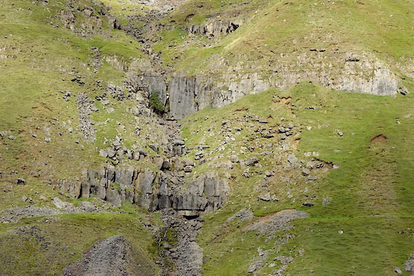
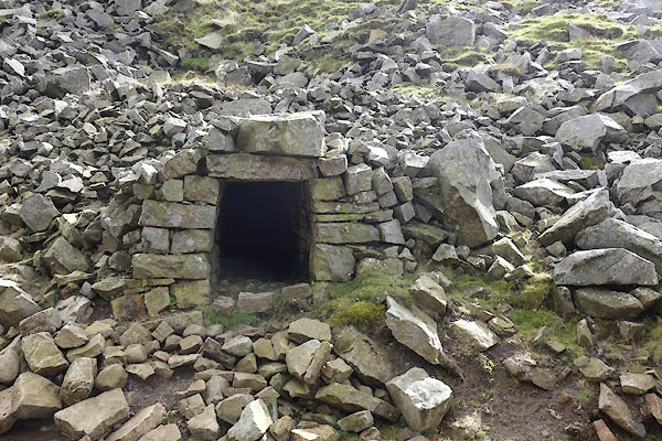 CGO56.jpg Level, (taken 14.9.2017) 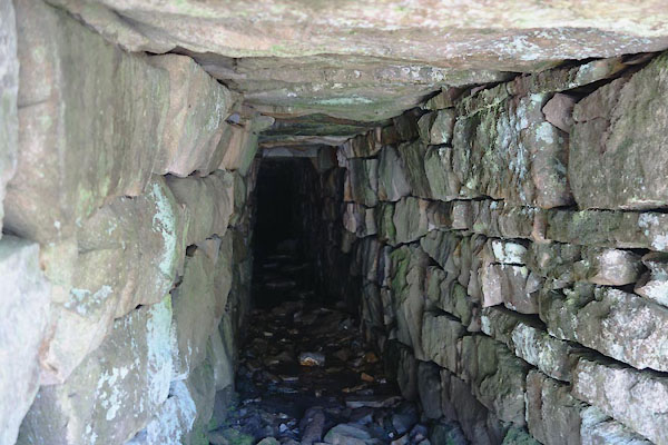 CGO57.jpg Level, (taken 14.9.2017) |
||
|
|
||
| evidence:- | old map:- OS County Series (Wmd 5 16) |
|
| source data:- | Maps, County Series maps of Great Britain, scales 6 and 25
inches to 1 mile, published by the Ordnance Survey, Southampton,
Hampshire, from about 1863 to 1948. "Lead Mine / Crushing Mill / Level / Levels" |
|
|
|
||
| evidence:- | perhaps old map:- Jefferys 1770 (Wmd) |
|
| source data:- | Map, 4 sheets, The County of Westmoreland, scale 1 inch to 1
mile, surveyed 1768, and engraved and published by Thomas
Jefferys, London, 1770.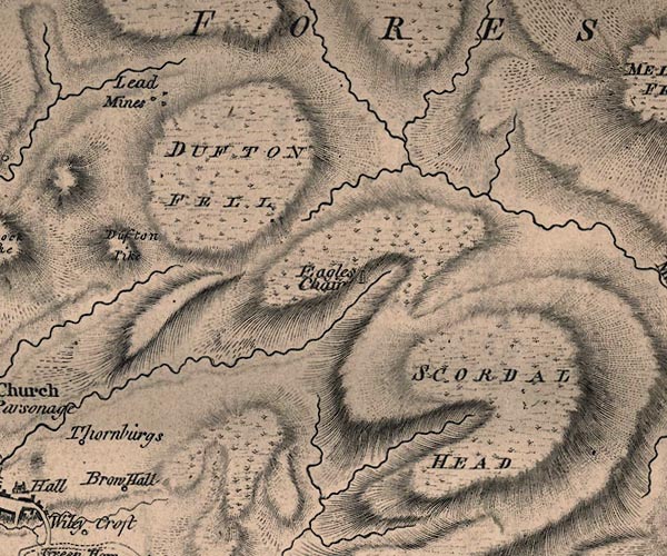 J5NY72NW.jpg "Lead Mines" 3 dots item:- National Library of Scotland : EME.s.47 Image © National Library of Scotland |
|
|
|
||
| evidence:- | perhaps old map:- Cary 1789 (edn 1805) |
|
| source data:- | Map, uncoloured engraving, Westmoreland, scale about 2.5 miles
to 1 inch, by John Cary, London, 1789; edition 1805.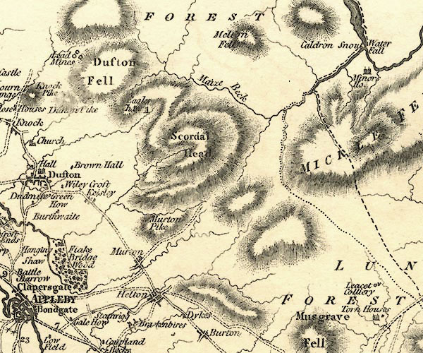 CY24NY72.jpg "Lead Mines" group of three circles item:- JandMN : 129 Image © see bottom of page |
|
|
|
||
| evidence:- | old map:- Postlethwaite 1877 (3rd edn 1913) placename:- Dufton Fell Mine |
|
| source data:- | Map, uncoloured engraving, Map of the Lake District Mining Field, Westmorland, Cumberland,
Lancashire, scale about 5 miles to 1 inch, by John Postlethwaite, published by W H
Moss and Sons, 13 Lowther Street, Whitehaven, Cumberland, 1877 edn 1913.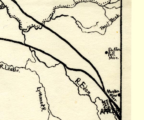 PST2NY62.jpg "Dufton Fell Mine" mine symbol item:- JandMN : 162.2 Image © see bottom of page |
|
|
|
||
| evidence:- | visit log:- KDMRS 1979-82 placename:- Dufton Mines item:- galena; barytes |
|
| source data:- | Notes, log book of Geological Outings, mine plans, etc, Kendal
and District Mine Research Society, Kendal area, Cumbria, etc,
visits made 1979-82. Geological Outing of the Kendal and District Mine Research Society Log book page 61:- "DATE - 15/6/80 / MAP REF - 7180/2780 / LOCATION - DUFTON / NAME - DUFTON MINES / TYPE OF SITE - MINES. / WORKING OR DISUSED - DISUSED / PEOPLE IN PARTY [ ] / NOS. OF PHOTOS - 36 / SPECIMENS FOUND - GALENA & BARYTES. / COMMENTS - WINDY, SHOWERY DAY. BORROWED A TOYOTA PICK UP TO TAKE US TO THE MINES. ENTERED TWO LEVELS AND EXPLORED FOR AS FAR AS WE COULD. THERE ARE SIX LEVELS OPEN, BUT TIME WAS LIMITED, SO ANOTHER VISIT WAS PROPOSED, AT A LATER DATE." item:- private collection : 82 Image © see bottom of page |
|
|
|
||
 CGO47.jpg Level in Threlkeld Side, NY71212753. (taken 14.9.2017) 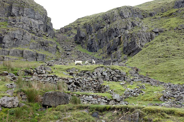 CGO51.jpg Buildings at NY71362741. (taken 14.9.2017) 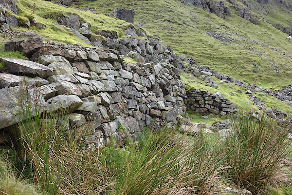 CGO52.jpg Buildings at NY71362741. (taken 14.9.2017) 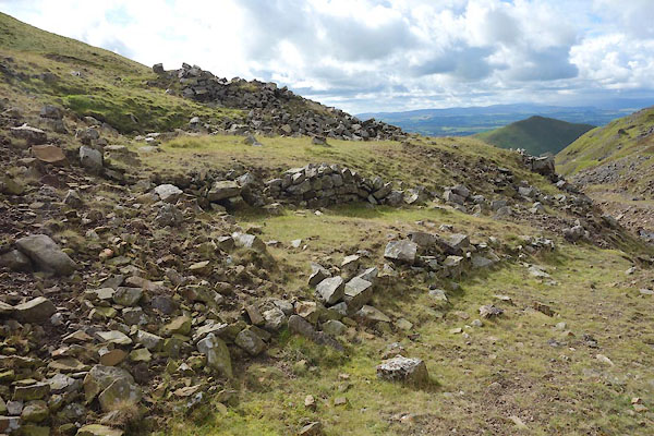 CGO58.jpg Buildings at NY71612779 (taken 14.9.2017) 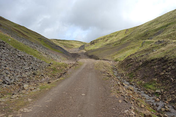 CGO59.jpg Area of mines, (taken 14.9.2017) |
||
|
|
||
| hearsay:- |
The London Lead Mining Company worked here in the 19th century. |
|
|
|
||
 Lakes Guides menu.