 Old Cumbria Gazetteer
 |
 |
|
| ford, Whinfell (2) | ||
| Guest Ford | ||
| site name:- | Mint, River | |
| locality:- | Guestford | |
| civil parish:- | Whinfell (formerly Westmorland) | |
| county:- | Cumbria | |
| locality type:- | ford | |
| coordinates:- | SD55629926 | |
| 1Km square:- | SD5599 | |
| 10Km square:- | SD59 | |
| SummaryText:- | The track leads to a house called Guestford | |
| SummaryText:- | The parish boundary to the west is on an old bed of the river, where this ford would have been | |
|
|
||
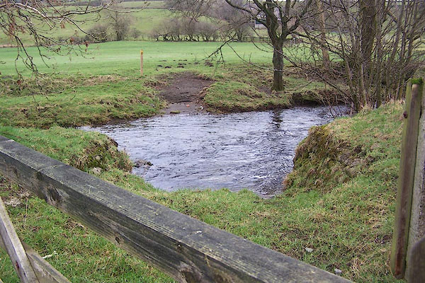 BNG96.jpg From the Whitwell and Selside bank; after a little recent rain. (taken 2.3.2007) 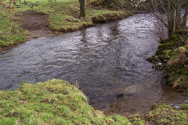 BNG97.jpg From the Whitwell and Selside bank; after a little recent rain. (taken 2.3.2007) |
||
| It makes you realise what was 'fordable' in the days of horse travel and a more robust
attitude to foot travel. |
||
|
|
||
| evidence:- | old map:- OS County Series (Wmd 34 6) |
|
| source data:- | Maps, County Series maps of Great Britain, scales 6 and 25
inches to 1 mile, published by the Ordnance Survey, Southampton,
Hampshire, from about 1863 to 1948. "Ford" |
|
|
|
||
| evidence:- | old map:- Jefferys 1770 (Wmd) |
|
| source data:- | Map, 4 sheets, The County of Westmoreland, scale 1 inch to 1
mile, surveyed 1768, and engraved and published by Thomas
Jefferys, London, 1770.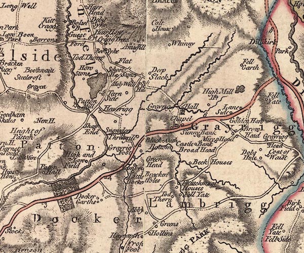 J5SD59NE.jpg road interrupted by river; ford item:- National Library of Scotland : EME.s.47 Image © National Library of Scotland |
|
|
|
||
 Lakes Guides menu.