 Old Cumbria Gazetteer
 |
 |
|
| Low House, Cartmel Fell | ||
| Low House | ||
| civil parish:- | Cartmel Fell (formerly Lancashire) | |
| county:- | Cumbria | |
| locality type:- | buildings | |
| coordinates:- | SD40878904 | |
| 1Km square:- | SD4089 | |
| 10Km square:- | SD48 | |
|
|
||
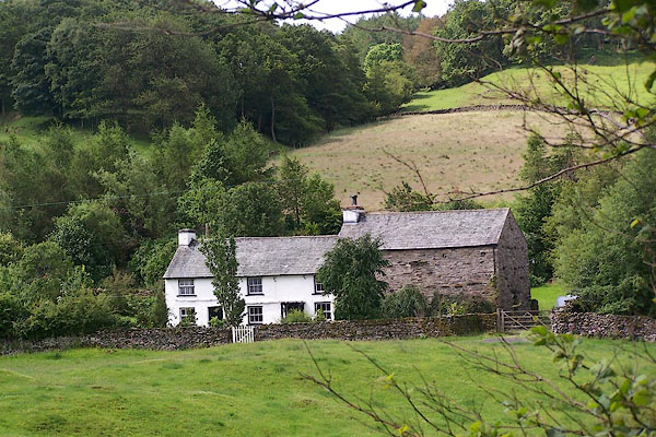 BNW05.jpg (taken 27.6.2007) |
||
|
|
||
| evidence:- | old map:- OS County Series (Lan 8 8) placename:- Low House placename:- House, Low |
|
| source data:- | Maps, County Series maps of Great Britain, scales 6 and 25
inches to 1 mile, published by the Ordnance Survey, Southampton,
Hampshire, from about 1863 to 1948. |
|
|
|
||
| evidence:- | database:- Listed Buildings 2010 placename:- Lightwood Cottage |
|
| source data:- | courtesy of English Heritage "LIGHTWOOD COTTAGE AND ADJOINING BARN / / / CARTMEL FELL / SOUTH LAKELAND / CUMBRIA / II / 75576 / SD4086689048" |
|
|
|
||
 Lakes Guides menu.