 Old Cumbria Gazetteer
 |
 |
|
| Satterthwaite Bridge, Satterthwaite | ||
| Satterthwaite Bridge | ||
| site name:- | Force Beck (2) | |
| locality:- | Satterthwaite | |
| civil parish:- | Colton (formerly Lancashire) | |
| county:- | Cumbria | |
| locality type:- | bridge | |
| coordinates:- | SD33719210 | |
| 1Km square:- | SD3392 | |
| 10Km square:- | SD39 | |
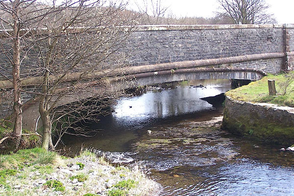
| SummaryText:- | An even newer bridge. | |
|
|
||
 BNN31.jpg (taken 5.4.2007) 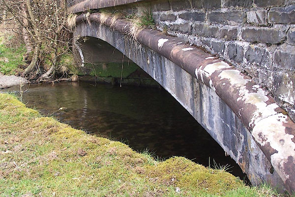 BNN32.jpg (taken 5.4.2007) |
||
|
|
||
| evidence:- | old map:- OS County Series (Lan 5) placename:- Satterthwaite New Bridge |
|
| source data:- | Maps, County Series maps of Great Britain, scales 6 and 25
inches to 1 mile, published by the Ordnance Survey, Southampton,
Hampshire, from about 1863 to 1948. "Satterthwaite New Br." |
|
|
|
||
| evidence:- | old map:- OS County Series (Lan 5 13) placename:- New Bridge placename:- Bridge, New |
|
| source data:- | Maps, County Series maps of Great Britain, scales 6 and 25
inches to 1 mile, published by the Ordnance Survey, Southampton,
Hampshire, from about 1863 to 1948. |
|
|
|
||
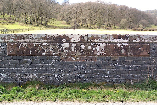 BNN33.jpg Sandstone plaques:- "C.C SATTERTHWAITE BRIDGE / REBUILT 1905" (taken 5.4.2007) |
||
|
|
||
| hearsay:- |
An early example of Hennebique reinforced concrete bridge, built by L G Mouchel and
Yorkshire Hennebique Co, 1905. Quite an elegant skew elliptical arch. |
|
|
|
||
 Lakes Guides menu.