 Old Cumbria Gazetteer
 |
 |
|
| Bonners Farm, Branthwaite | ||
| Bonners Farm | ||
| locality:- | Branthwaite | |
| civil parish:- | Caldbeck (formerly Cumberland) | |
| county:- | Cumbria | |
| locality type:- | buildings | |
| coordinates:- | NY29443713 | |
| 1Km square:- | NY2937 | |
| 10Km square:- | NY23 | |
|
|
||
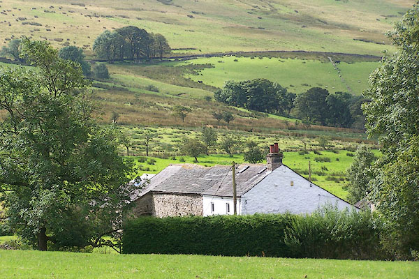 BNY27.jpg (taken 15.8.2007) 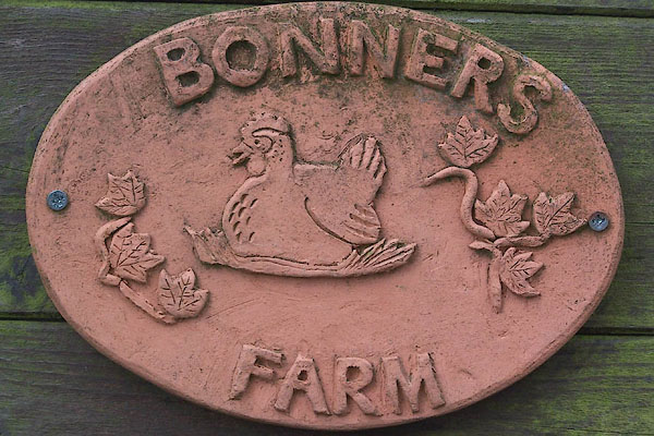 BNY28.jpg Pottery name sign:- "BONNERS FARM" (taken 15.8.2007) |
||
|
|
||
| evidence:- | old map:- OS County Series (Cmd 47 3) placename:- Bonners |
|
| source data:- | Maps, County Series maps of Great Britain, scales 6 and 25
inches to 1 mile, published by the Ordnance Survey, Southampton,
Hampshire, from about 1863 to 1948. |
|
|
|
||
 Lakes Guides menu.