 Old Cumbria Gazetteer
 |
 |
|
| Green Lead Mines, Durham | ||
| Green Lead Mines | ||
| county:- | Durham | |
| locality type:- | lead mine | |
| locality type:- | mine | |
| coordinates:- | NY81132664 (etc) | |
| 1Km square:- | NY8126 | |
| 10Km square:- | NY82 | |
|
|
||
| evidence:- | old map:- Jefferys 1770 (Wmd) |
|
| source data:- | Map, 4 sheets, The County of Westmoreland, scale 1 inch to 1
mile, surveyed 1768, and engraved and published by Thomas
Jefferys, London, 1770.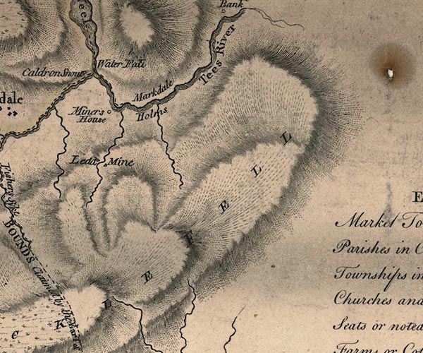 J5NY82NW.jpg "Lead Mine" 2 ?triangles item:- National Library of Scotland : EME.s.47 Image © National Library of Scotland |
|
|
|
||
 Lakes Guides menu.