 Old Cumbria Gazetteer
 |
 |
|
| Kings Arms Hotel, Shap | ||
| Kings Arms Hotel | ||
| locality:- | Shap | |
| civil parish:- | Shap (formerly Westmorland) | |
| county:- | Cumbria | |
| locality type:- | inn | |
| coordinates:- | NY56421476 | |
| 1Km square:- | NY5614 | |
| 10Km square:- | NY51 | |
|
|
||
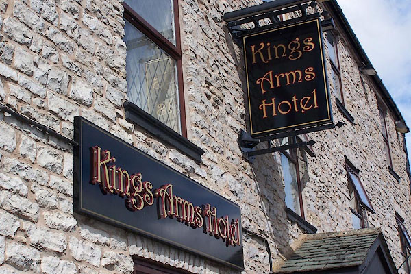 BNW85.jpg (taken 30.7.2007) 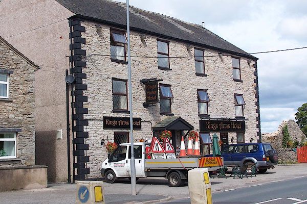 BNW84.jpg (taken 30.7.2007) |
||
|
|
||
| evidence:- | old map:- OS County Series (Wmd 14 14) placename:- Kings Arms |
|
| source data:- | Maps, County Series maps of Great Britain, scales 6 and 25
inches to 1 mile, published by the Ordnance Survey, Southampton,
Hampshire, from about 1863 to 1948. |
|
|
|
||
| evidence:- | road book:- Cary 1798 (2nd edn 1802) placename:- King's Arms |
|
| source data:- | Road book, itineraries, Cary's New Itinerary, by John Cary, 181
Strand, London, 2nd edn 1802. goto source goto source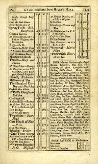 click to enlarge click to enlargeC38269.jpg page 269-270 "INNS. ... Shap, King's Arms, New Inn. ..." item:- JandMN : 228.1 Image © see bottom of page |
|
|
|
||
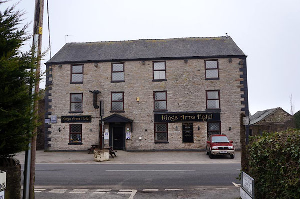 CAB34.jpg (taken 14.3.2104) |
||
|
|
||
Lakes Guides menu.