 Old Cumbria Gazetteer
 |
 |
|
| milestone, Thrimby | ||
| site name:- | road, Shap to Penrith | |
| civil parish:- | Thrimby (formerly Westmorland) | |
| county:- | Cumbria | |
| locality type:- | milestone | |
| coordinates:- | NY55052092 | |
| 1Km square:- | NY5520 | |
| 10Km square:- | NY52 | |
| references:- | OS 2000s Explorer |
|
|
|
||
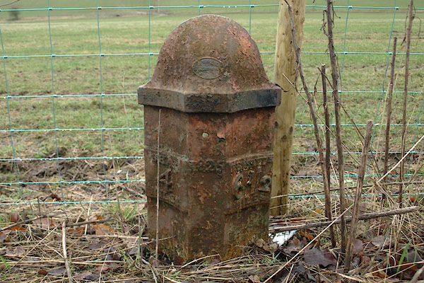 BSJ12.jpg Cast iron:- "SHAP 4 MILES / 1825 / PENRITH 6½ MILES" (taken 26.3.2010) |
||
|
|
||
| evidence:- | old map:- OS County Series (Wmd 8) |
|
| source data:- | Maps, County Series maps of Great Britain, scales 6 and 25
inches to 1 mile, published by the Ordnance Survey, Southampton,
Hampshire, from about 1863 to 1948. "M.S. SHAP 4 PENRITH 6½" |
|
|
|
||
| evidence:- | old map:- OS County Series (Wmd 8 13) placename:- |
|
| source data:- | Maps, County Series maps of Great Britain, scales 6 and 25
inches to 1 mile, published by the Ordnance Survey, Southampton,
Hampshire, from about 1863 to 1948. "M.S. Shap ... 4 Penrith 6½" |
|
|
|
||
 Lakes Guides menu.