 Old Cumbria Gazetteer
 |
 |
|
| mines, Milburn | ||
| civil parish:- | Milburn (formerly Westmorland) (?) | |
| civil parish:- | Dufton (formerly Westmorland) (?) | |
| county:- | Cumbria | |
| locality type:- | lead mine | |
| locality type:- | mine | |
| 1Km square:- | NY7131 | |
| 10Km square:- | NY73 | |
|
|
||
| evidence:- | old map:- Morden 1695 (Wmd) placename:- Lead Mines, The |
|
| source data:- | Map, hand coloured engraving, Westmorland, scale about 2.5 miles to 1 inch, by Robert
Morden, published by Abel Swale, the Unicorn, St Paul's Churchyard, Awnsham, and John
Churchill, the Black Swan, Paternoster Row, London, 1695.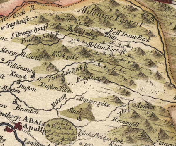 MD10NY72.jpg "The Lead mines" No symbol. item:- JandMN : 24 Image © see bottom of page |
|
|
|
||
| evidence:- | old map:- Bowen and Kitchin 1760 |
|
| source data:- | Map, hand coloured engraving, A New Map of the Counties of
Cumberland and Westmoreland Divided into their Respective Wards,
scale about 4 miles to 1 inch, by Emanuel Bowen and Thomas
Kitchin et al, published by T Bowles, Robert Sayer, and John
Bowles, London, 1760.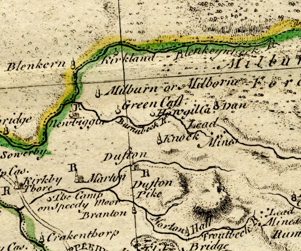 BO18NY62.jpg "Lead Mines" spots? east of Knock item:- Armitt Library : 2008.14.10 Image © see bottom of page |
|
|
|
||
 Lakes Guides menu.