 Old Cumbria Gazetteer
 |
 |
|
|
| road, Shap to Tebay | |||
| Shap to Tebay | |||
| Tebay to Shap | |||
| civil parish:- | Shap (formerly Westmorland) | ||
| civil parish:- | Shap (formerly Westmorland) | ||
| civil parish:- | Crosby Ravensworth (formerly Westmorland) | ||
| civil parish:- | Orton S (formerly Westmorland) | ||
| civil parish:- | Tebay (formerly Westmorland) | ||
| county:- | Cumbria | ||
| locality type:- | road route | ||
| 10Km square:- | NY51 | ||
| 10Km square:- | NY50 | ||
| 10Km square:- | NY60 | ||
| SummaryText:- | An old route, now gone? | ||
| references:- | Morden 1695 |
||
|
|
|||
| evidence:- | old map:- Morden 1695 (Wmd) |
||
| source data:- | Map, hand coloured engraving, Westmorland, scale about 2.5 miles to 1 inch, by Robert
Morden, published by Abel Swale, the Unicorn, St Paul's Churchyard, Awnsham, and John
Churchill, the Black Swan, Paternoster Row, London, 1695.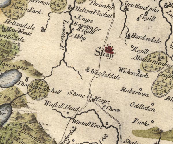 MD10NY51.jpg Double line. 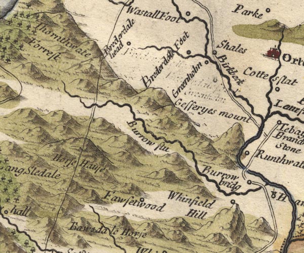 MD10NY50.jpg Double line. item:- JandMN : 24 Image © see bottom of page |
||
|
|
|||
| evidence:- | perhaps old map:- Bowen and Kitchin 1760 |
||
| source data:- | Map, hand coloured engraving, A New Map of the Counties of
Cumberland and Westmoreland Divided into their Respective Wards,
scale about 4 miles to 1 inch, by Emanuel Bowen and Thomas
Kitchin et al, published by T Bowles, Robert Sayer, and John
Bowles, London, 1760. BO18NY40.jpg double line, solid  BO18NY50.jpg double line, solid? item:- Armitt Library : 2008.14.10 Image © see bottom of page |
||
|
|
|||
 Act of Parliament Act of Parliament |
|||
|
|
|||
| places:- |  Shap Scout Green, Orton S High Scales, Orton S Greenholme, Orton S Tebay Shap Scout Green, Orton S High Scales, Orton S Greenholme, Orton S Tebay |
||
|
|
|||
Lakes Guides menu.