 Old Cumbria Gazetteer
 |
 |
|
| milestone, Strickland Ketel | ||
| site name:- | road, Kendal to Windermere Ferry | |
| civil parish:- | Strickland Ketel (formerly Westmorland) | |
| county:- | Cumbria | |
| locality type:- | milestone | |
| coordinates:- | SD49199478 | |
| 1Km square:- | SD4994 | |
| 10Km square:- | SD49 | |
|
|
||
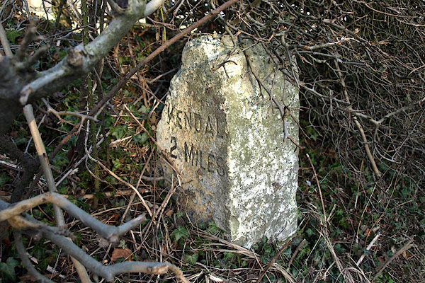 BOR65.jpg Inscribed stone:- "KENDAL 2 MILES" (taken 15.2.2008) 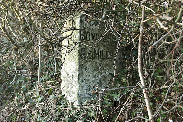 BOR66.jpg Inscribed stone:- "BOWNESS 6¼MILES" (taken 15.2.2008) |
||
|
|
||
| evidence:- | old map:- OS County Series (Wmd 33 15) |
|
| source data:- | Maps, County Series maps of Great Britain, scales 6 and 25
inches to 1 mile, published by the Ordnance Survey, Southampton,
Hampshire, from about 1863 to 1948. "M.S. Kendal .. 2 Bowness .. 7" |
|
|
|
||
 Lakes Guides menu.