 Old Cumbria Gazetteer
 |
 |
|
| Murton Lead Mines, Murton | ||
| Murton Lead Mines | ||
| Amber Hill Mines | ||
| locality:- | Scordale | |
| civil parish:- | Murton (formerly Westmorland) | |
| county:- | Cumbria | |
| locality type:- | lead mine | |
| locality type:- | mine | |
| coordinates:- | NY76232271 (etc) | |
| 1Km square:- | NY7622 | |
| 10Km square:- | NY72 | |
|
|
||
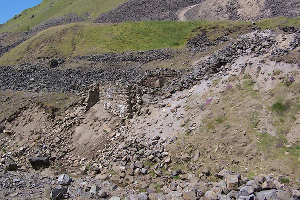 BVB67.jpg (taken 24.7.2011) 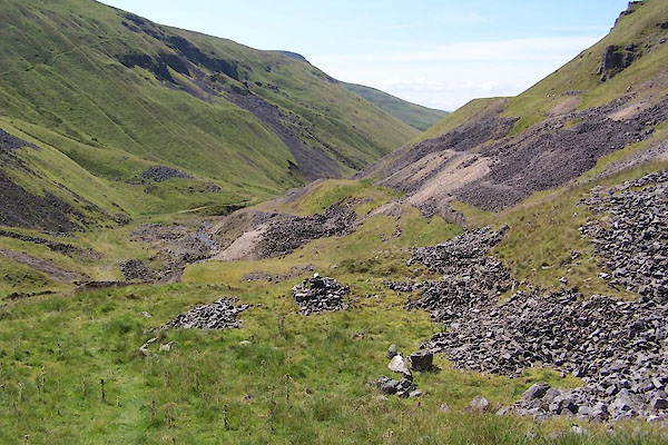 BVB68.jpg (taken 24.7.2011) |
||
|
|
||
| evidence:- | old map:- OS County Series (Wmd 10 10) placename:- Murton Lead Mines item:- tramroad |
|
| source data:- | Maps, County Series maps of Great Britain, scales 6 and 25
inches to 1 mile, published by the Ordnance Survey, Southampton,
Hampshire, from about 1863 to 1948. "Murton Lead Mines / Tramway / Crushing Mill / Mill Race / Level / Level" |
|
|
|
||
| evidence:- | possibly old map:- Morden 1695 (Wmd) |
|
| source data:- | Map, hand coloured engraving, Westmorland, scale about 2.5 miles to 1 inch, by Robert
Morden, published by Abel Swale, the Unicorn, St Paul's Churchyard, Awnsham, and John
Churchill, the Black Swan, Paternoster Row, London, 1695.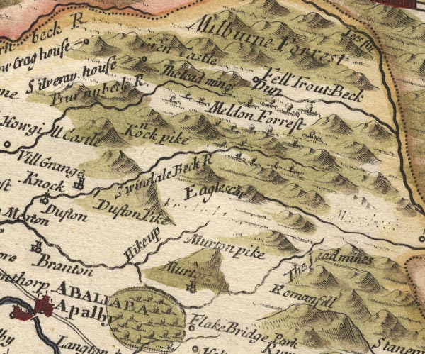 MD10NY72.jpg "The Lead mines" No symbol. item:- JandMN : 24 Image © see bottom of page |
|
|
|
||
| evidence:- | old map:- Simpson 1746 map (Wmd) |
|
| source data:- | Map, uncoloured engraving, Westmorland, scale about 8 miles to 1
inch, printed by R Walker, Fleet Lane, London, 1746.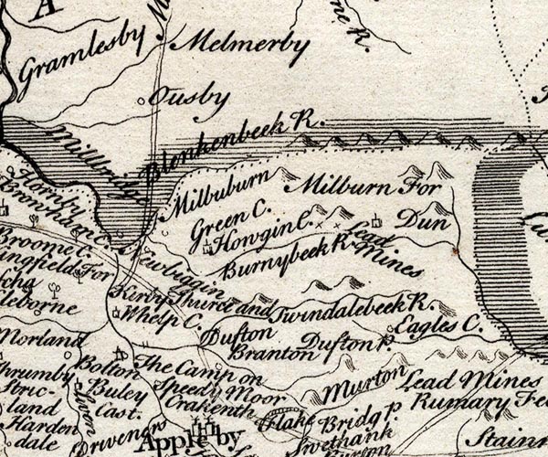 SMP2NYR.jpg "Lead Mine" Crosses (x). item:- Dove Cottage : 2007.38.59 Image © see bottom of page |
|
|
|
||
| evidence:- | old map:- Bowen and Kitchin 1760 |
|
| source data:- | Map, hand coloured engraving, A New Map of the Counties of
Cumberland and Westmoreland Divided into their Respective Wards,
scale about 4 miles to 1 inch, by Emanuel Bowen and Thomas
Kitchin et al, published by T Bowles, Robert Sayer, and John
Bowles, London, 1760.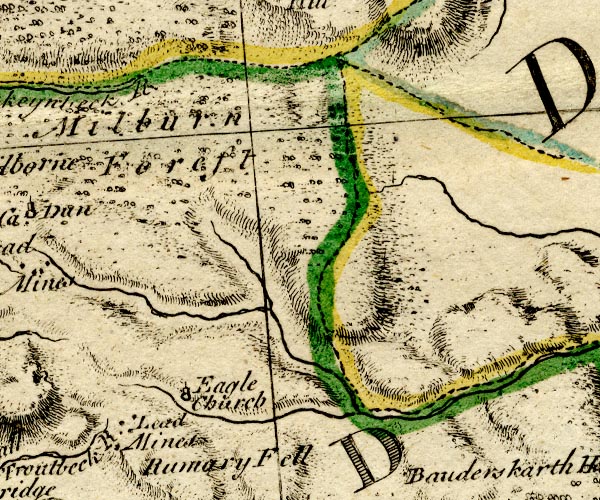 BO18NY72.jpg "Lead Mines" spots, on Rumary Fell item:- Armitt Library : 2008.14.10 Image © see bottom of page |
|
|
|
||
| evidence:- | old text:- Postlethwaite 1877 (3rd edn 1913) placename:- Murton Mine item:- lead ore; galena |
|
| source data:- | Book, Mines and Mining in the English Lake District, by John Postlethwaite, Keswick,
published by W H Moss and Sons, Whitehaven, Cumberland now Cumbria, 1877; published
1877-1913. goto source goto sourcepage 140:- "... This mine [Hilton Mine] may almost be regarded as a continuation of Murton Mine, as it is on the same vein, and only separated from it by a narrow ravine. The workings in Murton Mine are probably more extensive than those in Hilton, and both of them have yielded large quantities of galena." |
|
|
|
||
| evidence:- | old map:- Postlethwaite 1877 (3rd edn 1913) placename:- Murton Mine |
|
| source data:- | Map, uncoloured engraving, Map of the Lake District Mining Field, Westmorland, Cumberland,
Lancashire, scale about 5 miles to 1 inch, by John Postlethwaite, published by W H
Moss and Sons, 13 Lowther Street, Whitehaven, Cumberland, 1877 edn 1913.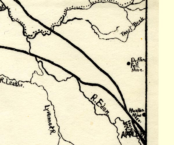 PST2NY62.jpg "Murton Mine" mine symbol item:- JandMN : 162.2 Image © see bottom of page |
|
|
|
||
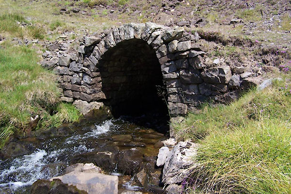 BVB66.jpg (taken 24.7.2011) |
||
|
|
||
| :- |
There are many old mine working in this area. |
|
| Tyler, Ian:2006: Lakes and Cumbria Mines Guide: Blue Rock Publications |
||
|
|
||
Lakes Guides menu.