 Old Cumbria Gazetteer
 |
 |
|
| bridge, Gilsland | ||
| site name:- | Poltross Burn | |
| locality:- | Gilsland | |
| civil parish:- | Upper Denton (formerly Cumberland) | |
| county:- | Cumbria | |
| locality type:- | bridge | |
| coordinates:- | NY63366647 | |
| 1Km square:- | NY6366 | |
| 10Km square:- | NY66 | |
| county:- | Northumberland | |
| current boundary | ||
| locality:- | Cumbria boundary | |
| old boundary | ||
| locality:- | Cumberland boundary | |
|
|
||
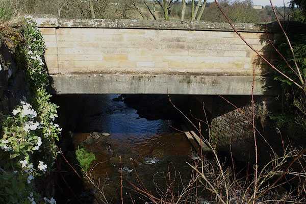 BOV51.jpg Modern widening, boring. (taken 21.3.2008) 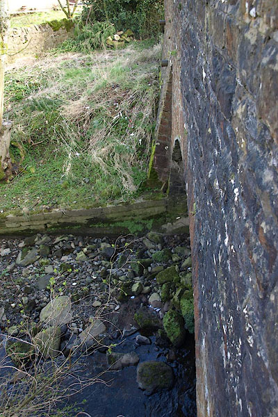 BOV52.jpg Older arch. (taken 21.3.2008) |
||
|
|
||
| evidence:- | old map:- Ogilby 1675 (plate 86) |
|
| source data:- | Road strip map, uncoloured engraving, the Road from Tinmouth ...
to Carlisle, scale about 1 inch to 1 mile, by John Ogilby,
London, 1675.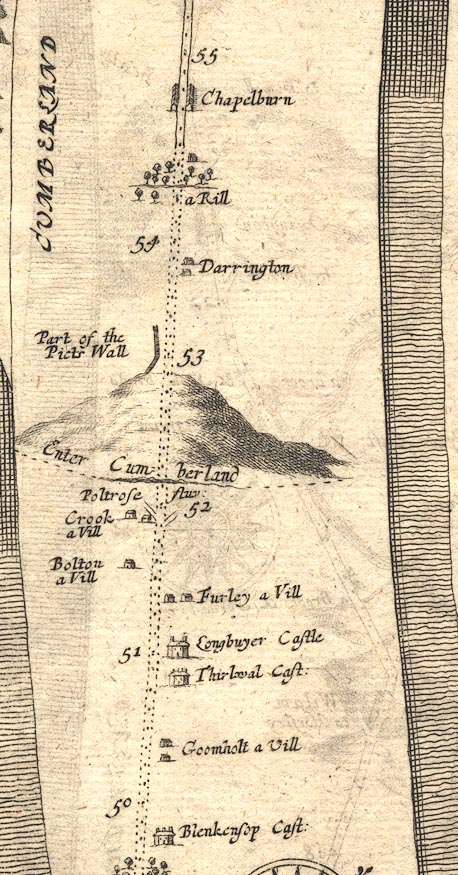 OG86m050.jpg In mile 52, Northumberland, Cumberland. Road crosses:- "Poltrose fluv: / Enter Cumberland" drawn across the road; and crosses the county boundary. item:- JandMN : 73 Image © see bottom of page |
|
|
|
||
| evidence:- | old map:- Ogilby 1675 (plate 86) |
|
| source data:- | Road strip map, uncoloured engraving, the Road from Tinmouth ...
to Carlisle, scale about 1 inch to 1 mile, by John Ogilby,
London, 1675. OG86m050.jpg Road passing under the Poltrose Burn, from Northumberland to Cumberland. item:- JandMN : 73 Image © see bottom of page |
|
|
|
||
| evidence:- | old map:- Morden 1695 (Cmd) |
|
| source data:- | Map, uncoloured engraving, Cumberland, scale about 4 miles to 1
inch, by Robert Morden, 1695, published by Abel Swale, the
Unicorn, St Paul's Churchyard, Awnsham, and John Churchill, the
Black Swan, Paternoster Row, London, 1695-1715.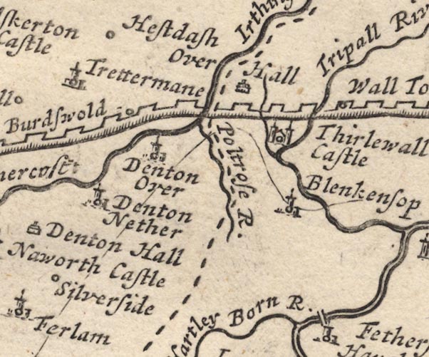 MD12NY66.jpg Single line over the Poltrose Burn. item:- JandMN : 90 Image © see bottom of page |
|
|
|
||
| evidence:- | old map:- Bell 1892 placename:- Powtross Bridge |
|
| source data:- | Map, colour lithograph, Road Map of Cumberland, by George Joseph
Bell, scale about 2.5 miles to 1 inch, printed by Charles
Thurnam and Sons, Carlisle, Cumberland, 1892.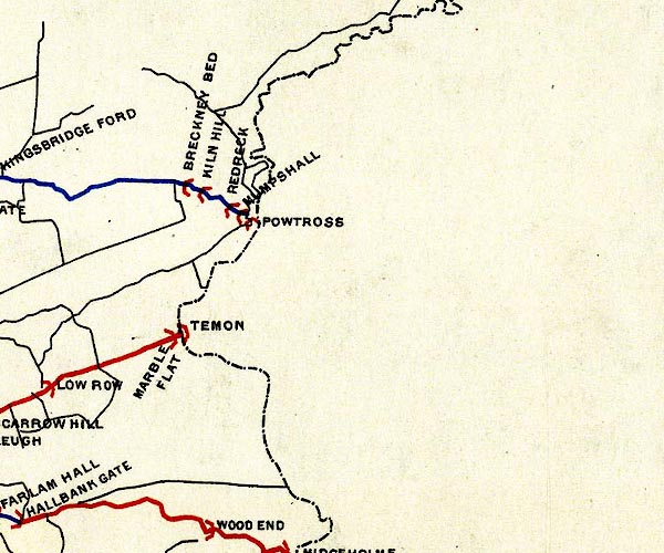 BEL9NY66.jpg "POWTROSS" bridge symbol; on county boundary? Road map of Cumberland showing County Bridges item:- Carlisle Library : Map 38 Image © Carlisle Library |
|
|
|
||
| notes:- |
The landlord of the Bridge Inn was once responsible for collecting shire tolls for
livstock crossing the county boundary at the bridge, for Cumberland County Council. |
|
|
|
||
 Lakes Guides menu.