 Old Cumbria Gazetteer
 |
 |
|
| Mumps Hall Bridge, Gilsland | ||
| Mumps Hall Bridge | ||
| site name:- | Irthing, River | |
| locality:- | Gilsland | |
| civil parish:- | Upper Denton (formerly Cumberland) | |
| civil parish:- | Waterhead (formerly Cumberland) | |
| county:- | Cumbria | |
| locality type:- | bridge | |
| coordinates:- | NY63216647 | |
| 1Km square:- | NY6366 | |
| 10Km square:- | NY66 | |
|
|
||
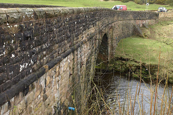 BOV61.jpg (taken 21.3.2008) 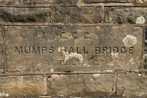 BOV62.jpg Inscribed stone on parapet:- "C.C.C. / MUMPS HALL BRIDGE / REBUILT 18[ ]" (taken 21.3.2008) |
||
|
|
||
| evidence:- | old map:- OS County Series (Cmd 13 9) placename:- Mumpshall Bridge |
|
| source data:- | Maps, County Series maps of Great Britain, scales 6 and 25
inches to 1 mile, published by the Ordnance Survey, Southampton,
Hampshire, from about 1863 to 1948. |
|
|
|
||
| evidence:- | old map:- Saxton 1579 |
|
| source data:- | Map, hand coloured engraving, Westmorlandiae et Cumberlandiae Comitatus ie Westmorland
and Cumberland, scale about 5 miles to 1 inch, by Christopher Saxton, London, engraved
by Augustinus Ryther, 1576, published 1579-1645. Sax9NY66.jpg item:- private collection : 2 Image © see bottom of page |
|
|
|
||
| evidence:- | probably old map:- Mercator 1595 (edn?) placename:- |
|
| source data:- | Map, hand coloured engraving, Northumbria, Cumberlandia, et
Dunelmensis Episcopatus, ie Northumberland, Cumberland and
Durham etc, scale about 6.5 miles to 1 inch, by Gerard Mercator,
Duisberg, Germany, about 1595.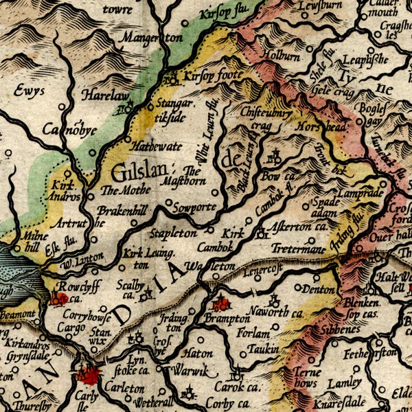 MER8CumA.jpg "" double across a stream; bridge, over the Irthing item:- JandMN : 169 Image © see bottom of page |
|
|
|
||
| evidence:- | old map:- Bell 1892 placename:- Mumpshall Bridge |
|
| source data:- | Map, colour lithograph, Road Map of Cumberland, by George Joseph
Bell, scale about 2.5 miles to 1 inch, printed by Charles
Thurnam and Sons, Carlisle, Cumberland, 1892.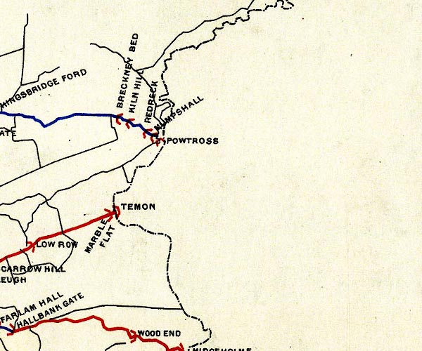 BEL9NY66.jpg "MUMPSHALL" bridge symbol Road map of Cumberland showing County Bridges item:- Carlisle Library : Map 38 Image © Carlisle Library |
|
|
|
||
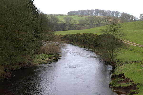 BOV63.jpg View of river. (taken 21.3.2008) |
||
|
|
||
 Lakes Guides menu.