 Old Cumbria Gazetteer
 |
 |
|
| Lampert, Northumberland | ||
| Lampert | ||
| site name:- | Spadeadam Forest | |
| county:- | Northumberland | |
| locality type:- | buildings | |
| coordinates:- | NY68217451 | |
| 1Km square:- | NY6874 | |
| 10Km square:- | NY67 | |
|
|
||
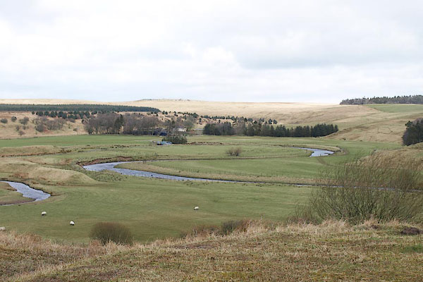 BOV90.jpg In the trees in the distance. (taken 21.3.2008) |
||
|
|
||
| evidence:- | possibly old map:- Mercator 1595 (edn?) placename:- Lamprade |
|
| source data:- | Map, hand coloured engraving, Northumbria, Cumberlandia, et
Dunelmensis Episcopatus, ie Northumberland, Cumberland and
Durham etc, scale about 6.5 miles to 1 inch, by Gerard Mercator,
Duisberg, Germany, about 1595.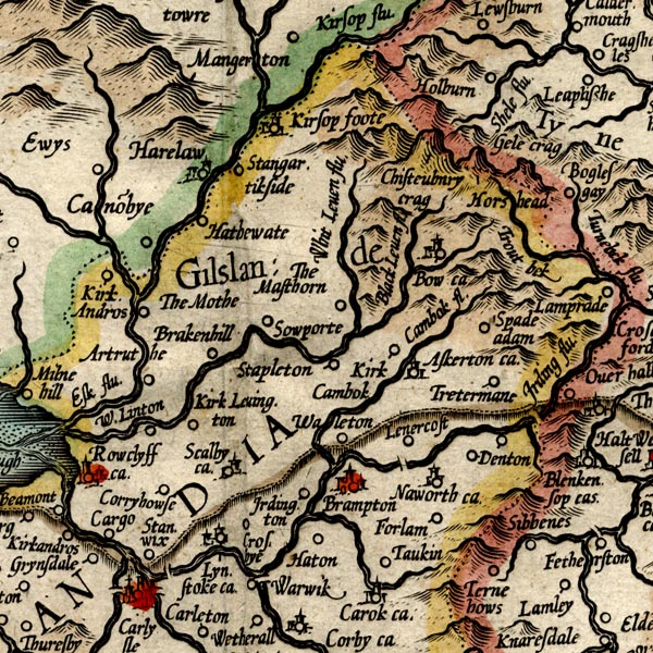 MER8CumA.jpg "Lamprade" circle item:- JandMN : 169 Image © see bottom of page |
|
|
|
||
| evidence:- | old map:- Donald 1774 (Cmd) placename:- Lampeart House |
|
| source data:- | Map, hand coloured engraving, 3x2 sheets, The County of Cumberland, scale about 1
inch to 1 mile, by Thomas Donald, engraved and published by Joseph Hodskinson, 29
Arundel Street, Strand, London, 1774.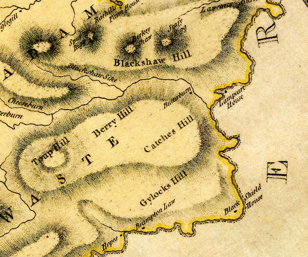 D4NY67SE.jpg "Lampeart House" block or blocks, labelled in lowercase; a hamlet or just a house item:- Carlisle Library : Map 2 Image © Carlisle Library |
|
|
|
||
| evidence:- | old map:- Ford 1839 map placename:- Lampart |
|
| source data:- | Map, uncoloured engraving, Map of the Lake District of
Cumberland, Westmoreland and Lancashire, scale about 3.5 miles
to 1 inch, published by Charles Thurnam, Carlisle, and by R
Groombridge, 5 Paternoster Row, London, 3rd edn 1843.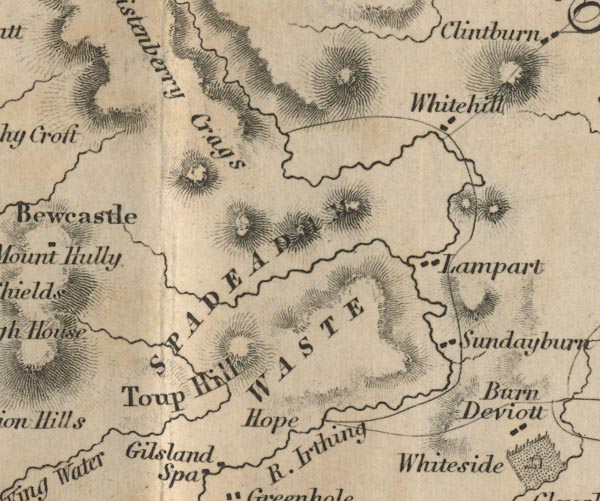 FD02NY67.jpg "Lampart" item:- JandMN : 100.1 Image © see bottom of page |
|
|
|
||
 Lakes Guides menu.