 Old Cumbria Gazetteer
 |
 |
|
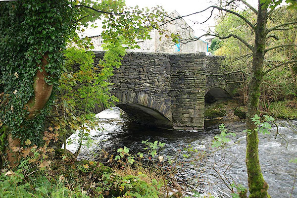
| Barley Bridge, Over Staveley | ||
| Barley Bridge | ||
| site name:- | Kent, River | |
| locality:- | Staveley | |
| civil parish:- | Over Staveley (formerly Westmorland) | |
| county:- | Cumbria | |
| locality type:- | bridge | |
| coordinates:- | SD47029873 | |
| 1Km square:- | SD4798 | |
| 10Km square:- | SD49 | |
|
|
||
| MN photo:- |
Repaired 1968. |
|
 BPS85.jpg (taken 17.10.2008) |
||
|
|
||
| evidence:- | old map:- OS County Series (Wmd 33 6) placename:- Barley Bridge |
|
| source data:- | Maps, County Series maps of Great Britain, scales 6 and 25
inches to 1 mile, published by the Ordnance Survey, Southampton,
Hampshire, from about 1863 to 1948. |
|
|
|
||
| evidence:- | old map:- Jefferys 1770 (Wmd) placename:- Barley Bridge |
|
| source data:- | Map, 4 sheets, The County of Westmoreland, scale 1 inch to 1
mile, surveyed 1768, and engraved and published by Thomas
Jefferys, London, 1770.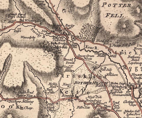 J5SD49NE.jpg "Barley B." double line, road, across a stream; bridge; nd settlement? item:- National Library of Scotland : EME.s.47 Image © National Library of Scotland |
|
|
|
||
| evidence:- | old map:- Cary 1789 (edn 1805) placename:- Barlet Bridge |
|
| source data:- | Map, uncoloured engraving, Westmoreland, scale about 2.5 miles
to 1 inch, by John Cary, London, 1789; edition 1805.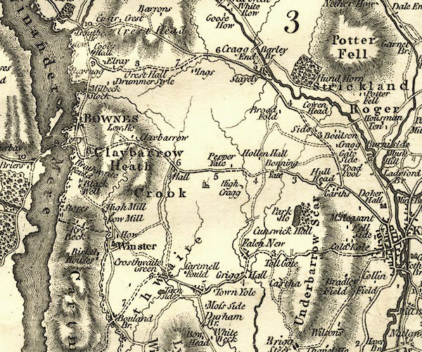 CY24SD49.jpg "Barlet Br" road across a stream; bridge over the Kent item:- JandMN : 129 Image © see bottom of page |
|
|
|
||
| evidence:- | database:- Listed Buildings 2010 placename:- Barley Bridge |
|
| source data:- | courtesy of English Heritage "BARLEY BRIDGE OVER THE RIVER KENT / / / OVER STAVELEY / SOUTH LAKELAND / CUMBRIA / II / 76489 / SD4702798722" |
|
| source data:- | courtesy of English Heritage "Bridge. Date uncertain. Possibly C17. North side partly rebuilt during C20: in keeping. Slate rubble. Approximately 8' wide. 2 segmental arches; cutwaters to central pier; pedestrian refuge over Northern cutwater. References: RCHM p.219; Jervoise p.124." |
|
|
|
||
 Lakes Guides menu.