 Old Cumbria Gazetteer
 |
 |
|
| Farfield Mill, Sedbergh | ||
| Farfield Mill | ||
| Street:- | Garsdale Road | |
| civil parish:- | Sedbergh (formerly Yorkshire) | |
| county:- | Cumbria | |
| locality type:- | mill | |
| locality type:- | water mill | |
| locality type:- | craft shop | |
| locality type:- | art gallery | |
| locality type:- | museum | |
| locality type:- | workplace | |
| coordinates:- | SD67769193 | |
| 1Km square:- | SD6791 | |
| 10Km square:- | SD69 | |
|
|
||
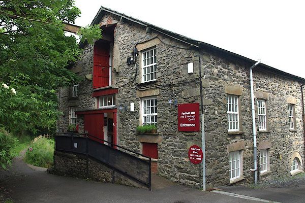 BPJ66.jpg (taken 30.6.2008) 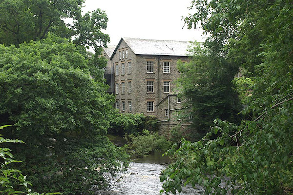 BPJ59.jpg (taken 30.6.2008) |
||
|
|
||
| evidence:- | old map:- OS County Series (Yrk 63 4) placename:- Farfield Mills |
|
| source data:- | Maps, County Series maps of Great Britain, scales 6 and 25
inches to 1 mile, published by the Ordnance Survey, Southampton,
Hampshire, from about 1863 to 1948. |
|
|
|
||
| evidence:- | database:- Listed Buildings 2010 |
|
| source data:- | courtesy of English Heritage "FORMER SMITHY AT FARFIELD MILLS / / HAWES ROAD / SEDBERGH / SOUTH LAKELAND / CUMBRIA / II / 484569 / SD6768891948" |
|
|
|
||
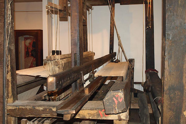 BPJ67.jpg Hand loom. (taken 30.6.2008) 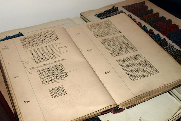 BPJ68.jpg Draughts and tramps in a pattern book. (taken 30.6.2008) 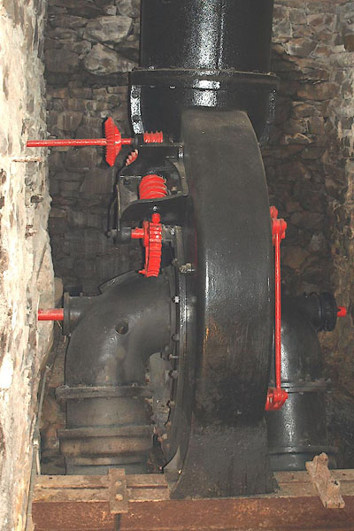 BPJ69.jpg 20hp water turbine by Gilbert, Gilkes and Gordon, 1896. (taken 30.6.2008) 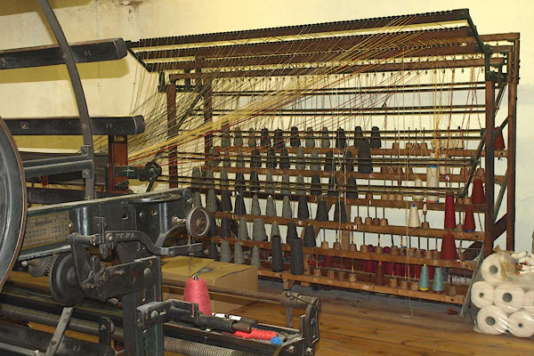 BPJ70.jpg Bobbin creel. (taken 30.6.2008) 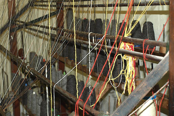 BPJ71.jpg Bobbin creel. (taken 30.6.2008) 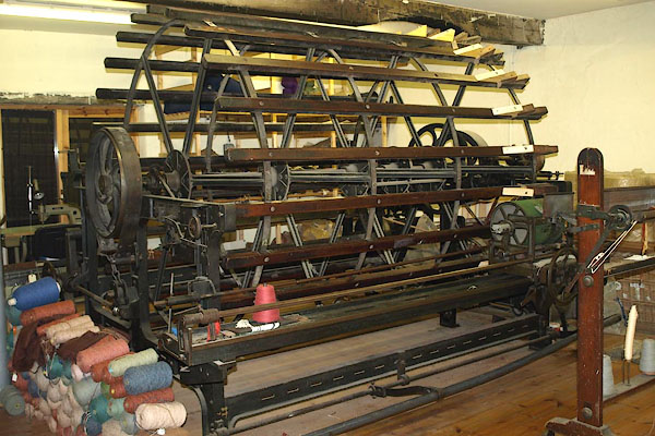 BPJ72.jpg Warp mill. (taken 30.6.2008) 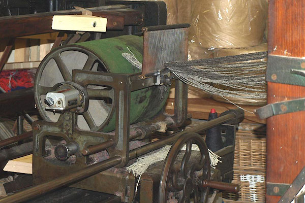 BPJ73.jpg Warp mill. (taken 30.6.2008) 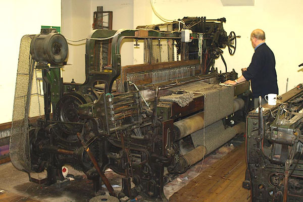 BPJ74.jpg Power loom. (taken 30.6.2008) 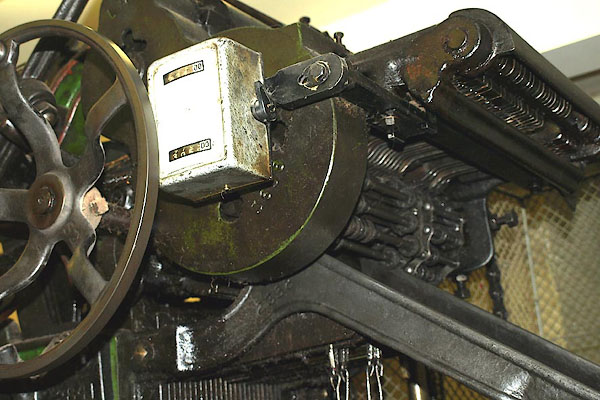 BPJ75.jpg Dobby machine. (taken 30.6.2008) |
||
|
|
||
| hearsay:- |
Built by Joseph Dover, 1837. It was a weaving mill powered by water which was supplied
by a 350 yard lade alongside the River Clough. It burnt down in 1909, and was rebuilt.
It closed 1937. It was used by Armstrong Siddeley for manufacturing aircraft engines
in World War II. |
|
|
|
||
 Lakes Guides menu.