 Old Cumbria Gazetteer
 |
 |
|
| Knott, Dunnerdale-with-Seathwaite | ||
| Knott End | ||
| civil parish:- | Dunnerdale-with-Seathwaite (formerly Lancashire) | |
| county:- | Cumbria | |
| locality type:- | hill | |
| coordinates:- | SD224919 | |
| 1Km square:- | SD2291 | |
| 10Km square:- | SD29 | |
| altitude:- | 932 feet | |
| altitude:- | 284m | |
|
|
||
| evidence:- | old map:- OS County Series (Lan 7 14) placename:- Knott, The |
|
| source data:- | Maps, County Series maps of Great Britain, scales 6 and 25
inches to 1 mile, published by the Ordnance Survey, Southampton,
Hampshire, from about 1863 to 1948. |
|
|
|
||
| evidence:- | old map:- Otley 1818 placename:- Knot End |
|
| source data:- | Map, uncoloured engraving, The District of the Lakes,
Cumberland, Westmorland, and Lancashire, scale about 4 miles to
1 inch, by Jonathan Otley, 1818, engraved by J and G Menzies,
Edinburgh, Scotland, published by Jonathan Otley, Keswick,
Cumberland, et al, 1833.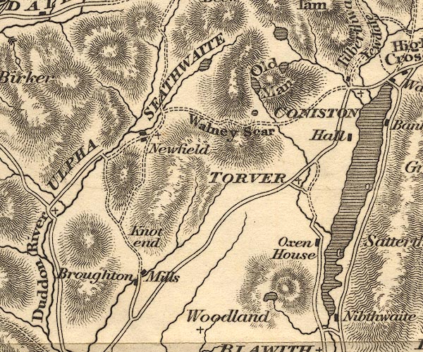 OT02SD29.jpg item:- JandMN : 48.1 Image © see bottom of page |
|
|
|
||
| evidence:- | outline view:- Black 1856 (23rd edn 1900) placename:- Knot End |
|
| source data:- | Print, lithograph, Outline Views, Grasmere and Coniston - Mountains as seen from Redbank,
Grasmere, and Mountains as seen a little beyond Tent Lodge on the Road from Coniston
to Ulverstone, by J Flintoft, Keswick, Cumberland, engraved by R Mason, Edinburgh,
Lothian, about 1900.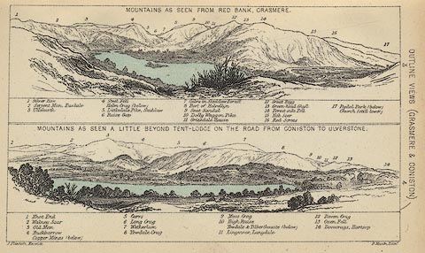 click to enlarge click to enlargeBC08E3.jpg "... 1 Knot End ..." item:- JandMN : 37.12 Image © see bottom of page |
|
|
|
||
| evidence:- | presumably outline view:- Black 1841 (3rd edn 1846) placename:- Knot End |
|
| source data:- | Print, engraving, outline view, Mountains as seen from Red Bank, Grasmere, and Mountains
as seen a little beyond Tent-Lodge on the Road from Coniston to Ulverston, by J Flintoft,
Keswick, Cumberland, engraved by R Mason, Edinburgh, Lothian, about 1846.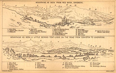 click to enlarge click to enlargeBC02E3.jpg "... 1 Knot End ..." item:- JandMN : 32.5 Image © see bottom of page |
|
|
|
||
 Lakes Guides menu.