 Old Cumbria Gazetteer
 |
 |
|
| milestone, Brampton | ||
| site name:- | road, Carlisle to Brampton N | |
| civil parish:- | Brampton (formerly Cumberland) | |
| county:- | Cumbria | |
| locality type:- | milestone | |
| coordinates:- | NY51915947 | |
| 1Km square:- | NY5159 | |
| 10Km square:- | NY55 | |
|
|
||
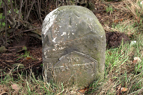 BPX27.jpg Cast iron plate on stone:- "TO / BRAMPTON / 1" (taken 16.1.2009) 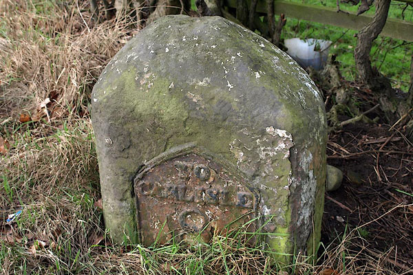 BPX28.jpg Cast iron plate on stone:- "TO / CARLSISLE / 8" (taken 16.1.2009) |
||
|
|
||
| evidence:- | old map:- OS County Series (Cmd 17 12) |
|
| source data:- | Maps, County Series maps of Great Britain, scales 6 and 25
inches to 1 mile, published by the Ordnance Survey, Southampton,
Hampshire, from about 1863 to 1948. "M.S. Brampton .. 1 Carlisle .. 8" |
|
|
|
||
| evidence:- | database:- Listed Buildings 2010 |
|
| source data:- | courtesy of English Heritage "MILESTONE AT NGR NY 51910 59480 / / A69 (NORTH OF NEW GELT BRIDGE) / BRAMPTON / CARLISLE / CUMBRIA / II / 77794 / NY5192159488" |
|
| source data:- | courtesy of English Heritage "Milestone. 1830 for Carlisle-Brampton Turnpike Trust. Sandstone, cast-iron plate. Squared stone with pyramidal top, set at angle to road to give 2 faces in direction of traffic. Cast plates set into each face inscribed TO CARLISLE 8 MILES and TO BRAMPTON 1 MILE. Whitewashed with lettering picked-out in black." |
|
|
|
||
 Lakes Guides menu.